Blog · World webcams
Travel Without Moving: Watch Cities Around the World Live via Webcam
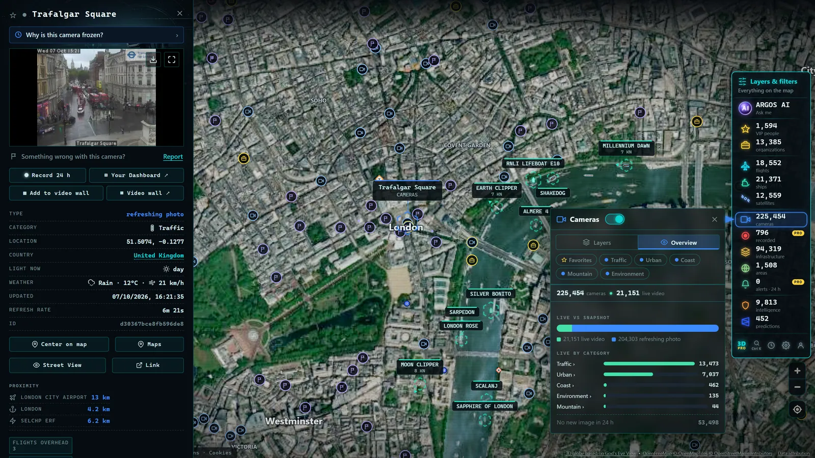
It is midnight in London and you are watching the sun rise. Not in a film or a stock photo, in a frame captured a few minutes ago by an official camera in a city on the eastern edge of Asia, where daylight has just broken over a highway filling steadily with traffic. Watching cities live via webcam is one of those small, strangely addictive experiences that the internet makes possible and almost nobody takes advantage of: leaning out, at this precise moment, over a place that is thousands of kilometres away and half a world apart in time. This guide explains what types of cameras show cities, how to play with time zones, and what practical use this no-luggage journey actually serves.
Looking Into Another City Right Now
There is a profound difference between seeing a photograph of a city and seeing that city now. The photograph is an embellished past; the webcam is an unfiltered present. It is raining or it is not. The intersection is gridlocked or the avenue is empty. It is dark, even though your instinct says it should be afternoon.
That simultaneity is what makes it compelling. While you eat dinner in Berlin, people in Sydney are heading to work. While you drink your morning coffee in New York, it is the dead of night on the US West Coast, and urban cameras show traffic lights blinking for nobody. The planet never stops, and cities live on camera demonstrate that in the most literal way possible: with the image from five minutes ago.
There is no need to be dramatic about it, but there is something genuinely valuable here. For centuries, knowing what was happening in another city required weeks of travel or post. Today it is one click, it is free, and the source is, in most cases, a public body that publishes that image deliberately.
What Types of Cameras Show Cities
Not all urban cameras are alike, and knowing what you are looking at helps you get more out of them. Cameras that show cities fall mainly into three families.
Urban Traffic Cameras
These are the most numerous. Transport authorities and city governments across North America, Europe, and Asia maintain cameras above intersections, ring roads, main avenues, and city access points, published openly so drivers can check traffic conditions. Their purpose is functional, but as a side effect they offer a constant portrait of urban life: rush hour, the quiet of the small hours, snow settling on asphalt, Christmas lights at the far end of a boulevard.
In the United States, the 511 systems operated by state DOTs publish thousands of live camera feeds covering major cities, from the clogged freeways of Los Angeles to the tunnels and bridges serving Manhattan. In the United Kingdom, National Highways publishes cameras on motorways feeding London, Manchester, and Birmingham. France's ASFA network does the same across the autoroute system into Paris and Lyon.
Official Panoramic Cameras
Some administrations and organisations publish panoramic cameras designed as showcase views: elevated shots of a skyline, an urban harbour, an iconic square. New York's various official feeds include views over key transport corridors and the Hudson waterfront. Tokyo's metropolitan government and transport operators publish elevated views across the city's dense grid. London's Transport for London network includes cameras covering key arterial routes as well as river crossings. These cameras tend to have better framing and sometimes higher refresh rates or even live streaming. They are less numerous than traffic cameras but considerably more photogenic.
Mobility and Transport Authority Cameras
Transport authorities and urban infrastructure managers publish cameras over strategic points: tunnels, bridges, interchanges, city access routes. The Port Authority of New York and New Jersey, Transport for London, and equivalent bodies across dozens of cities operate these feeds. Technically they are management cameras, but they show the city breathing through its main arteries.
The combination of these three families gives uneven but surprisingly rich coverage. To understand the full catalogue of public cameras that exist (urban and otherwise) the guide on types of public cameras online covers them one by one, including the important distinction between cameras published deliberately and private cameras accidentally exposed.
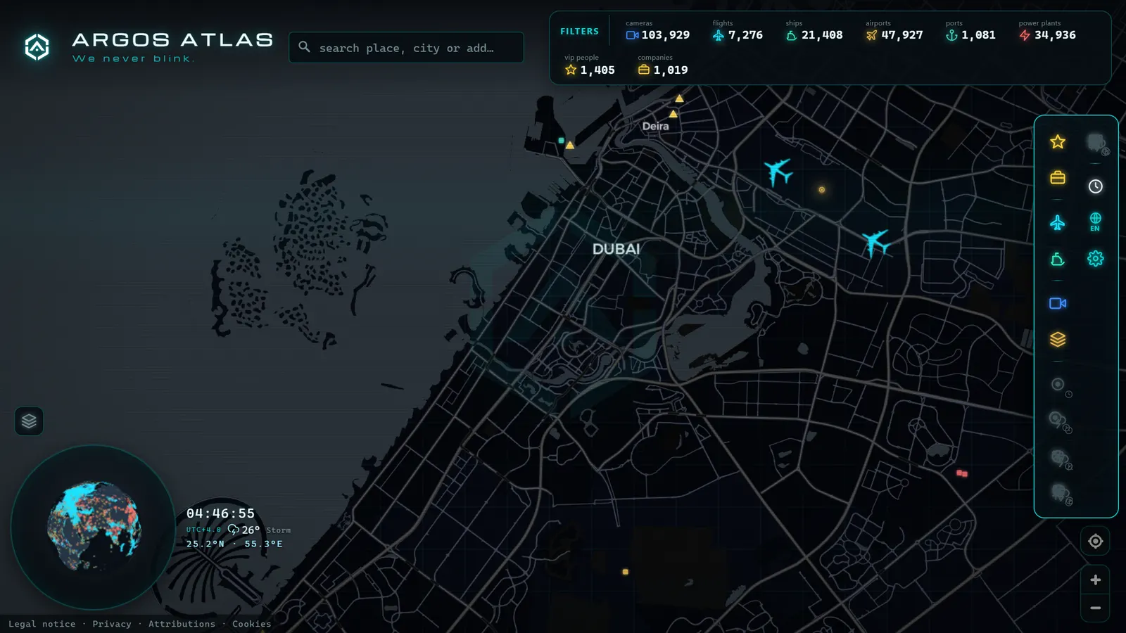
The Time Zone Game: Chasing the Sunrise
This is where things get genuinely hypnotic. The Earth rotates, which means that at any given moment somewhere is experiencing sunrise. The line dividing night from day (the terminator, in astronomical terms) crosses the planet without pause, east to west, and with a map of cameras you can chase it.
The game works like this: think about the time where you are and calculate where the sun is rising right now. If it is midnight in New York, dawn is somewhere over East Asia. If it is mid-afternoon in London, look for first light over the Americas. Open cameras in that band and you will see orange skies, long shadows, cities starting the day.
Some variations to try:
- Follow the day line. Start with the easternmost camera you can find showing dawn light and hop westward, city by city, watching each one sit a little earlier in its morning.
- Compare the same solar hour. Open two cities where it is eight in the evening local time, one in each hemisphere: in one it will be a bright summer evening and in the other, full winter darkness.
- Watch a city sleep on Sunday. Urban traffic cameras narrate the week without words. The silence of a Sunday afternoon shows up in the asphalt of any city in the world, traffic that should be there, but is not.
This is applied geography in its most intuitive form. Anyone who has tried to explain time zones to a child knows that no diagram competes with showing them on screen, right now, that in Tokyo it is already tomorrow morning.
From the ARGOS ATLAS channel.
Practical Uses of Virtual Travel
Beyond the pleasure of watching, virtual travel by webcam has concrete applications.
Checking your destination before you leave. A camera shows you what no guidebook can: the real weather at your destination this week, how people are dressed in the streets, whether the famous square is crowded or quiet, and what the light looks like at the time you will be arriving. If you are deciding whether to pack a coat or just a light jacket, a frame from ten minutes ago is worth more than any forecast. And if the weather itself is your primary concern, the guide on weather webcams for live conditions covers the specific tools for that.
Teaching geography. For teachers and families, a map of cameras is a living globe. Time zones, reversed seasons between hemispheres, climates, urban density: everything becomes tangible when you see it in images from right now rather than in textbook diagrams. Pulling up a camera over a city in the southern hemisphere in the middle of a northern winter (bright sunshine, summer clothes) lands harder than any infographic.
Staying connected to a place you have left. Anyone who has lived abroad for a period understands this without explanation: opening a camera of a familiar city and seeing that it is still there, with its usual traffic and its usual light, has an oddly reassuring effect. It is the closest thing to leaning out of a window in a home you no longer have.
Professional context. Professionals coordinating teams in other cities, organising events, or tracking developments in a specific location use cameras as a quick visual thermometer: what is the situation there, right now. For a conference organiser checking whether a venue district is accessible ahead of an event, a traffic camera is faster than a phone call.
Honest Limits: What Urban Webcams Will Not Give You
It is worth being direct about this, because the experience is better when expectations are realistic.
Not every city publishes cameras. Coverage depends entirely on what each administration decides to make public. There are European capitals with dozens of official feeds and entire megacities (including some of the world's largest) with no accessible public stream whatsoever. If a city you care about does not appear, that is not a failure of the map: it means no authority there publishes anything.
Refresh rates vary. Most official urban cameras publish one still frame every few minutes rather than continuous video. For getting a sense of a city's pulse it is more than enough, but do not expect to follow the movement of a specific vehicle. The refresh rate depends on each source, and the timestamp on the frame is always your reference point.
Resolution is functional, not cinematic. Public images tend to be low resolution: they are designed to convey general conditions, not to allow detailed zoom. That also protects the privacy of people passing through the frame, which is as it should be.
An urban webcam is not a perfect postcard: it is an honest window. And honesty (it is raining, there is a jam, it is dark) is precisely its value.
Exploring by Map, Not by Lists
The traditional way to look for urban cameras is painful: lists of websites, country-by-country directories, authority portals in languages you do not speak. It works, but it turns curiosity into a chore. As covered in the general guide on live webcams from around the world, the problem has never been a shortage of cameras but their dispersal across hundreds of official portals.
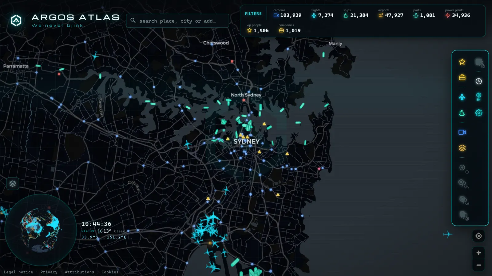
The alternative is to explore by territory: a world map where cameras appear geolocated wherever they actually are. This is the approach behind Argos Atlas: you navigate the planet as you would any map (drag, zoom, search for a place) and open the cameras you find along the way, thousands of them, all from cited official sources, free and without registration. The difference in experience is the same as the difference between looking up a restaurant in a phone directory and seeing it on a street map: the information is the same, but one format invites exploration and the other does not.
And because the map also shows live flights and ships, the city you open is not an isolated image: you see the aircraft on approach to its airport and the vessels waiting at its port, the complete context of a place that is, right now, awake or asleep on the other side of the world.
Frequently Asked Questions
Which cities can I watch live?
Many, but not all, and coverage is uneven. Cities whose transport authorities, infrastructure managers, or local governments publish open camera feeds are well represented, this is widespread across Europe, North America, and much of Asia and Oceania. Some capitals have dozens of official cameras; large cities in other regions may have none at all. The fastest way to see what is available is to open the map directly.
Is it really in real time?
It is close to real time, and the distinction matters. Most official urban cameras publish one still frame every few minutes rather than continuous video; some panoramic cameras do stream live. The timestamp on each image shows the exact moment of capture. For what these cameras offer (atmosphere, light, weather, traffic in a city right now) that cadence is entirely sufficient.
Can I use it to plan a trip?
Yes, and it is one of the most practical uses. A webcam shows you the real weather at your destination this week, how people are dressed, how busy the central areas are, and what the light looks like at different times of day. It is honest, current information that no promotional photograph can provide, and it helps with decisions as practical as what to pack.
Why is my city not on the map?
Because no authority in that city publishes open camera feeds, or the cameras that exist are not accessible from official sources. Coverage on any responsible camera map depends entirely on what each administration has chosen to publish openly. Where there is no official publication, there is nothing to show.
Conclusion
Travelling without moving is not an empty metaphor when the image is from five minutes ago. Watching cities live by webcam combines the best of curiosity and utility: the pleasure of chasing sunrises across time zones and the practical advantage of knowing a destination before you set foot in it. The limits are real (not every city streams, refresh rates vary) but what is publicly available, published in the open by authorities across dozens of countries, is enough to sustain years of exploration. If you want to start now, open the map, think about where the sun is rising at this moment, and go and check it with your own eyes.
Frequently asked questions
Which cities can I watch live?
Many, but not all. Coverage is strongest where transport authorities or city governments publish open camera feeds, this is widespread across Europe, North America, and much of Asia and Oceania. Coverage is uneven: some capitals have dozens of official cameras while large cities in other regions have none publicly available.
Is it really in real time?
It is close to real time. Most official urban cameras publish one still frame every few minutes rather than continuous video. The timestamp on each image tells you exactly when it was captured. For gauging the atmosphere, light, and weather of a city right now, that refresh rate is more than adequate.
Can I use it to plan a trip?
Yes, and very effectively. A webcam shows you the real weather at your destination this week, how people are dressed, how busy the central areas are, and what the light looks like at different times of day. It is honest, current information that no promotional photograph can provide.
Why is my city not showing up?
Because no public authority in your city publishes open camera feeds, or the cameras that exist are not accessible from official sources. Coverage depends entirely on what each administration chooses to make public. A responsible aggregator only shows cameras deliberately opened by their owners.
- How to Tell Whether a Webcam Is Official (and Why the Source Matters)
- Live Webcams from Latin American Cities: Buenos Aires, Mexico City, Bogota, Lima and Santiago
- Live Webcams from European Cities: Paris, Rome, Berlin, Amsterdam, Vienna, Prague and Brussels
- Live Webcams from Caribbean Coasts: Cuba, Dominican Republic, Jamaica, Puerto Rico, Aruba and Barbados
- APRR Webcam Live: Every Camera, One Live Map
- Spain Eclipse Traffic Measures Aug 12: Path & Live Webcams