Blog · World webcams
Guatemala live map: what you can see right now, layer by layer
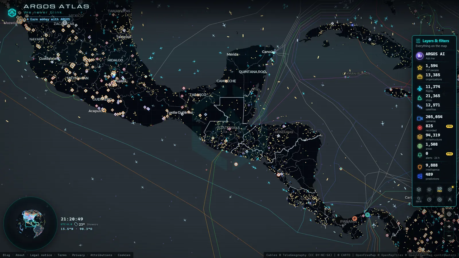
Guatemala live on an open map comes down to four working layers: a handful of public cameras in the metropolitan area (count as of October 2026), live aircraft over La Aurora International Airport (ICAO MGGT, IATA GUA), AIS ship positions off Puerto San José on the Pacific, and a watch camera pointed at Volcán de Fuego. All of it is free, none of it asks for an account, and it runs in a browser tab.
The honest part first: Guatemala has no open, nationwide traffic camera feed. If you got here after using the COSEVI cameras in Costa Rica, that is the comparison to unlearn. What the country does publish, plus what aircraft and ships broadcast on their own, still adds up to a usable live picture, and this page says where each piece of it sits.
The essentials, in 20 seconds
- No open national camera network: no Guatemalan road agency publishes a public traffic camera feed, unlike COSEVI in Costa Rica or the DGT in Spain.
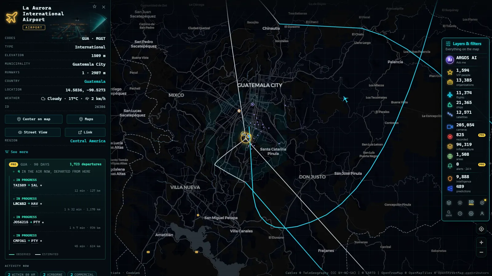
- La Aurora (MGGT / GUA) is the live anchor: the runway lies inside Guatemala City, so arrivals cross the city on the flight layer.
- 11,863 aircraft were in the air worldwide at the moment of this count, 105 of them military.
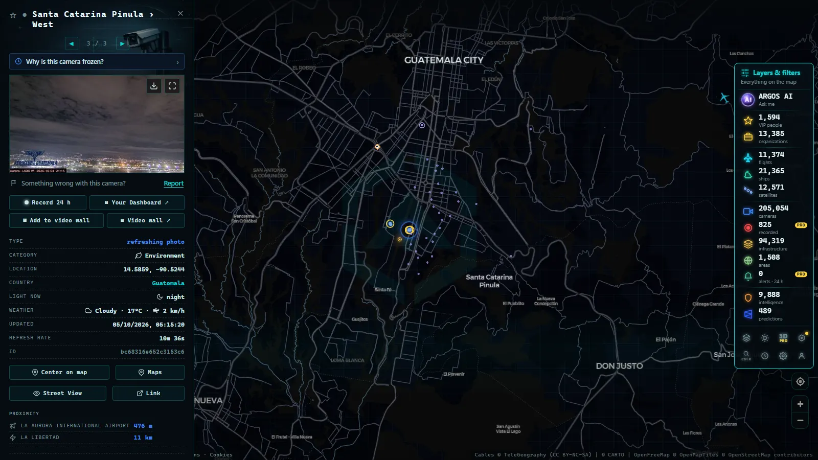
- Santa Catarina Pinula holds the core of the camera list (count as of October 2026): four views, one per cardinal direction, from the eastern edge of the metro area.
- Free and no sign-up: the camera layer serves still frames that refresh, not continuous video.
What a Guatemala live map actually shows
Four layers do the work, and each one arrives by a different route. The camera layer collects public still images from whoever chooses to publish them, which in Guatemala means institutional and private operators rather than a road agency. The flight layer is ADS-B, broadcast by the aircraft themselves, so it does not depend on any local authority agreeing to share anything. The ship layer is AIS, broadcast by vessels and picked up along the coast. The fourth is the fixed catalogue: 47,927 airports and 1,081 ports worldwide, plus power plants and dams, which answers "where is it" instead of "what is happening right now".
That split explains why coverage of Guatemala is uneven rather than absent. The layers that depend on local publication are thin. The layers fed by transponders are as complete here as anywhere. Open the country on the live world map and all four stack on the same screen, each with its own toggle.
La Aurora, the airport that anchors everything live
La Aurora is unusual in a useful way: the runway lies inside the city, along Zona 13 and the southern edge of the built-up area. Aircraft on final approach pass over housing, which makes the flight layer legible even to someone who has never read a radar screen. Pick a track, follow it down, and you can tell which direction the airport is working that afternoon.
Guatemala's share of the air picture is small and lumpy: a cluster of scheduled arrivals from North America and the region, cargo movements at hours nobody watches, and overflights running between Mexico and Panama. Military traffic shows up occasionally and is tagged separately. If the altitude and callsign fields mean nothing to you yet, the guide to watching aircraft in real time explains what each number on the label is telling you.
Recorded straight off the map, no sound.
The public cameras around the capital
The core of the list is Santa Catarina Pinula, the hillside municipality on the eastern side of the metropolitan area, with four views facing north, south, east and west from roughly the same point. That sounds modest and it is, but it is also the best weather instrument available for the Carretera a El Salvador corridor: if all four frames are grey, cloud is sitting on the ridge and the drive out of the city will be slow.
These are not road agency cameras, and the difference matters when you plan around them. Framing can change without notice, an operator can switch one off for a week, and nobody publishes an uptime commitment. Before you trust any frame, work out who runs it: the method is in the piece on how to tell whether a webcam is official.
The skyline camera and the Volcán de Fuego view
Two cameras do something the neighbourhood views cannot. The skyline frame gives the capital at a glance, which is the fastest way to judge haze, smoke and light before opening anything else. The second, at Barranca Ceniza (FG14), watches Volcán de Fuego, the cone behind the frequent small explosions and the ash that dusts roads around Escuintla and Alotenango.
Expect to be disappointed often, because that is the truthful version. Through the rainy season the summit is capped for days at a time and the camera shows a wall of cloud. After sunset the frame is black, or a faint glow if an episode is strong. In the clear hours just after dawn you get the view people travel for, arriving as one still image after another rather than as video.
Why there is no open traffic camera network
Guatemala City's traffic is managed from control rooms, not from an open data portal. The municipal transit authority (EMETRA) and the national road bodies run cameras for their own operations, and none of that output is published as a feed a map can read. No public index, no still-image endpoints, no documented interface. That single fact is why this page is a guide to layers and not a traffic camera article.
The contrast within the region is sharp. Costa Rica publishes enough to fill a full piece on the COSEVI traffic cameras and Ruta 27, and Mexico City operates one of the largest municipal camera systems on the continent. Guatemala sits on the other side of that line, and the roundup of webcams in Latin American cities makes the gap visible capital by capital.
Ships off the Pacific: Puerto San José and the Caribbean side
Shipping is where Guatemala gets a genuinely live layer with no local cooperation required. Vessels broadcast AIS continuously, and the map was carrying 21,318 ships live with 39,113 tracked across the longer window at the moment of this count. On the Pacific, the anchorage off San José and the neighbouring Puerto Quetzal terminal hold most of the movement: container ships, car carriers and the occasional cruise call.
The Caribbean side is smaller and busier per berth, with Puerto Barrios and Santo Tomás de Castilla moving the banana and container flow toward the Gulf. Two reading habits help. A ship sitting motionless offshore is almost always waiting for a berth rather than broken down. And reception thins out the further a vessel gets from shore, so a track that stops mid-ocean is a coverage edge, not a sinking.
Guatemala live map, layer by layer
Same screen, different questions. This is which toggle to reach for:
| Layer | What it covers in Guatemala | What to look for |
|---|---|---|
| Cameras | A short list around the capital and Santa Catarina Pinula, plus the volcano watch | Daylight only: cloud on the Carretera a El Salvador ridge, and whether Fuego is clear |
| Flights (ADS-B) | Everything transponding over the country, hubbed on La Aurora | The arrival stream into MGGT, and cargo turnarounds in the small hours |
| Ships (AIS) | The Pacific anchorage off San José and Puerto Quetzal, plus the Caribbean approach | Vessels stopped offshore: that is the berth queue, not a problem |
| Airports | Catalogue entries for every strip, from MGGT down to the Petén airfields | Codes and coordinates first, before you go hunting for live traffic |
| Infrastructure | Power plants, dams and ports as fixed points | Where the grid and the ports are when a storm is in the forecast |
The best hours to open a Guatemala live map
Local time at La Aurora International Airport
Guatemala keeps one time zone all year and never shifts the clocks, so local time runs six hours behind UTC and the useful window is predictable. Sunrise and sunset barely move across the calendar at this latitude, which is a rare convenience: the camera day starts and ends at about the same hour in January as in July.
Mid-morning is the slot for the Volcán de Fuego frame, before the afternoon cloud builds over the cone. Late afternoon suits the skyline view, when low light shows the shape of the valley. The flight layer does not care about daylight at all, which makes the night hours into MGGT more interesting than they sound: that is when the freighters move.
Guatemala in context: why the open data is thin
Guatemala · GDP per capita
Guatemala · Internet users
An open camera network is a budget decision before it is a transparency decision. Published feeds need bandwidth, hosting and somebody who answers when a frame freezes, and road agencies across Central America publish them in rough proportion to what they can afford to keep running. The chart above is the usual shorthand for that gap: output per head, and the share of the population online.
It is context rather than an excuse, and it does change. Costa Rica's cameras were not always open either. If a Guatemalan agency starts publishing images, the catalogue picks the source up through the same route as every other one, and the layer fills in quietly with no announcement attached.
What you won't see
- No video: the camera layer serves still frames that refresh on their own cycle, so fast events arrive as a sequence of images.
- No people and no plates: the frames are too wide and too compressed to identify anybody, and nothing here is intended to.
- No usable night coverage on the skyline and volcano views: after dusk you get black, haze, or a single streetlight.
- No junction cameras: with no EMETRA or national road feed to read, the metropolitan traffic locals actually ask about is not on the map.
- No cover outside the capital's orbit: Petén, Quetzaltenango, Izabal and the Highlands have no public camera on the list, and the airport and port entries are all that mark them.
- No history: cameras are live only, and a frame you did not save is gone.
After all those subtractions, what is left still works as a live picture of Guatemala, and checking it costs one toggle.
Frequently asked questions
Is the Guatemala live map free, and does it need an account?
Yes, free and with no registration. It opens in a browser and the cameras, flights and ships load without a login or an app. The camera layer serves still frames that refresh on their own cycle rather than continuous video, so nothing is downloaded and nothing is installed on your device.
Are there public traffic cameras in Guatemala like in Costa Rica?
No. No Guatemalan road authority publishes an open camera feed, so there is no equivalent of the COSEVI network next door. What exists is a short list of institutional and private cameras around the capital, pointed at neighbourhoods, the skyline or a volcano rather than at road junctions and motorway kilometre markers.
Can I see planes landing at La Aurora in real time?
Yes, on the flight layer. La Aurora (MGGT, GUA) sits inside Guatemala City, so approach and departure tracks cross built-up ground and are easy to follow. You get positions, altitude and callsigns broadcast by the aircraft themselves, not a camera view of the runway or the terminal apron.
Can I watch Volcán de Fuego erupt live?
Sometimes, and only in daylight with clear air. The watch camera at Barranca Ceniza (FG14) delivers still frames, so an explosion arrives as a sequence of images instead of video. Cloud caps the cone for days during the rainy season, and after sunset the frame goes black or shows a faint glow.
What time is it in Guatemala, and when are the cameras worth opening?
Guatemala keeps one time zone all year and never shifts the clocks, so local time runs six hours behind UTC. The cameras are useful from mid-morning to late afternoon local time. Before dawn and after dusk most frames are black or lit only by streetlights, while the flight layer works around the clock.
- ARGOS ATLAS vs WorldCam: 3 Free Cameras a Day vs 45 Seconds
- Live Webcam Maps Compared: 6 Ways to Watch the World (2026)
- Live Webcams from Around the World: How to Find and Watch Them on One Map
- Travel Without Moving: Watch Cities Around the World Live via Webcam
- Public cameras online: what types exist and which ones you can legally watch
- How to Tell Whether a Webcam Is Official (and Why the Source Matters)