Blog · OSINT & verification
Albania Live Map: What 90 Days of Open Data Really Show
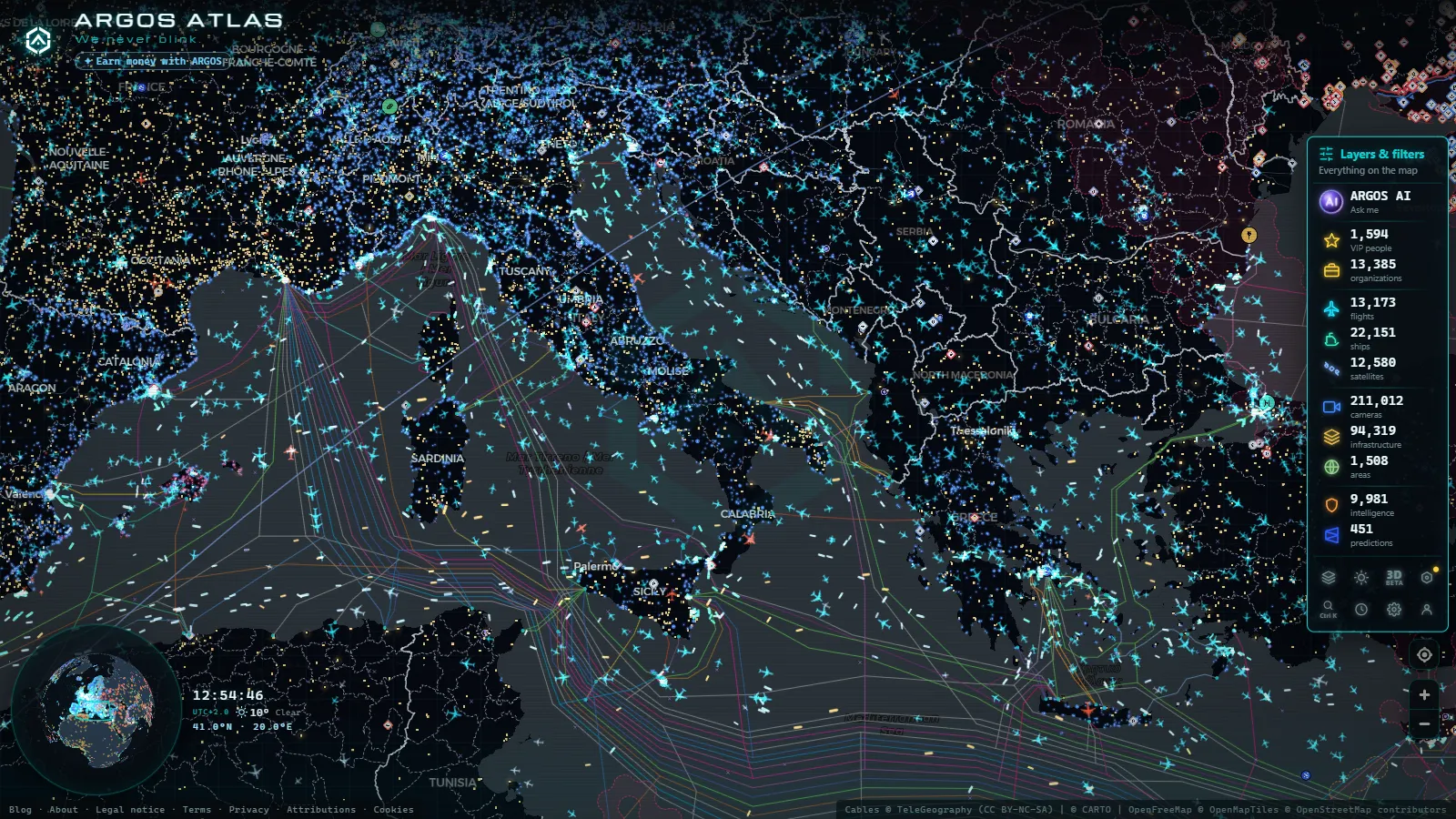
Albania is a useful stress test for any live map. Point the flight layer at Tirana and you get a clean, readable picture within seconds. Zoom out over the Adriatic between Durrës and Bari and it gets better still, because ship transponders are dense in that corridor. Then ask for a street level traffic camera on the Llogara Pass or in Shkodër, and the map goes quiet. That silence is not a rendering bug. It is what open data over Albania actually looks like, and any page promising you a full national camera grid is selling something it cannot deliver.
So this piece starts from the gap instead of hiding it. What follows is what really renders over Albania, which layers hold up under pressure, which ones are thin, and why the public camera coverage in particular is shaped the way it is. If you want to follow along, open the live world map of cameras, flights and ships and drag to the eastern Adriatic.
What the Albania live map shows on a normal night
Four families of data behave very differently over this country, and knowing which is which saves you an hour of pointless zooming.
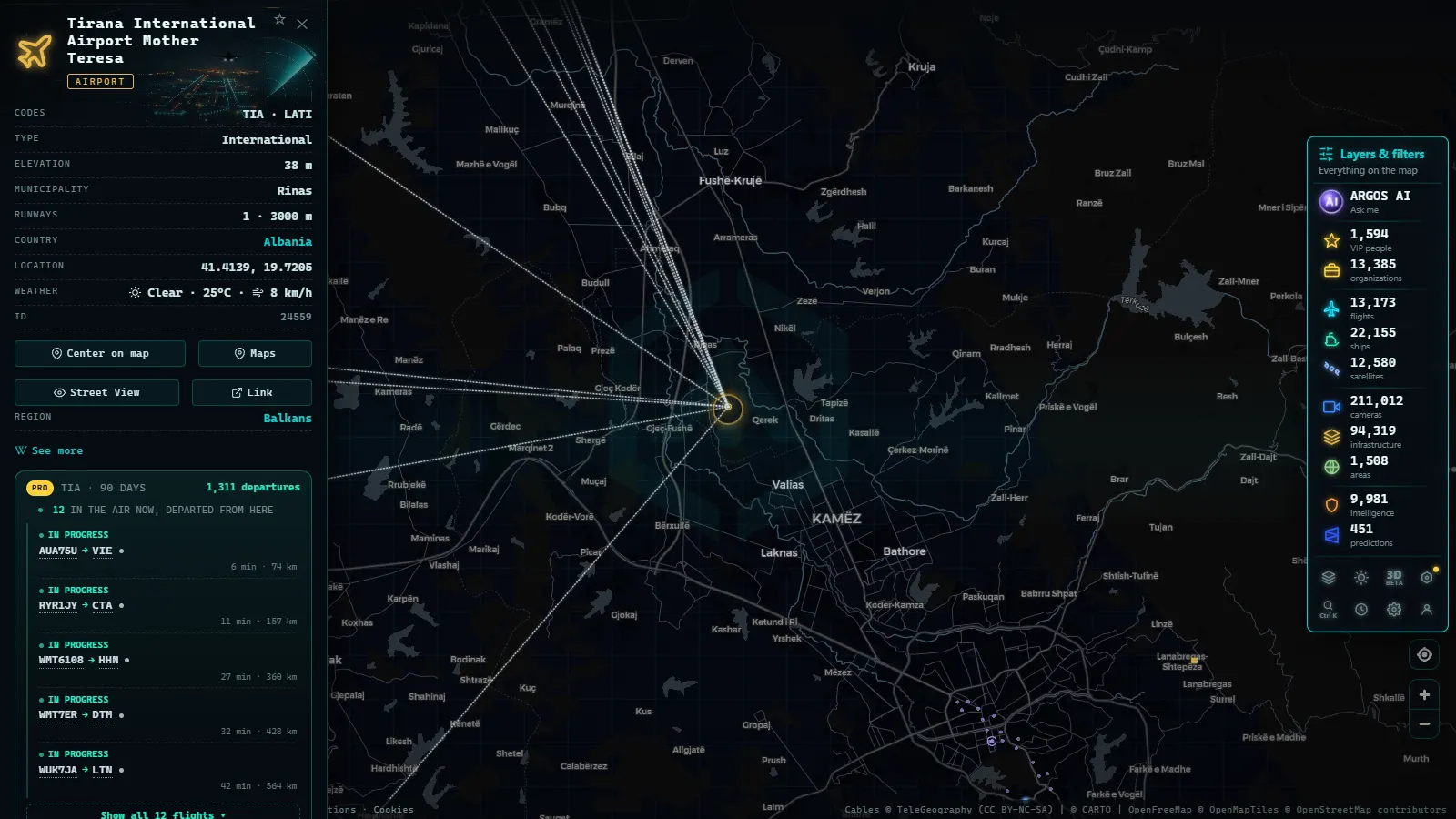
Aircraft are the easy win. ADS-B is broadcast by the aircraft itself, so coverage depends on volunteer receivers on the ground rather than on any Albanian agency publishing anything. Approaches into Tirana and the overflight traffic between Italy, Greece and the northern Balkans render reliably.
Ships are the second easy win, for the same structural reason. AIS is broadcast by the vessel, and the Adriatic is ringed by receivers along the Italian coast. How AIS works and why coastal coverage is uneven covers the mechanics; the practical effect over Albania is that Durrës, Vlorë Bay and the Strait of Otranto sit in some of the better covered water in Europe.
Static infrastructure is catalogue data, not live data. Airports, ports and power plants render because somebody mapped them once, not because Albania streams anything. The global catalogue carries 47,927 airports and airfields, 1,081 ports and 34,936 power facilities, and Albania has its share of each: the Drin hydro cascade in the north, the Devoll plants, the Vlorë thermal site, the commercial harbours and the ferry terminals.
Public cameras are where it collapses. The catalogue holds 200,000+ cameras worldwide (count as of September 2026), and the overwhelming majority sit in a handful of countries whose road and city authorities publish open feeds. Albania is not one of them.
| Layer | How fresh | What you get over Albania | The blind spot |
|---|---|---|---|
| Flights (ADS-B) | Continuous | Tirana approaches, Balkan and Adriatic overflights | Low altitude in the northern mountains; anything not broadcasting |
| Ships (AIS) | Continuous | Durrës, Vlorë, Sarandë, the Otranto funnel, tanker anchorages | Small fishing boats, switched-off transponders, self-reported cargo |
| Airports and ports | Daily rebuild | Rinas, Kukës, the commercial and ferry harbours | No gate, no runway status, no cargo throughput |
| Power infrastructure | Daily rebuild | Drin cascade, Devoll plants, Vlorë thermal site | No output, no load, no outage state |
| Public cameras | Daily ingest | Almost nothing national | No agency feed to ingest; private webcams are not redistributable |
| Open source events | Rolling 90 days | Effectively empty | Empty means peaceful here, not broken |
Tirana and the flight layer: the clearest signal in the country
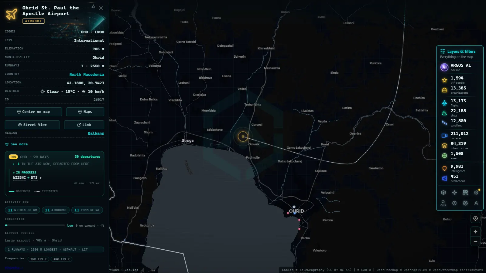
Almost all scheduled traffic in the country funnels through Tirana International, out at Rinas northwest of the capital. Kukës, in the northeast near the Kosovo border, handles a thin seasonal schedule. A third field near Vlorë has been under construction on the coastal plain. That concentration is what makes the flight layer legible: watch Rinas for twenty minutes and you have effectively watched Albanian civil aviation.
The map holds 12,430 aircraft in the air at a representative moment worldwide, of which 229 carry a military flag and 3,831 are position estimates rather than fresh reports. Those two numbers matter more here than anywhere else in this article. The estimated positions are the map's honest admission that a track has gone stale and is being extrapolated, which happens over terrain like the Albanian Alps. And the military figure is a reminder of what you will never see: the air base at Kuçovë has been rebuilt as a NATO facility, and military aircraft routinely do not broadcast at all. An empty sky over Kuçovë tells you nothing about whether anything flew.
If you are new to reading transponder data, the guide to watching aircraft in real time explains what each field means and where the estimates come from.
The Adriatic off Durrës and Vlorë: AIS does the heavy lifting
This is the best thing the Albania live map does. Durrës is the country's main commercial port and its passenger gateway, with the Italian ferry runs to Bari and Ancona. Vlorë works the shorter crossing toward Brindisi. Sarandë, right at the bottom, faces Corfu and fills up with the Greek island hops in season. Shëngjin in the north is small. Porto Romano, just above Durrës, handles fuel.
At a representative moment the map is showing 21,663 vessels, with 40,113 distinct ships tracked across the tracking window, so the Adriatic corridor is never empty. Three things are worth watching specifically:
- The ferry rhythm. The Bari and Ancona runs are the metronome of the Albanian coast. Once you know the pattern, an unexpected gap is informative.
- The Vlorë Bay anchorages. Tankers waiting offshore are visible long before anything happens on land.
- The Otranto Strait funnel. Everything entering or leaving the Adriatic squeezes through it, which makes it one of the densest chokepoints in the region.
The map also flags 1,540 vessels under sanctions programmes worldwide, so if a name in the bay looks odd you can check the flag rather than guess. What AIS will not give you: real cargo. The destination field is typed by a crew member and is wrong often enough that you should treat it as a claim. Transponders get switched off. Small fishing craft frequently carry no Class A unit at all, so a stretch of coast that looks deserted may be busy.
From the ARGOS ATLAS channel.
Why the Albania live map has so few public cameras
The honest answer is boring and structural: nobody publishes them.
Every large block of cameras in the catalogue comes from a public agency that decided road users should see the road. Spain's DGT publishes 1,948 feeds, which is part of why the map carries 10,782 cameras across Spain. Transport for London contributes 840. Illinois DOT publishes 2,154, New York's 511 system 1,870, Ontario 1,672. Those are administrative decisions, not technical ones. Albania's road authority runs traffic management, but it does not expose an open still-image or stream endpoint that anyone can ingest, and a source that returns zero is not a working source. It is an empty promise with a hostname.
The country is not short of cameras in the physical sense. Hotels in Sarandë and Ksamil, beach cams along the Durrës strip, ski and pass views inland: they exist. They are commercial embeds with terms that do not allow redistribution, they change URL without warning, and a good share of them are dead on any given week. Cataloguing them would produce a map that looks impressive and breaks constantly.
The contrast with the neighbours is instructive. Greece's motorway and city camera coverage exists because Greek operators publish it. Same peninsula, same tourism pressure, completely different result on the map, purely because of who decided to open a feed.
What the Albania live map does not show
Worth stating flatly, because this is the part most sites skip:
- No national traffic camera grid. Not thin, not partial. Essentially absent.
- No border crossing views. Morinë toward Kosovo, Kakavijë toward Greece, Hani i Hotit toward Montenegro: no public feed for any of them.
- No live road incident feed. Closures on the Nation's Highway or the Llogara route will not appear.
- No ground movement detail at Rinas. You see approaches and departures, not taxiways.
- No power output. The Drin and Devoll plants are pins on a catalogue, not a grid dashboard.
- An empty event layer. The open source event layer carries 2,222 geolocated items on a rolling 90 day window, concentrated in active conflict zones. Over Albania it is effectively blank, which is the correct answer for a peaceful country and not a fault to report.
One consequence for verification work: if a clip circulates claiming to show Durrës port right now, you cannot confirm it with a camera, because there is no camera. You confirm it with the vessel picture, the weather and the shadows. The practical method for checking a viral video is the right tool for that, and Albania is exactly the kind of country where it earns its keep.
A ten minute routine for Albania
- Open the map and drag to the eastern Adriatic, roughly between Bari and Corfu. Enable ships first, since that is the densest signal available.
- Click one ferry and note its reported destination. Then look for the return leg. Learning the rhythm takes one evening and pays off every time after.
- Switch to flights and centre on Rinas. Watch the approach line form. Ignore anything marked as an estimated position unless you can confirm it against a second report.
- Turn on ports and power to get the fixed skeleton of the country: the harbours on the coast, the hydro cascade inland.
- Copy the URL. The map encodes position and active layers into it, so you can reopen exactly this view tomorrow and compare rather than starting from scratch.
And the rule that matters most here: never conclude anything from a single layer. Over Albania, one layer is usually the only one talking.
Frequently asked questions
Is the Albania live map free, live and usable without registration?
Yes. The map opens with no account, no email and no trial. Flights and ships update continuously while the tab is open, the infrastructure catalogue is rebuilt by a daily job, and nothing is held back behind a signup wall. If a site asks you to register before showing you a vessel position in the Adriatic, you are paying for something you can read for free.
Are there live traffic cameras in Albania on the map?
Effectively no, and it is better to say so than to fake it. The camera catalogue holds 173,667 feeds worldwide (count as of September 2026), and those come from road and city agencies that publish open feeds: Spain's DGT, Transport for London, Illinois DOT, New York 511. Albania's road authority does not publish an equivalent open feed, so there is nothing to ingest. Private hotel and beach webcams exist but are not redistributable and go dark constantly.
Can I watch flights landing at Tirana International Airport?
Yes, and this is the layer that works best over Albania. ADS-B is broadcast by the aircraft, so coverage depends on ground receivers rather than on any Albanian institution. Approaches into Rinas render clearly, as does overflight traffic between Italy, Greece and the northern Balkans. Expect gaps at low altitude in the mountainous northeast, where terrain blocks line of sight to receivers.
Why does the conflict and events layer look empty over Albania?
Because it is, and that is the correct result. The event layer carries 2,222 geolocated open source items on a rolling 90 day window worldwide, weighted toward active war zones. Albania generates almost none. An empty layer over a peaceful country is a working layer, not a broken one. The mistake is reading absence of events as absence of data.
How reliable is AIS ship data off Durrës and Vlorë?
Structurally good, because the Adriatic is ringed by receivers, but AIS is self reported. A transponder can be switched off, the destination field is whatever the crew typed, and small fishing boats often carry no Class A unit at all. Treat a position as a strong claim to verify, not as a fact. Cross-check a ferry against its published schedule before you build anything on it.
- Algeria Live Map: Airports, Ships and the Camera Blank Spot
- Lebanon Live Map: What 90 Days of Open Data Show
- Pakistan Airspace Map Live: Flights, Ships, No Cameras Yet
- Chernyakhovsk Air Base and Kaliningrad: What You Can Track
- Israel live map tracking: flights, ships and conflict events
- South America Air Bases Live Map: What You Can Really See