Blog · OSINT & verification
Israel live map tracking: flights, ships and conflict events
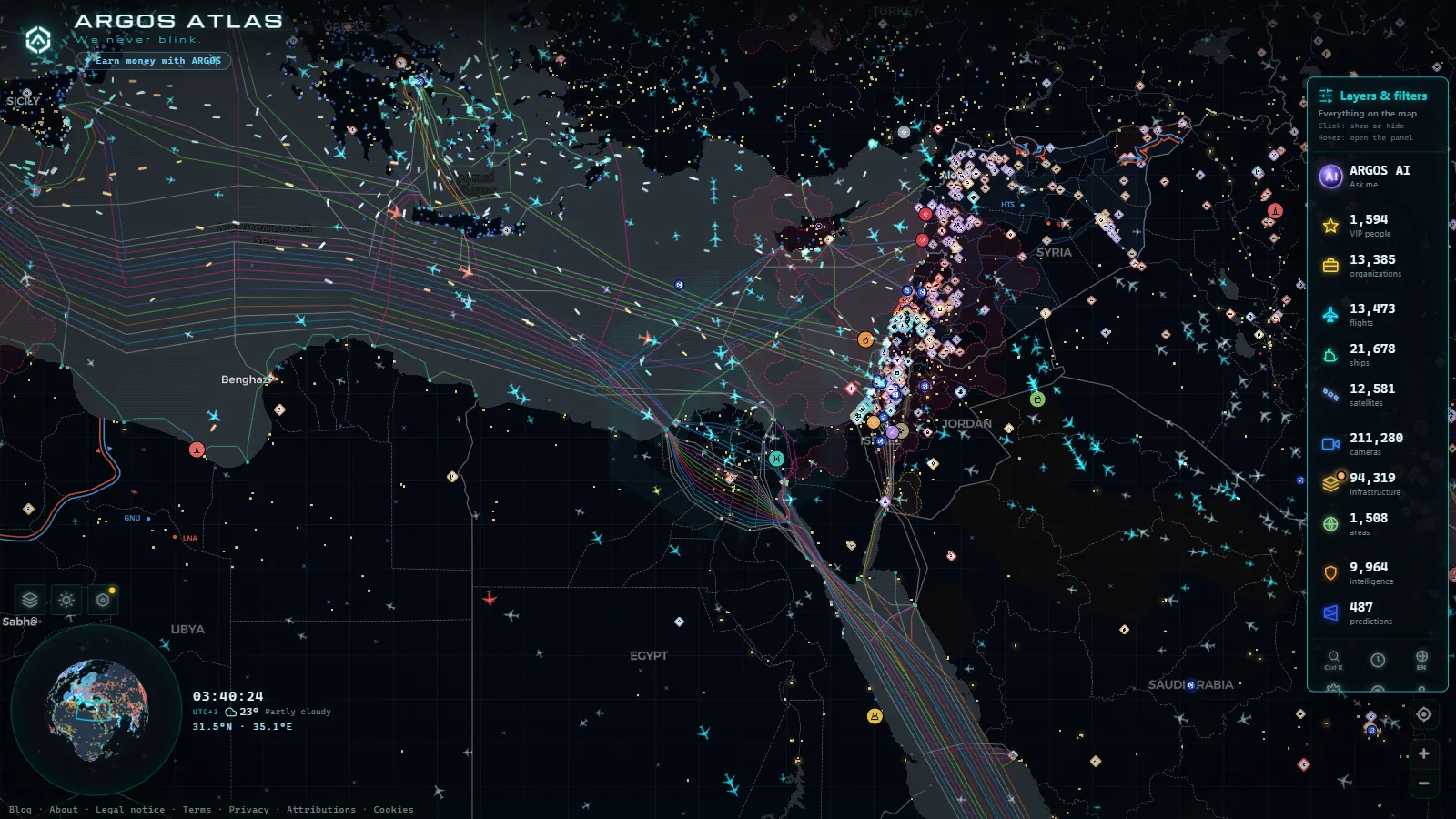
Israel can be followed live from open sources, free and without an account: ADS-B flight traffic in and out of Ben Gurion, AIS ship movements off Haifa and Ashdod, and a rolling window of geolocated conflict events. Public webcams exist too, but only a handful (beach views in Tel Aviv-Yafo, a shore angle in Haifa, a street camera in Jerusalem), nothing close to the traffic networks that countries like Spain or the United States publish.
This is a manual, not an opinion piece about the war. Which layers exist for Israel, how stale each one is by the time it reaches your screen, and how to check an image before you repeat it. Ukraine's open-source picture is built around a land front. Here the usable signal is almost entirely air and sea, plus an event log that arrives after the fact.
The essentials, in 20 seconds
- Flights: ADS-B positions refresh continuously, but transponders are switched off or spoofed near sensitive airspace, so absence is never proof of anything.
- Ships: AIS shows tankers and container ships queuing off Haifa and Ashdod, and it is self-reported, which means it can be turned off or faked.
- Conflict events: the map keeps a rolling 90 days of geolocated incidents, 1,921 worldwide with 1,376 carrying video or photo (counts as of September 2026).
- Cameras: the Israeli feeds in the catalogue are tourist and municipal views, never state security cameras.
- Free: all of it opens in a browser with no registration, no app and no trial.
What Israel live map tracking really covers
Three layers do almost all the work, and they are not equally good. Aircraft positions come from ADS-B receivers, dense around the eastern Mediterranean because civil traffic is dense. Ship positions come from AIS, near live along the coast and thinner offshore. Conflict incidents come from a curated log that is geolocated and dated, the slowest of the three by design. Everything else (airports, ports, power plants, dams) is static reference: good for context, useless for knowing what happened an hour ago. The country card for Israel gathers that reference in one place. Worldwide the catalogue holds 47,927 airports, 1,081 ports and 34,936 power sites (counts as of September 2026), and the Israeli entries are a normal slice of it. The mistake most people make is treating all four as if they updated at the same speed.
Flights: Ben Gurion, ADS-B and the holes in the sky
Ben Gurion (TLV, known locally as Natbag) near Tel Aviv-Yafo is the airport that makes the map move, with Ramon Airport (ETM) near Eilat as the southern relief valve and Haifa handling short domestic hops. Worldwide the live flight layer carries around 12,089 aircraft at any moment, 241 of them tagged military (snapshot, September 2026). When airspace tightens, what you actually see is the effect and not the cause: diversions into Larnaca and Athens, holding patterns over the sea, carriers that stop filing routes for days. State aircraft mostly do not broadcast, so an empty patch of sky means nothing. Reading arrival and departure density over several days tells you far more than staring at one icon. For the regional picture, the shape of traffic at the largest airports in the Middle East is the baseline these anomalies stand out against.
From the ARGOS ATLAS channel.
Israel live map tracking at sea: AIS off Haifa and Ashdod
Haifa and Ashdod are where the maritime story is visible. Container ships and tankers waiting at anchor, arrival gaps, reroutings around the Red Sea and the Suez approach: all of it shows up as position reports. Worldwide the layer carries 21,965 vessels live and 41,217 tracked over the window, plus 1,540 sanctioned vessels and 342 sanctioned aircraft flagged separately (counts as of September 2026). The catch is structural: AIS is transmitted by the ship itself, so switching it off, broadcasting a wrong position or reusing another vessel's identity are all possible and all documented. A vessel that goes dark near a port is a question, not an answer. The mechanics are worth understanding first in what AIS is and how ships are located in real time.
The conflict layer: 90 days, geolocated and sourced
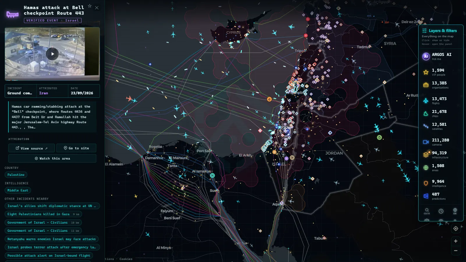
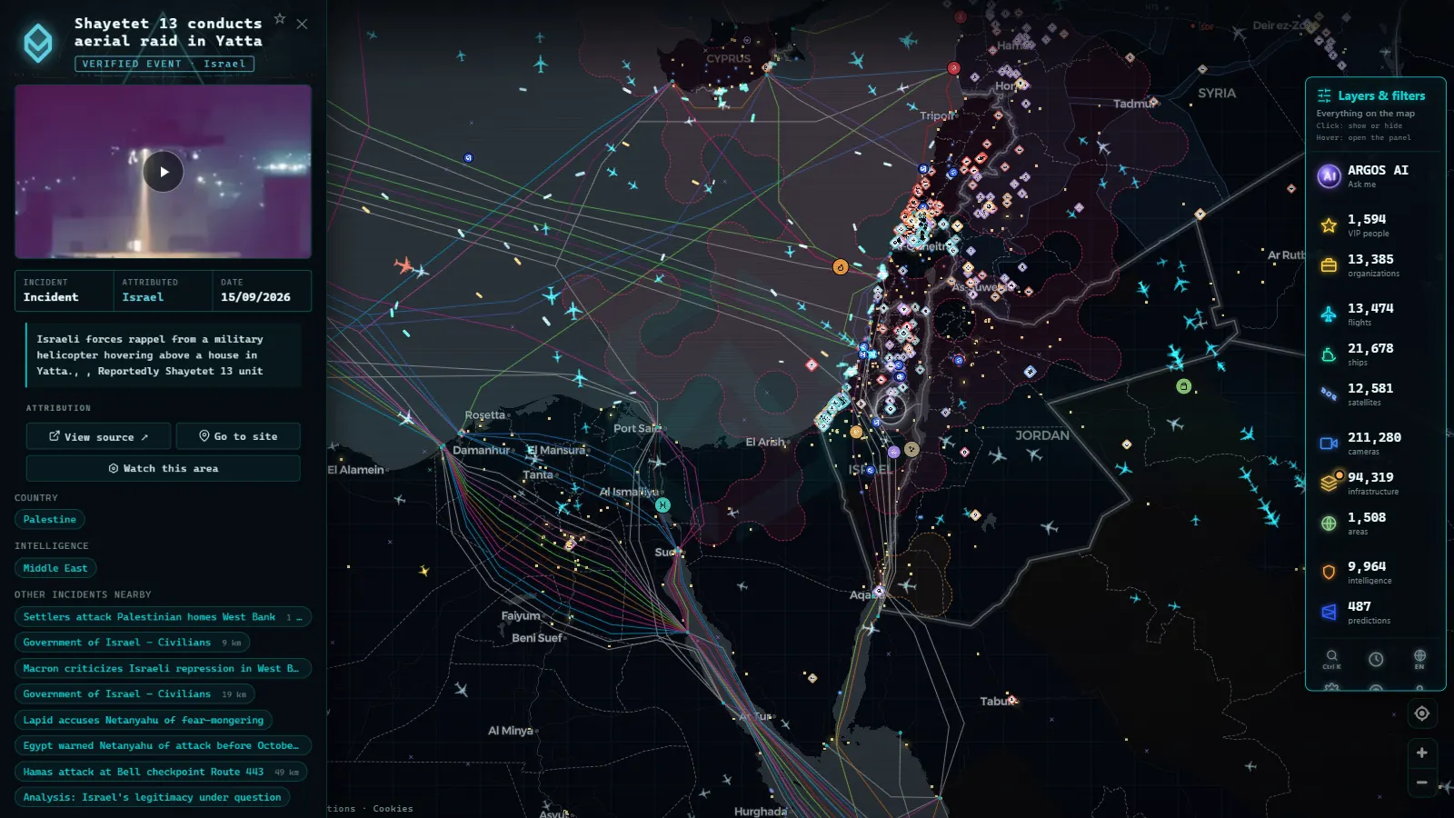
The event log is the part people misuse most. It holds 1,921 geolocated incidents across a rolling 90 day window, 1,376 of them with video or imagery attached, spread over 8 tracked theatres and 192 watched zones, with 399 briefs and 1,364 GDELT signals feeding the background (counts as of September 2026). Israel is one of those theatres. Every event carries a date, a coordinate, an action type and an attribution field that is frequently empty, and an empty attribution field is information: it means nobody has established who did it to a standard worth publishing. This is a record, not a feed. It confirms that something happened at a place on a day. It will not tell you what is happening right now. The contrast is clean against the live map of the war in Ukraine, where 16 fronts over 966 km carry the narrative and the air layer is the quiet one.
The public cameras you can actually open
There is no Israeli equivalent of a national traffic camera network in the catalogue. For scale: 11,475 catalogued cameras in Spain, 1,732 around London, 2,276 around New York (counts as of September 2026). What exists for Israel is a short list of coastal and urban views, published by tourism operators and municipalities, useful for weather, light conditions and whether a promenade is busy. That is a real limitation and it is worth saying plainly rather than implying a coverage that is not there.
How fresh each layer is
| Layer | Where it comes from | How fresh | What to do with it |
|---|---|---|---|
| Flights | ADS-B receivers | Seconds to a couple of minutes | Read approach and diversion patterns, not single military aircraft |
| Ships | AIS transponders | Near live by the coast, slower offshore | Check the queue off Haifa and Ashdod before believing a port closure claim |
| Conflict events | Curated geolocated log | Hours, sometimes a day | Date and place a claim with it, never treat it as breaking news |
| Cameras | Public webcam operators | Still frames, refreshed in minutes | Confirm weather, daylight and whether a street is busy |
| Airports, ports, power | Static reference records | Updated in batches | Get the context (runways, berths, capacity) behind a headline |
GPS jamming, and why a track can be a lie
The map marks 63 GPS interference zones worldwide (count as of September 2026), and the eastern Mediterranean is exactly the kind of airspace where reported positions drift. Jamming and spoofing push aircraft and ships onto coordinates they are not at, sometimes hundreds of kilometres off, sometimes parked on top of an airport. The symptom is recognisable once you have seen it: a track that teleports, a vessel apparently sailing across land, a cluster of aircraft all reporting the same improbable point. When that happens the position field is worthless and the rest of the record (callsign, type, operator) still is not. Interference is also, in itself, a signal worth noting rather than a bug to ignore.
Checking an image before you repeat it
A clip labelled Israel is a claim about place and time, and both are checkable. Shadow direction and length against the hour, signage language and script, vehicle plates and their format, the skyline behind the subject, the weather on that date. A public camera pointing at the same area is one of the cheapest checks available: if the sky in the viral video is overcast and the live frame shows clear noon sun, one of them is wrong. Reverse image search catches recycled footage from previous years, which is the single most common failure. The full routine, step by step, is in how to verify a viral video.
What you won't see
- No state security cameras. Israeli government, police and defence cameras are closed systems and always will be. Nothing in the catalogue comes from them.
- No military movements in real time. Ground units, naval vessels on operations and combat aircraft do not broadcast. Absence on the map is absence of data.
- Still frames, not video. Public cameras publish images that refresh periodically. There is no continuous stream and no rewind.
- No people and no plates. Resolution and framing are not designed to identify anyone, and the map does not attempt it.
- Night is mostly blank. Unlit coastal and street cameras give you a dark rectangle for many hours.
- No live conflict feed. The event layer lands hours later, after geolocation and review.
A five-minute routine on the map
Open the live map, zoom to the eastern Mediterranean and turn on one layer at a time instead of all of them. Flights first, to see whether approach patterns look ordinary. Then ships, to check the anchorage off Haifa and Ashdod. Then the event layer, filtered to the last few days, to see what has actually been confirmed and dated. Cameras last, as a sanity check on weather and daylight. Working in that order stops you from reading a dramatic story into a quiet day, which is the most common failure mode of open-source map watching.
What ARGOS sees right now
Frequently asked questions
Is Israel live map tracking free, and does it need an account?
Yes, free and with no registration. The flight layer, the ship layer, the conflict event log and the public cameras all open in a browser, on desktop or phone. No app, no trial, no email. What costs you something is time: reading the layers correctly takes longer than glancing at a single moving dot.
Can you watch Israeli military movements live?
No. Military aircraft and naval units generally do not broadcast ADS-B or AIS, and when they do the data is filtered or spoofed. Worldwide the map tags 241 aircraft as military out of 12,089 live, and almost all of those are transport or support types. Ground forces leave no open-source live trace at all.
Why do flights disappear from the map over Israel?
Transponders get switched off, positions get spoofed, or receiver coverage simply thins out. Around sensitive airspace all three happen. Treat a gap as missing data, never as evidence that something was hidden. The useful signal is the pattern around the gap: diversions, holding stacks, airlines that stop filing routes.
Are there public traffic cameras in Israel like in Spain?
Only a handful, and they are tourist and municipal views, not a traffic network. Spain publishes 11,475 catalogued cameras and the London area 1,732 (counts as of September 2026). For Israel the catalogue holds beach and street angles in Tel Aviv-Yafo, Haifa and Jerusalem. State security cameras are never public anywhere.
How delayed is the conflict event layer?
Hours, sometimes a full day. Events are geolocated, dated and checked before they land, which is slower than social media and much more reliable. The map keeps a rolling 90 days, with 1,921 events worldwide and 1,376 carrying video or photo evidence (counts as of September 2026). It dates claims; it does not break news.
- South America Air Bases Live Map: What You Can Really See
- Kerala live map: 4 international airports, ships and flights
- Turkey live map: Bosphorus ships, flights and road cameras
- ARGOS ATLAS vs God's Eye View: No Install, No API Keys
- God's Eye View Alternatives That Run in Your Browser
- How to Install God's Eye View: Requirements, Keys and Steps