Blog · OSINT & verification
South America Air Bases Live Map: What You Can Really See
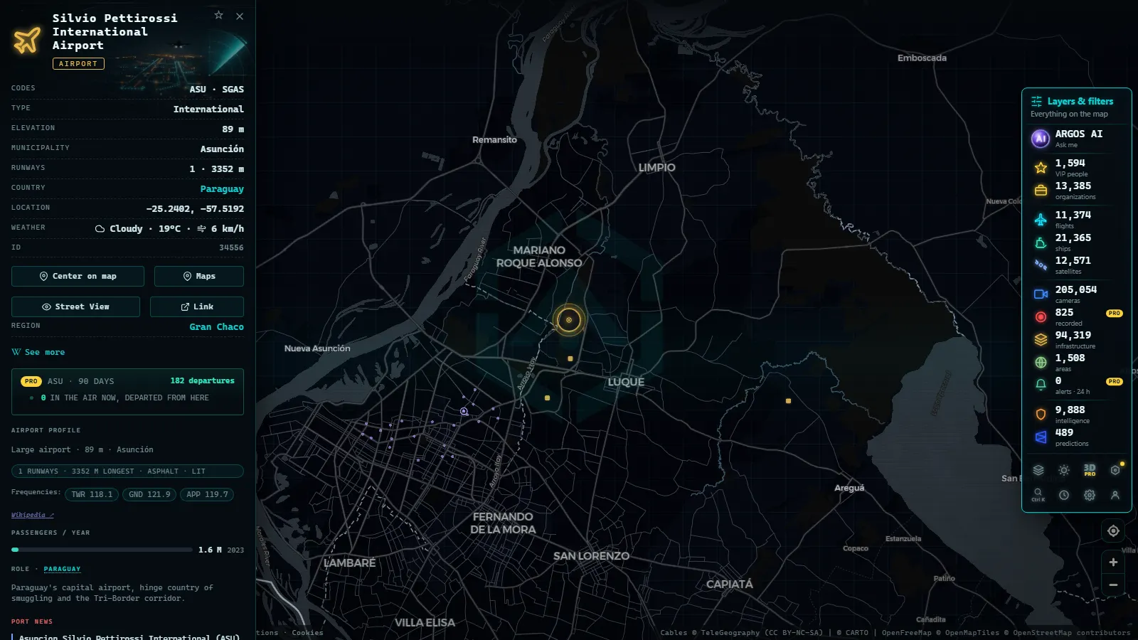
South America's military airfields are already on the live map, they just are not filed under a label that says air bases: they sit inside the airports layer, as points you open and read. The two that people pull up first are the Fuerza Aérea Paraguaya base beside Silvio Pettirossi in Asunción and Marco Fidel Suárez in Cali. Both are free to open, with no account and no app.
What you get is the installation on the ground: its position, the runway's shape and orientation over satellite imagery, the civil terminal next door when there is one, and whatever aircraft is broadcasting ADS-B overhead at that second. What you do not get is a feed of military movements. Military traffic appears only while it transponds, and much of it does not.
The essentials, in 20 seconds
- 47,927 airports and airstrips are in the catalogue, military fields included, with no separate bases layer to switch on.
- Ñu Guasú (Asunción) shares its concrete with Paraguay's main international airport, so a single point covers both uses.
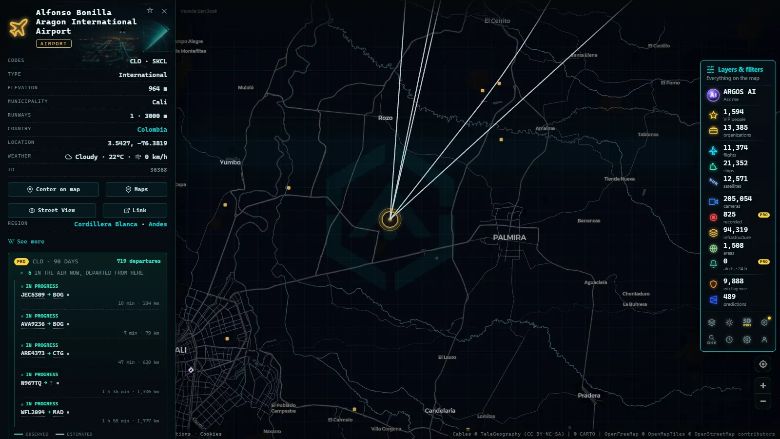
- Marco Fidel Suárez sits inside Cali, while the city's airline traffic uses Alfonso Bonilla Aragón, out in Palmira.
- 105 military flights were broadcasting worldwide in one snapshot of the live layer, which tells you how thin that signal is.
- No live camera points at a South American air base: the closest public optics in the Andes watch volcanoes, not runways.
Asunción and Cali, the two fields people open first
In Asunción the air force and the airlines share the same concrete. Silvio Pettirossi International (ASU, in Luque) carries the commercial schedule, and the Fuerza Aérea Paraguaya keeps its main base on the same field, so the map shows one busy point: arrivals from São Paulo, Lima and Buenos Aires with a transport or a trainer mixed in. Paraguay's other field worth typing is Mariscal Estigarribia, deep in the Chaco, with a runway out of all proportion to the town beside it and almost nothing flying over it.
Cali splits the two uses instead. The Escuela Militar de Aviación Marco Fidel Suárez, the Colombian Air Force academy, flies from inside the city, which is why training circuits appear over Cali's rooftops rather than over the airport. Scheduled flights land at Alfonso Bonilla Aragón, northeast in Palmira. Two points on the same screen, two completely different traffic patterns, and only one of them has a terminal.
How to read the South America air bases live map
The routine is the same in every country. Open the live map of South America, bring up the airports family, and zoom until the points separate. Then read the ground rather than the labels. A civil airport has a terminal, car parks and a taxiway system that feeds gates. A military field shows an apron with aircraft parked in rows or in revetments, hangars with no street entrance, often a single long runway with a parallel taxiway and nothing else, and a perimeter that cuts straight across farmland.
In South America the giveaway is usually the neighbourhood: a fenced field with hangars and no visible passenger access, a few kilometres from a city that already has an airport. Switch the base map to satellite and the comparison takes seconds. Local naming helps too: Base Aérea, Base Aérea Militar, Grupo Aéreo, Ala, CACOM, or BA followed by a number on Brazilian and French fields.
From the ARGOS ATLAS channel.
Military traffic shows up only when it transponds
This is the part worth being blunt about. The flight layer is built on ADS-B, which means an aircraft is on the map because it is announcing its own position. Airlines do that always. Air forces do it when it suits them, which in practice means transports on logistics runs, trainers in the circuit, maritime patrol, government jets and medevac. Fighters on a tactical sortie usually do not, and when they do the callsign may say nothing useful.
So an empty sky over Palanquero or Anápolis means exactly one thing: nothing there is broadcasting right now. It is not evidence of an empty base, a stood down unit or a quiet week. If you want the mechanics, what ADS-B is and how flight tracking works covers the protocol, and what open sources really show about military aircraft covers the aircraft side of the same gap.
Nine fields, country by country
These are the ones that get searched by name. The last column is the useful part: what to look for once you have the point open.
| Field | Country, city | How it reads on the map | What to watch for |
|---|---|---|---|
| Ñu Guasú | Paraguay, Asunción | one point shared with the international airport | military transports slotted between airline arrivals |
| Marco Fidel Suárez | Colombia, Cali | an in-city field with no terminal | training circuits on weekday mornings |
| Palanquero | Colombia, Puerto Salgar | isolated field by the Magdalena | long silences, then a transport appearing mid route |
| Anápolis | Brazil, Goiás | large field inland from Brasília | logistics hops to and from the capital |
| Canoas | Brazil, greater Porto Alegre | military field inside the metro area | traffic that never touches the civil airport nearby |
| El Palomar | Argentina, greater Buenos Aires | military field with civil use layered on | mixed registrations on one apron |
| Cerro Moreno | Chile, Antofagasta | shared with the civil airport | desert light, so unusually clear imagery |
| Las Palmas | Peru, Lima | inside the south of the city | academy circuits over built up ground |
| Rochambeau | French Guiana, Cayenne | air force side beside a civil terminal | European transports on the South Atlantic run |
Names and units change over time. Geography does not: each of those points stays where it is whether anything is transponding or not.
Dual use fields, where the line blurs
Across the continent the common arrangement is not a sealed base but a shared field. Asunción, Cerro Moreno in Antofagasta, Galeão in Rio de Janeiro, El Alto above La Paz, Timehri in Guyana: the air force holds one side, the airlines the other, and the catalogue carries a single entry for the pair.
That has two consequences for anyone reading the map. First, a busy point is not evidence of military activity, because most of what you see is scheduled passenger and cargo traffic. Second, a military movement at a shared field hides in plain sight, since it arrives in the same stream as everything else and looks like one more track.
The useful habit is to stop asking whether something is a base and start asking which side of the field is which. Satellite imagery answers that in one look, and it does not depend on anything being airborne at the moment you happen to look.
The camera layer does not cover bases
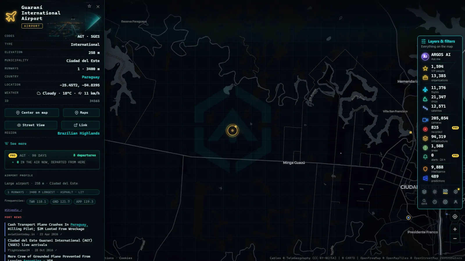
Worth stating plainly: there are 205,054 cameras in the catalogue (count as of October 2026) and not one of them points at a South American air base. Public cameras exist because a road authority, a port or a scientific agency decided to publish them, and no air force publishes a view of its own apron.
What the region does publish is monitoring optics on its volcanoes. The Volcán Puracé cameras in Colombia are a good example of what a genuinely open live feed looks like in the Andes: still frames, infrared and visible channels, refreshed on a fixed schedule.
Use them as a calibration exercise. If that is the image quality and refresh rate you get from an agency that wants you to look, you can work out for yourself how much a military field that does not want you to look is putting online.
The points on this page
50 km
A ten minute routine for one base
Ten minutes on the South America air bases live map is enough to work one field properly.
- Type the local name into the search, not the English one. Base Aérea de Anápolis finds it, the translated version often does not.
- Open the point and note what the catalogue holds: position, codes, elevation, and the civil field it shares with, if any.
- Switch to satellite and read the apron: rows of parked aircraft, revetments, maintenance hangars, a fuel farm.
- Turn on the flight layer and leave it running. Draw no conclusion from the first minute.
- Check the neighbours. A military field a few kilometres from a civil airport explains odd tracks over the city.
- Write the hour down in UTC. Half the confusion in open source aviation work is two people comparing different clocks.
What Argos sees right now
What you won't see
- No video. Public cameras in this region deliver still frames on a refresh cycle, and none of them look at a runway.
- No non-cooperative aircraft. If a flight is not broadcasting ADS-B, it is not on the map, with no partial version of that.
- No people and no registrations read from the ground. Nothing in these layers identifies individuals, and camera frames are far too coarse for plates or tail numbers.
- No alerting on an installation. There is no reliable way to be told when something lands at Palanquero, because neither satellite imagery nor cameras are continuous there.
- No airspace volumes drawn around each field. Restricted and prohibited areas are not ringed base by base, so a quiet sky can be quiet for regulatory reasons you cannot see on this screen.
- Thin nights. With no transponding traffic and no cameras, an air base at three in the morning local time is a point on a dark image.
Where to go next
The same exercise on another continent reads very differently. A Russian air base at Chernyakhovsk and what is actually visible shows how much a field can tell you when the traffic around it goes silent, and what open sources really show about Area 51 does the same job for restricted airspace rather than for an installation on the ground. Both are good calibration before you draw conclusions here.
Then come back to the airports layer on the live map and work the table above one field at a time: open the point, switch to satellite, read the apron, and only then look at what is flying. Keep notes with the hour attached, and a week of ten minute checks will tell you more about a field than any single screenshot ever does.
Frequently asked questions
Is the map free, live and open without registering?
Yes. The airports layer, the flight layer and the cameras open with no account, no app and no payment. Flights refresh continuously from ADS-B, the airport points are a fixed catalogue, and camera frames update on each source's own schedule. Nothing in this article needs a login to reproduce.
Why is there no aircraft over the air base I am looking at?
Because nothing there is broadcasting. The flight layer only shows aircraft that transmit their own position by ADS-B, and air forces transmit selectively: transports and trainers often do, tactical sorties usually do not. An empty sky over a base is a statement about the signal, not about the base.
How do I tell a military field from a civil airport?
Read the ground, not the traffic. Civil airports have terminals, car parks and taxiways that feed gates. Military fields show aprons with aircraft in rows or revetments, hangars with no public access and a perimeter that cuts across farmland. The local name helps too: Base Aérea, Grupo Aéreo, Ala or BA with a number.
Are there live cameras pointing at South American air bases?
No. There are 205,054 cameras in the catalogue (count as of October 2026) and none of them watches a military airfield in the region. Public cameras exist because a road authority, port or scientific agency published them. The closest open live optics in the Andes are volcano monitoring cameras, such as Volcán Puracé in Colombia.
Does Asunción's air force base share the field with the airport?
Yes. Paraguay's main air force base sits on the same field as Silvio Pettirossi International in Luque, so the catalogue holds one point for both uses. That means a busy screen there is mostly airline traffic, and a military movement arrives in the same stream, which makes shared fields harder to read than isolated ones.
- Kerala live map: 4 international airports, ships and flights
- Turkey live map: Bosphorus ships, flights and road cameras
- ARGOS ATLAS vs God's Eye View: No Install, No API Keys
- God's Eye View Alternatives That Run in Your Browser
- How to Install God's Eye View: Requirements, Keys and Steps
- God's Eye View vs World Monitor: Differences and Which to Pick