Blog · OSINT & verification
Live Cameras as a Journalistic Verification Tool
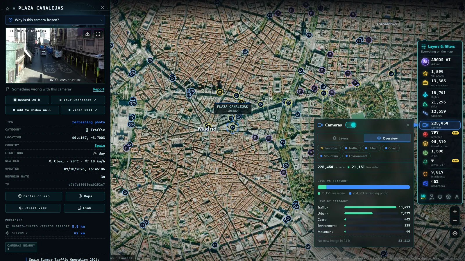
When a rumor claims that a motorway is closed, or a viral video insists it is showing what is happening "right now" in a particular city, there is one source that can settle the matter in minutes: a public camera pointed at that location. Live camera verification is one of the most direct and least exploited techniques in fact-checking journalism. Rather than reconstructing the past, it means looking at the present through thousands of institutional eyes deployed on highways, in city centers, and along coastlines.
This guide explains why an official webcam is a valuable witness, what it can and cannot confirm, how to integrate it into a professional verification workflow, and how to cite it as a source, limits included, because a tool is only reliable when you know exactly where its reach ends.
The Public Camera as a Neutral Witness
Consider what makes an official public camera distinctive among visual sources. It is a fixed point: it does not choose what to show or seek the most dramatic angle; it has been watching the same frame for months or years. It has a known location: the agency that publishes it documents where it is, often down to the exact junction or kilometer marker. It has a timestamp: the image almost always carries a time indicator, and the consultation itself is dated by the viewer. And it has an institutional operator: it is published by a transport authority, a port agency, or a city council, not an anonymous account with unknown interests.
That combination makes it hard to fake within a disinformation operation. Someone fabricating a rumor can invent a video, recycle old footage, or impersonate an account; what they cannot easily do is alter what appears on the official website of a government agency via a camera that anyone can consult independently. The verifier sees the primary source for themselves, and any colleague can repeat the consultation and reach the same conclusion.
In verification work, a public camera is the closest thing to an impartial correspondent stationed on the ground: it does not interpret, does not exaggerate, does not select. It shows.
What a Live Camera Can Confirm, or Debunk
The range of facts verifiable with official webcams is substantial. These are the four main categories.
Actual weather conditions at a specific place and time. If a claim depends on the weather ("historic blizzard," "the storm has devastated the seafront," "dense fog at the airport") cameras in the area provide direct observation: you see snowpack or clear asphalt, real surf or a calm sea. A camera at an Alpine or Rocky Mountain pass tells a different story from a social media post claiming it is impassable; a US 511 highway feed can instantly contradict or confirm a claim about Interstate conditions.
The state of a road or border crossing. Transport agencies concentrate their cameras on sensitive points: mountain passes in the Rockies, Pyrenees, or Alps; city approach roads; major interchanges; international border crossings. Faced with "everything is blocked" or "hours-long queues at the border," cameras on the relevant stretch respond with imagery, free-flowing traffic, a real tailback, or an empty carriageway.
Visible activity at a port or infrastructure access point. Cameras pointing at quayside areas, aprons, or facility entrances make it possible to verify activity or its absence at a glance: movement where paralysis is claimed, or calm where chaos is alleged.
Whether something genuinely mass-scale is happening on public ground right now. Large demonstrations, evacuations, gatherings: truly massive events in open spaces almost always appear in at least one local camera frame. Their total absence from available feeds is not definitive proof that nothing is happening (we will address this in the limits section) but it is a signal that demands more evidence from anyone making the claim.
The Workflow: From Claim to Archived Capture
Using cameras in professional verification requires more than glancing at an image. A rigorous procedure has four steps.
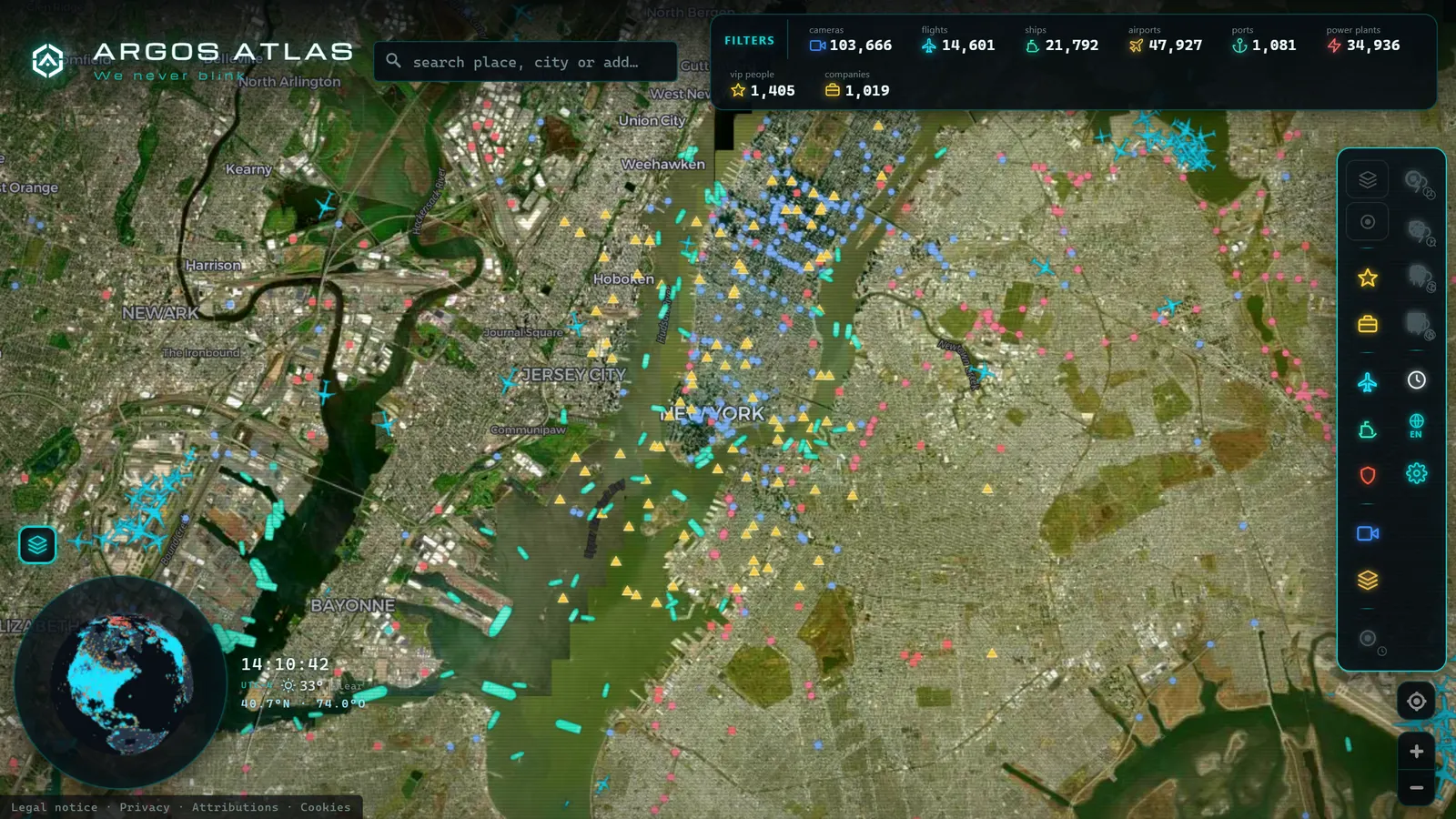
- Locate cameras for the area on an aggregated map. The historic bottleneck was finding the right camera: each agency publishes its own feeds on its own website, with different interfaces and no common overview. An aggregator solves this: you navigate to the coordinates of the event and see at a glance which institutional eyes are nearby. Argos Atlas aggregates thousands of official public traffic cameras, geolocated with their source cited, alongside live flights and vessels; details of what is aggregated and how appear on its sources and methodology page.
- Capture with date, time, and source noted. A live image is ephemeral: what you see now will not be available later. Take a screenshot that includes the image timestamp, note the date and time of your consultation, the operating agency, and the camera's location. Without an archived capture you have a memory, not evidence.
- Cross-check with a second independent source. No single source closes a verification, not even a camera. Cross-reference with a nearby camera, real-time traffic data from the relevant authority (such as US 511 services, UK National Highways, or France's ASFA network), official statements from the operating agency, or verifiable eyewitnesses.
- Archive and document. Store captures with a system that preserves traceability: which camera, operated by which agency, consulted when, showing what. If the verification is published, that documentation is what sustains it against any subsequent challenge.
From the ARGOS ATLAS channel.
Three Scenario Types Where the Camera Decides
The "motorway closed" rumor. A claim circulates on social media that a major route has been blocked for hours. Official cameras on the corridor show normal traffic with a recent timestamp. Capture, cross-reference with traffic data from the transport authority, and the rumor is debunked with dated visual evidence in minutes.
The viral video placed in the wrong location. A dramatic video is attributed to a specific city. First, the scene is geolocated using visual image analysis techniques; then, public cameras in both the claimed and actual locations complete the verification by showing current conditions, the weather, the light, and the visible environment expose the misattribution.
The exaggerated weather event. A claim asserts that a "snowfall has buried" a specific region. Cameras at local mountain passes show snow, yes, but operational roads and ordinary depths. The event is real; its scale is inflated. The camera allows you to calibrate the nuance: neither deny the phenomenon nor accept the hyperbole.
Honest Limits: What a Camera Cannot Do
A tool is only professional when its edges are understood. Public cameras have several.
Frame rate and refresh interval. Many public cameras do not stream continuous video but publish images that refresh at set intervals, seconds for some feeds, several minutes for others. Between one frame and the next, something may have occurred that was not recorded. Always check the timestamp before drawing conclusions.
A limited field of view. The camera sees its frame and nothing beyond it. A clear section of road does not mean the entire route is clear; the incident may be two hundred meters beyond the edge of the shot. This is why consulting multiple cameras covering the same zone matters.
Cameras that go down. They depend on power and connectivity and they fail, sometimes precisely during the storm or incident you were trying to verify. A camera with no signal is an absence of data, not a data point: it permits no conclusion in either direction.
Areas with no coverage. The public camera network is dense on major roads and infrastructure and sparse or nonexistent in rural areas, secondary streets, and large portions of the world. If the event occurs outside the reach of any camera, this technique does not apply, and forcing it would be bad practice.
The rule that summarizes every limit: the camera proves what it shows, not what it does not show. A positive image (you can see X) is strong evidence. A negative result (you cannot see X) is only an indicator that demands more sources. Conflating the two is the most serious mistake a verifier can make with this tool.
How to Cite a Webcam as a Source
If the verification is going to be published, the camera must be cited with the same rigor as any other source. The minimum standard has four elements:
- Operating agency: who publishes the camera (a transport authority, a port authority, a city council, a state DOT).
- Location: the documented location, with available detail (road, kilometer marker, junction name).
- Time: the date and time of the image timestamp and of your consultation.
- Archived capture: the saved image, because a live source retains no history and the evidence must be producible afterward.
Anyone reading the piece can thus evaluate the source and (while the camera remains operational) repeat the consultation. That reproducibility is what turns an image into journalistic evidence.
Where to Find Them All in One Place
The bottleneck of this technique was never the existence of cameras (there are thousands, published by agencies in dozens of countries) but their dispersion: each source on its own website, with no common map. For a verifier working against a deadline, spending twenty minutes finding the right camera can mean arriving too late.
That is the gap an aggregator fills. Argos Atlas brings together thousands of official public traffic cameras in a single interactive map, geolocated, with each camera's source cited, showing the latest frame published by the operating agency, no registration required, free to use. For the workflow described in this guide, it means always starting from the same place: the map of the area in question. It integrates naturally with the rest of the verification process, from checking a viral video to completing a geolocation by observing the current state of the site.
Frequently Asked Questions
Can I use a public camera as a journalistic source?
Yes, and it is a primary visual source of the first order, always subject to the caution you apply to any source. Identify the operating agency, verify that the image is current via its timestamp, capture and archive with date and time, and cross-check with a second independent source before publishing. An official camera with a known location and timestamp, consultable by anyone, meets the verifiability standards that journalism demands of its sources.
How do you cite a webcam?
With four elements: the agency that publishes the feed, the camera's documented location, the date and time of both the image timestamp and your consultation, and the archived capture as evidence. A standard form: "Camera operated by [agency] at [road and location], consulted on [date] at [time]; capture held in editorial archive." The citation must allow a third party to evaluate the source and, while the camera remains active, repeat the consultation.
What can a camera NOT prove?
Anything outside its field of view, anything that occurs between two frames, or anything that happens while the camera is down. The camera proves what it shows, not what it does not show: a clear stretch of road does not mean the entire route is clear, and the absence of something in a frame is an indicator, never conclusive proof. It also cannot establish causes or intent: it shows the visible what, not the why.
What if the camera is down exactly when I need it?
It happens, sometimes precisely during the storm or incident that prompted the verification, because cameras depend on power and connectivity. Plan B: other nearby cameras covering the same zone, alternative live sources (traffic data, live flight and vessel feeds), and official information from the operating agency. And a rule of caution: a camera that is down is an absence of data, and speculating about the reason without additional evidence is pure conjecture.
Conclusion
Live public cameras give verifiers something almost no other source offers: direct, immediate, reproducible access to the present state of a specific location, backed by an identified institutional operator. Used correctly (with an archived capture, a second source, and clear-eyed awareness of their limits) they dismantle breaking rumors in minutes and provide visual evidence that is hard to dispute. Used incorrectly (absence of image treated as proof, a single frame taken as the whole picture) they produce a false confidence that no journalist can afford.
The method is in this guide; the eyes are already out there, distributed across the roads and cities of much of the world, and they are public. To see how they come together in a single place (with every source cited and an explicit commitment to transparency) you can open the map and start incorporating live visual sources into your verification toolkit.
Frequently asked questions
Can I use a public camera as a journalistic source?
Yes, with the same caution you apply to any source: identify the agency that operates it, check that the image is current via its timestamp, capture and archive it with date and time, and cross-check with a second independent source. An official camera with a known location and timestamp is a citable primary visual source.
How do you cite a webcam?
With four elements: the agency that publishes the feed, the camera's documented location, the date and time of both the image timestamp and your consultation, and the archived capture itself. Example: 'Traffic camera operated by [agency] at [location], consulted on [date] at [time]; capture held in editorial archive.'
What can a camera NOT prove?
Anything outside its field of view or between two frames. The camera proves what it shows, not what it does not show: a clear stretch of road does not mean the entire route is clear. It also cannot establish causes, it shows the visible what, not the why.
What if the camera is down exactly when I need it?
A common scenario: cameras depend on power and connectivity. Fall back to nearby cameras covering the same area, other live sources (traffic data, live flight or vessel feeds), and official statements from the operating agency. A camera that is down is an absence of data, not evidence of anything.
- Free OSINT Tools for Open-Source Investigations: The Starter Kit
- The Ethics of OSINT: What Is Legal to Investigate with Open Sources
- How to Get Started With OSINT: Beginner's Guide & Free Tools
- OSINT Examples: 8 Techniques You Can Try Today
- Ukraine War Map, Live: Front Lines and Black Sea Ships
- Area 51 Live Map: What Open Sources Really Show Over Groom Lake