Blog · Live flights
What is ADS-B: the technology that makes flight tracking possible

Every time you open a flight radar and watch hundreds of aircraft moving in real time, you are seeing the result of a technical decision made decades ago: that aircraft should report their position openly, to anyone willing to listen. Understanding what ADS-B is means understanding why that map exists, why it is free, why anyone can contribute to it with a rooftop antenna, and also why it has gaps. This guide explains it without unnecessary jargon: where ADS-B came from, how it works, what data travels in each signal, and how those signals become the icons you see on screen.
Before ADS-B: radars that ask questions
To appreciate the change, it helps to understand what came before. Classical air surveillance relied on two types of radar.
Primary radar works like the kind depicted in films: it fires pulses of radio energy, they bounce off the metal skin of an aircraft, and the antenna measures the echo. It detects any object, cooperative or not, but it only says "something is there", no identity, no precise altitude.
Secondary radar is more conversational: it interrogates a piece of onboard equipment called a transponder via radio, and the transponder replies with an identification code and altitude. This works well, but the information depends on the radar asking the question. Radar installations are expensive and their coverage has hard limits, especially over oceans and remote terrain, the North Atlantic, the central Pacific, or the Sahara, for instance.
Towards the end of the twentieth century, the combination of satellite navigation and data links opened a different possibility: an aircraft that already knew its position with great precision could simply broadcast it, without waiting to be asked.
What ADS-B means, word by word
ADS-B stands for Automatic Dependent Surveillance–Broadcast, and the name, although dry, describes the system accurately:
- Automatic: the aircraft transmits on its own, with no pilot input and no external interrogation.
- Dependent: the position depends on the aircraft itself, which calculates it using its onboard satellite navigation receivers.
- Surveillance: the purpose is surveillance, knowing who is where.
- Broadcast: the information is sent to everyone simultaneously, not to a specific recipient.
In practice: the aircraft calculates its position by satellite and broadcasts it on 1090 MHz, openly and several times per second. Any receiver tuned to that frequency (whether in an air traffic control tower at Heathrow or Chicago O'Hare, or on an enthusiast's rooftop anywhere in between) receives exactly the same information.
This is a complete philosophical shift from radar: from "I illuminate and interrogate you" to "I announce myself continuously." That is why online flight viewers are not radars in the strict sense, even though the name has stuck. They are networks listening to what aircraft say about themselves, as explained in the guide on how to see aircraft in real time.

What data travels in each signal
Each ADS-B message is short, but the sum of messages assembles a complete picture of a flight. The essential fields:
- Identity: every transponder carries a unique hexadecimal code, the ICAO24, which identifies the individual aircraft for its entire life, like a chassis number or Vehicle Identification Number. The flight callsign is also transmitted.
- Position: latitude and longitude calculated by satellite, with accuracy far superior to classical radar.
- Altitude: barometric altitude, the standard reference in aviation.
- Speed and heading: the movement vector, which allows viewers to draw the flight path and predict position between updates.
With the ICAO24 and public aircraft registration databases (maintained by authorities such as the FAA in the United States, the CAA in the United Kingdom, and EASA across Europe) a flight viewer can tell you not just "there is an aircraft there," but exactly which airframe it is, what model, and which flight it is operating.
From the ARGOS ATLAS channel.
Who listens: the rooftop network
This is the most surprising part of the story. Receiving ADS-B requires no expensive infrastructure: a cheap software-defined radio receiver (the kind that plugs in via USB for around twenty dollars) and a simple antenna are sufficient. With a well-placed antenna, anyone can pick up aircraft over a radius of several hundred kilometres, depending on local terrain and antenna height.
Global networks have been built on this foundation: thousands of enthusiasts have receivers on balconies, rooftops, and attics across every continent, and they share their data with aggregators that combine all those feeds into a worldwide picture. It is citizen science at a planetary scale. The coverage of the flight maps you use was not funded by any government agency; it was assembled piece by piece by a community.
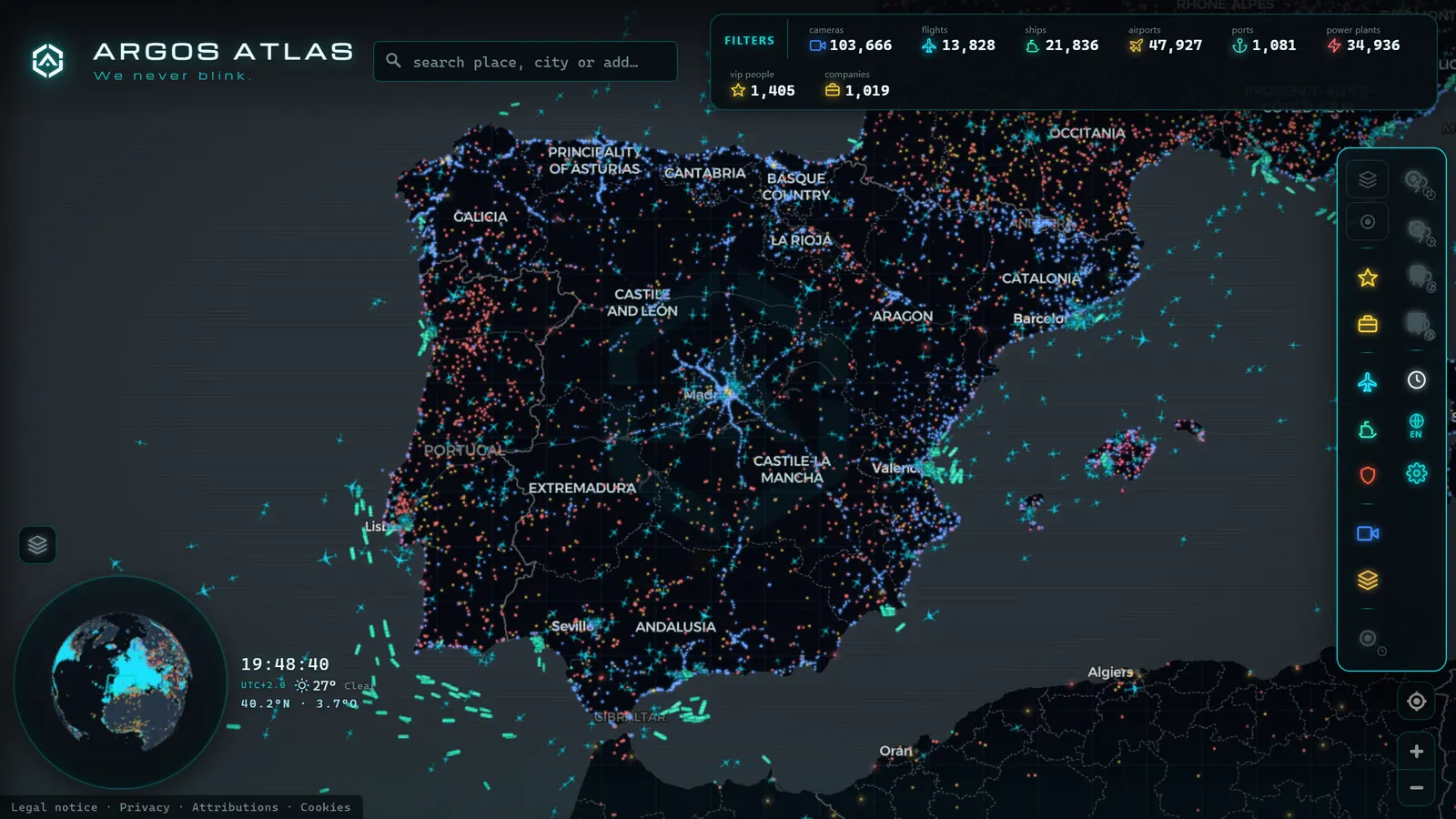
This also explains the geography of coverage: excellent where there are population and enthusiasts (Western Europe, the US East Coast, Japan, Australia's major cities) patchy in sparsely populated regions, and practically non-existent in the middle of oceans, where there are no rooftops to put antennas on.
Why the signal is public and unencrypted
It often surprises people that such a safety-critical system transmits openly, but it is a deliberate design decision. ADS-B was created for cooperative surveillance and collision avoidance: the more actors that receive an aircraft's position (controllers, other aircraft equipped with collision-avoidance systems, airport ground vehicles) the safer the system. Encrypting the signal would add complexity and potential failure points in exactly the context where the goal is the opposite: making sure that everyone can see everyone else.
The side effect is transparency: if the signal is open so that another aircraft can receive it, it is equally open to the enthusiast with the antenna. Privacy for certain operators is managed through other mechanisms (agreements with aggregators, data-filtering programmes) not by encrypting the transmission. That nuance fuels interesting debates covered in other articles on this blog.
Increasingly mandatory
For years ADS-B was optional, but the regulatory balance has shifted decisively. The FAA mandated ADS-B Out in US controlled airspace from 1 January 2020, and the EU introduced equivalent requirements for most IFR traffic from June 2020 under EASA Implementing Regulation EU 2017/386. The reasoning of regulators (with Eurocontrol and the FAA leading the respective rollouts) is straightforward: cooperative surveillance is more precise and cheaper than carpeting territory with radar installations.
Exemptions remain, particularly for light aviation and recreational flying in certain airspace classes, which is why some small aircraft and microlights you see overhead do not appear on the maps. The trend, in any case, points in one direction: more aircraft transmitting, more sky visible.
MLAT: triangulating aircraft that do not broadcast position
There is an intermediate case worth explaining: aircraft whose transponder does emit signals (responding to secondary radar, transmitting identity) but does not broadcast its position, because the equipment is older or lacks the full ADS-B output function. For these aircraft, multilateration, or MLAT, provides an alternative.
The idea is elegant: if four or more ground receivers pick up the same signal, each receives it at a very slightly different instant, according to its distance from the aircraft. By comparing those time differences using precise clocks, it is possible to calculate where the signal originated, a time-difference-of-arrival approach, similar in spirit to how satellite navigation works but in reverse. MLAT requires a dense network of well-synchronised receivers, so it works best in areas with good collaborative coverage such as Western Europe and the northeastern United States.
The limits: where the system falls short
No system is complete, and ADS-B has structural gaps that are worth knowing in order to read flight maps correctly.
The primary one is coverage: the signal travels in a straight line and needs a receiver within range. Over the Atlantic, Pacific, and other remote regions there are no ground receivers, and at low altitudes mountains block the signal. Satellite-based receivers (constellations that listen for ADS-B from low Earth orbit) partly address this, and they are the reason that more oceanic segments appear on viewers each year. Full global coverage, however, remains a work in progress.
The second limit is equipment: what does not transmit cannot be seen. Exempt aircraft, older equipment, and flights operating with transponders in limited modes all create absences on the map that are not viewer errors but physics and regulation. The full catalogue of reasons is covered in why some aircraft do not appear on online radars.
From receiver to your screen
To close the loop, it is worth tracing how all of this ends up as a map. Every position you see has travelled through three stages. First, aggregation: data from thousands of receivers arrives at platforms that combine it; the same aircraft may be picked up by dozens of antennas simultaneously. Second, deduplication and cleaning: multiple feeds are merged into a single coherent track, erroneous readings are discarded, and the data stream is ordered. Third, visualisation: each aircraft becomes an icon with its heading, data sheet, and flight path, refreshing every few seconds.
This is how flights reach a viewer like Argos Atlas, where the live aviation layer shares the same map with public traffic cameras and vessel positions, the same open-data philosophy applied to the sky, the road, and the sea.
Frequently asked questions
What exactly does an aircraft transmit via ADS-B?
Its identity (the aircraft's unique ICAO24 hexadecimal code and the flight callsign) the satellite-calculated position, barometric altitude, speed, and heading, along with other technical parameters. Everything travels in short messages, unencrypted, broadcast several times per second on 1090 MHz.
Can anyone receive ADS-B signals?
Yes, and that is the foundation of the entire flight tracking ecosystem. The signal is open by design, and picking it up requires only an inexpensive radio receiver and a simple antenna. With a good location, the range can reach several hundred kilometres. The global tracking networks exist precisely because thousands of enthusiasts set up receivers and share their data.
Is ADS-B mandatory?
It depends on the airspace and aircraft type, but the direction is clear: Europe and the United States have required it for most traffic since 2020. Commercial aviation now transmits broadly as standard practice, while some light aviation and recreational flying retains exemptions in certain airspace classes, which explains why not every small aircraft appears on the maps.
Are ADS-B and a transponder the same thing?
No, though they often live in the same box. The classic transponder is equipment that responds when secondary radar interrogates it: it only speaks when asked. ADS-B is a broadcast function: the aircraft continuously transmits its position without waiting for any interrogation. Modern equipment integrates both capabilities, but conceptually they represent two distinct approaches to surveillance, one reactive, one proactive.
Is ADS-B a radar? What "ADS-B radar" and "ADS-B system" actually mean
No, ADS-B is not a radar, even though the two names get used as if they were interchangeable. A radar sends out a pulse and measures the echo that bounces back off the aircraft; ADS-B sends nothing out to the plane at all. The aircraft itself broadcasts its own position, altitude, speed and identity, picked from its onboard GPS, over a radio signal that anyone with the right receiver can hear. That is the whole difference between "asking" (radar) and "listening" (ADS-B), and it is why search engines and casual users still lump both under the word "radar": the result on the screen, a moving dot over a map, looks the same regardless of which method put it there.
| What people search | What it actually refers to |
|---|---|
| ADS-B radar / ADS-B flight radar | A site or app showing live flight positions sourced from ADS-B, not from a physical radar antenna |
| ADS-B system | The full chain: the aircraft's transponder, the ground receivers that pick up the broadcast, and the server that aggregates it |
| ADS-B (ADS-B, no "radar") | The broadcast standard itself, Automatic Dependent Surveillance-Broadcast |
| Radar (plain) | The older, separate technology that interrogates aircraft instead of listening to them |
The "ADS-B system" a search engine is looking for when someone types that phrase is not one device, it is three parts working together. First, the transponder on the aircraft, which transmits its data roughly once per second without needing anyone to ask. Second, the ground receiver, the kind of low-cost antenna that hobbyists run from a rooftop, which only captures signals from planes it has a clear line of sight to. Third, the aggregation layer, where many receivers around the world feed into one server that stitches their partial views into a single live map. None of those three parts involves a rotating radar dish, which is precisely why aviation and air traffic control still keep both technologies: radar works even on aircraft that broadcast nothing, while ADS-B gives far more detail (speed, callsign, exact altitude) from planes that do.
So when a flight-tracking site is described as "ADS-B flight radar," the phrase is really describing a radar-style display built from non-radar data. To see this distinction in practice, from raw broadcast to a dot moving on a live map, see how to watch aircraft in real time and, for the display layer itself, the flight-tracking tools built on this same data.
Conclusion
ADS-B is the short answer to the question everyone asks when they first discover flight maps: how is it possible to see all of this, free and in real time? It is possible because aircraft calculate their position by satellite and report it openly, because a global community of enthusiasts decided to listen, and because aggregators convert that chorus of signals into a readable map.
The best way to consolidate the theory is to see the result in motion: open the map, activate the live flight layer, and watch how thousands of transmissions on 1090 MHz become, before your eyes, the pulse of global air traffic.
Frequently asked questions
What exactly does an aircraft transmit via ADS-B?
Its unique identifier (the ICAO24 hexadecimal code stored in the transponder), the flight callsign, the satellite-calculated position, altitude, speed, and heading, among other data. Everything is transmitted openly, unencrypted, several times per second.
Can anyone receive ADS-B signals?
Yes. The signal is broadcast unencrypted on 1090 MHz, and a cheap radio receiver with a simple antenna is all it takes to pick it up. In fact, the global flight tracking networks are sustained by thousands of receivers set up by enthusiasts on balconies and rooftops.
Is ADS-B mandatory?
In much of the busiest airspace, yes: Europe and the United States have required it for most traffic since 2020, with requirements that vary depending on aircraft type and airspace class. Some light aviation and recreational flying remains exempt in many contexts.
Are ADS-B and a transponder the same thing?
Not exactly. The transponder is the classic piece of equipment that responds to secondary radar interrogations; ADS-B is a function that broadcasts position without waiting to be asked. In practice they usually coexist in the same onboard unit, but they are distinct concepts.
- Military Aircraft in Real Time: What You Can See in Open Sources, and What You Cannot
- The World's Busiest Air Routes (and Why Planes Don't Fly in Straight Lines)
- Track Flights in Real Time Over Mexico: A Complete Airspace Guide
- Live Flights Over Argentina: Ezeiza, Aeroparque and the Patagonian Airports
- Live Flights over Australia and Oceania: Qantas, Virgin Australia and Trans-Pacific Routes
- Live Flights Over Japan: ANA, JAL and the World's Busiest Domestic Routes