Blog · OSINT & verification
Sudan conflict map live: what you can track and what's dark
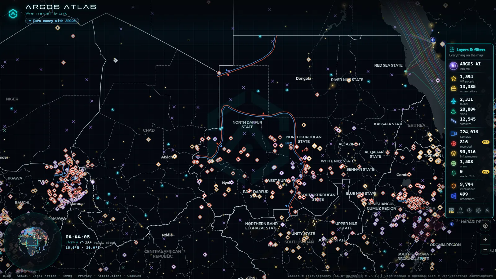
A live Sudan conflict map gives you three usable signals and no fourth: the incidents recorded in the country over a rolling 90 days, the aircraft still broadcasting a position over Sudanese airspace, and the ships sitting off Port Sudan. It is free to open, it needs no account, and the country layer is one click away on the live map of ARGOS ATLAS.
What it does not give you is eyes on the ground. There is no public camera in Sudan, no street view of Khartoum updating by the minute, and no confirmed front line drawn across Darfur. This piece is about the signal that survives when a country stops broadcasting: what it is, where to look for it, and which half of the map is simply dark.
The essentials, in 20 seconds
- 90 days is the window: the conflict layer carries a rolling three months of dated incidents, and anything older drops out of view.
- 1,690 recorded events fill that window across the whole map, 1,253 of them with a geolocated video attached.
- Port Sudan is the only node in the country where air signal and sea signal overlap in a useful way.
- No cameras: Sudan contributes nothing to a catalogue of 224,014 public cameras (count as of October 2026).
- Darfur, Kordofan and the Blue Nile are where coverage thins out fastest, in that order.

Sudan conflict map live: what the layer actually contains
Open the country and four things stack up. Dated incidents, each with a coordinate, over a rolling 90 days. Aircraft positions, which in Sudan means mostly traffic crossing the airspace rather than serving it. Ship positions in the Red Sea, concentrated off one port. And fixed infrastructure, which neither moves nor goes offline.
Those fixed layers are what makes an empty map readable. The catalogue holds 47,927 airports and airstrips, 1,078 ports, 34,936 power sites and 5,356 dams worldwide, and the Sudanese share of them appears whether or not anything is happening there. A named runway in North Darfur with no aircraft on it tells you something. So does a port with working infrastructure and no anchored vessels in front of it.
Where the recorded events cluster
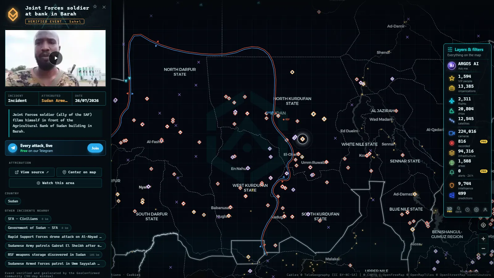
Three clusters do most of the work. The capital triangle of Khartoum, Omdurman and Khartoum Bahri generates the densest reporting, because that is where phones and witnesses were concentrated and where some of them stayed. El Fasher and the rest of North Darfur come second, in bursts rather than a steady stream. South Kordofan, North Kordofan and Al Jazirah appear as thinner, scattered points tied to specific offensives.
Read that distribution carefully. A cluster marks where incidents got reported, not where most of them happened. Every conflict layer carries the same bias: reading Lebanon through 90 days of events runs into it with Beirut overweighted against the Bekaa. In Sudan it bites harder, because the gap between a reporting district and a silent one is wider.
From the ARGOS ATLAS channel.
Airports and airstrips: who still broadcasts a position
Port Sudan is the country's working gateway and the only Sudanese airport where scheduled civil movements are a reasonable expectation. Khartoum International sits in the catalogue as a location with a runway and nothing arriving on it. The desert strips across Darfur and Kordofan are in the same state: mapped, named, silent.
What you see over Sudan is mostly transit. Aircraft at cruise altitude crossing between the Gulf, East Africa and Egypt broadcast cleanly, while anything low and slow often does not appear at all. The whole map carries 89 military-flagged aircraft at a time worldwide, so a military tag near the Red Sea is rare enough to check rather than assume. Why some aircraft show and others never do is covered in the guide to watching flights in real time.
Port Sudan and the Red Sea corridor
The sea is the least degraded signal Sudan has. Vessels transmit their own position, and the Red Sea is busy enough that the corridor past Port Sudan stays legible: ships at anchor off the breakwater, ships moving north toward Suez, ships holding south. Across the whole map 20,808 vessels are visible at a given moment out of 38,983 tracked, and that ratio matters more than either total.
What ARGOS sees right now
Two habits make the anchorage useful. Count the anchored cluster on several different days instead of reading one snapshot, and check whether a track enters the port or merely passes it. How the underlying signal works, including how easily it is switched off, is in what AIS is and how ships are located.
The parts of the country that are dark to every public map
Most of Sudan, by area. Western Darfur, the Blue Nile border country, the Nuba mountains and the long stretches of the Nile between towns produce almost no public signal of any kind: no cameras, no low-altitude aircraft, and incident points separated by days. Connectivity cuts make it worse, because the same blackout that stops a clip from being uploaded stops the report that would have placed it.
The points named here
The failure mode to avoid is reading emptiness as calm. An area with no points is an area with no reports, and in Sudan those are frequently the areas where access is hardest. The same pattern runs through Nigeria, 90 days of events and zero cameras: the quiet north is quiet on the map, not on the ground.
No cameras, and why that absence shapes everything
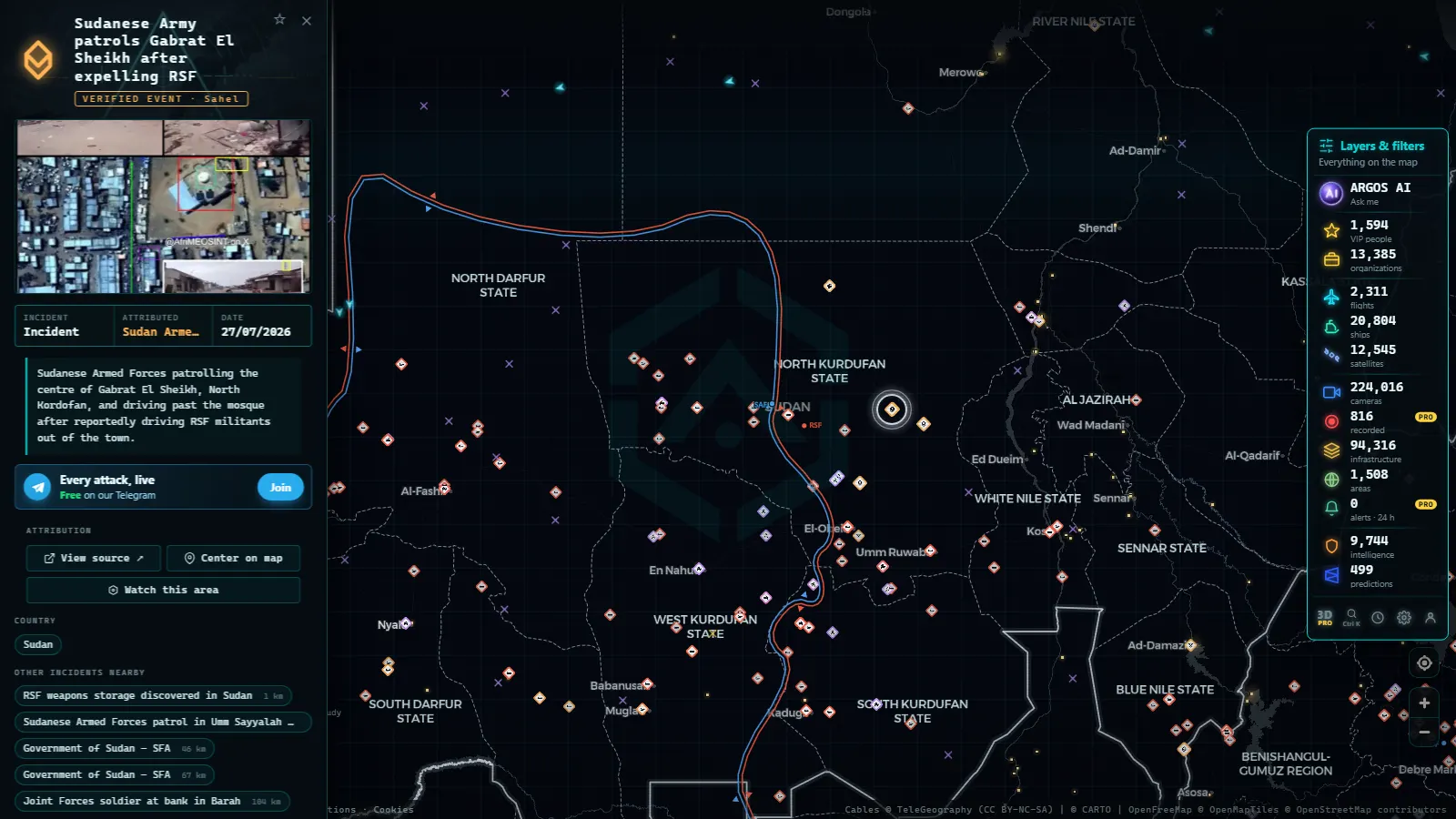
Public camera feeds exist because an operator chose to publish them, almost always a road authority, a city or a transport agency. No Sudanese operator does, so a catalogue of 224,014 public cameras (count as of October 2026) holds nothing inside the country. There is no live view of a Khartoum street, and there never was one to lose.
What stands in for it is retrospective video attached to events: footage somebody filmed, somebody placed and somebody dated. That is useful, and it is not live. Treat every clip as a claim with a location attached, which is exactly how verifying a viral video handles it.
Checking the Sudan conflict map live in five minutes
A routine beats browsing. Filter to the country, read the full 90 days, then narrow to the last week and watch what disappears: that difference is the live part. Read the air and sea layers separately from the events, because they answer different questions. And name the state before you repeat anything, because the states inside the country are not comparable to each other.
| Layer | What it holds for Sudan | What to do with it |
|---|---|---|
| Events, 90 days | Dated points, some with video attached | Check the date on each point before quoting the cluster |
| Flights | Overflights, plus arrivals at Port Sudan | See whether the track starts and ends outside the country |
| Ships | Vessels anchored and moving off the Red Sea coast | Count the anchorage across several days, not once |
| Ports and airports | Fixed nodes, with or without traffic | Spot the infrastructure that has no movement on it |
| Cameras | Nothing | Stop waiting for a feed that does not exist |
| Regions | State boundaries for filtering | Name the state, never the whole country |
Cross-checking before you repeat it
One signal is a hypothesis. A cluster of dated events plus a vessel that stopped calling plus an airport with no arrivals is an argument; any one of them alone is a coincidence waiting to embarrass you. Write down the date of every element you use, because a week-old point and a live ship position in the same sentence read as simultaneous and are not. Then name the absence out loud: no signal in West Darfur this week is defensible, nothing happened in West Darfur this week is not.
What you won't see
- No live camera anywhere in Sudan, and no archive of one either.
- No confirmed front line: incident clouds show reporting extent, not control.
- No faces or plates: nothing in these layers identifies a person, by design.
- No low-altitude aircraft over most of the country, so helicopters and light traffic stay invisible.
- No guarantee a ship is where it says: positions are self-transmitted, so they can stop or lie.
- No ground truth during a connectivity cut: the map goes quiet exactly when you want it most.
Frequently asked questions
Is the Sudan conflict map free, live and open without registration?
Yes. It opens with no account, no trial and no paywall, and the layers refresh on their own. \"Live\" means something different per layer: aircraft positions update in near real time, ship positions as often as they arrive, and recorded incidents land with a reporting delay measured in hours or days rather than seconds.
Can I see the front lines between the two sides in Sudan?
No, not as a confirmed line. Front lines are drawn only where the line is documented well enough to hold a shape, and an incident cloud is not that. If you see a dense shaded area, read it as the extent of reported events during the window, never as a military position or a claim of control.
Which airport in Sudan still has flights you can follow?
Port Sudan is the practical answer, since the Red Sea airport is where scheduled civil movements concentrate while Khartoum International sits in the catalogue as a runway with nothing arriving on it. Dozens of other Sudanese strips are mapped as fixed points. An airport in a catalogue is a location, not a promise of traffic.
Why do ships disappear from the track off Port Sudan?
Because the position is self-transmitted, not radar. A crew can switch the transmitter off, a position can be falsified, and reception over the Red Sea depends on what receives the signal. A gap in a track means the signal stopped arriving, which is not the same thing as the vessel stopping, turning or being hit.
Are there live cameras in Khartoum or anywhere else in Sudan?
No. Public camera feeds exist because a road or city operator publishes them, and no Sudanese operator does, so the country contributes nothing to the camera catalogue. For a street-level view you are limited to geolocated video attached to recorded events: retrospective, often low resolution, and always worth verifying before repeating.
- What Is OSINT? Open-Source Intelligence Explained with Real Examples
- How to Geolocate a Photo: OSINT Techniques Step by Step
- How to Verify a Viral Video: A Practical Visual Verification Guide
- Live Cameras as a Journalistic Verification Tool
- Free OSINT Tools for Open-Source Investigations: The Starter Kit
- The Ethics of OSINT: What Is Legal to Investigate with Open Sources