Blog · Live flights
Flightradar24 Alternatives: Free Flight Trackers Compared
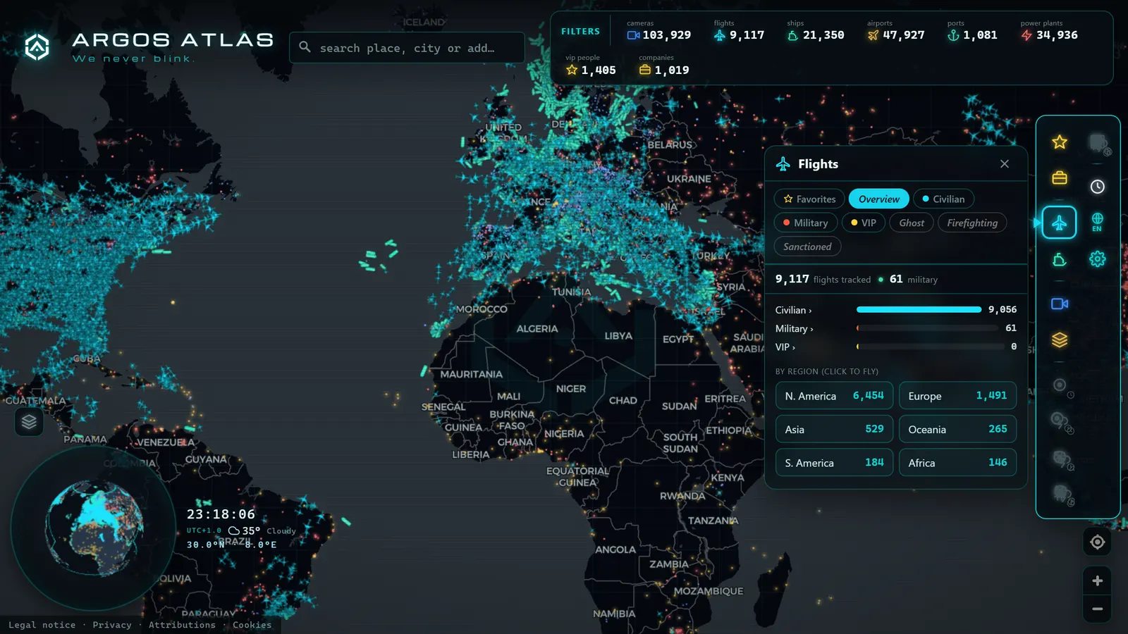
Every few weeks the same search spikes. Someone watches an aircraft cross the sky, opens a flight tracker, hits a subscription wall in front of the exact thing they wanted, and starts hunting for alternatives. Fair enough. The problem is that most "best Flightradar24 alternatives" lists are logo parades: ten names, no explanation of what actually separates them.
Here is the short version, and it changes how you shop. Nearly every civilian flight tracker on the internet drinks from the same well. Once you understand that well (ADS-B, and the volunteers who receive it) the question stops being which brand and becomes which capability, and is it worth paying for. This guide walks through it honestly: what Flightradar24 genuinely does well, what free alternatives tend to offer, where our own live map fits, and the limits that no platform can engineer away.
The essentials, in 20 seconds
- ADS-B: the signal every flight tracker reads is unencrypted and travels through open air, so no platform owns the data, only its receiver network.
- Flightradar24, FlightAware, ADS-B Exchange: three different platforms built on the same raw signal, not clones of each other.
- Live position: a commodity on every tracker; flight history and movement alerts are what gets paywalled.
- ARGOS ATLAS: shows civil, military and private jets live and free, without an account and with no blocking filter hiding aircraft.
- Our map: adds AIS ship positions, airports, ports and power infrastructure on the same screen as the live flights.
Every flight tracker starts with the same signal
Modern aircraft continuously broadcast who they are and where they are. The system is called ADS-B (automatic dependent surveillance–broadcast) and the detail that matters to you is that those transmissions are unencrypted and travel through open air. Any receiver in range can hear them. That single design decision is why flight tracking became a public phenomenon at all, and we unpack the mechanics in what ADS-B is and how flight tracking works.
The consequence is that no tracker owns the data. What each platform owns is a receiver network: volunteers plug a small antenna into a window, feed the signals upstream, and the service stitches thousands of those feeds into a single moving map. Where volunteers are dense (western Europe, North America, Japan, the Gulf) coverage is excellent. Over oceans, deserts and stretches of Africa and Central Asia it thins, and platforms patch the gaps with satellite reception or with multilateration, a technique that needs several ground receivers hearing the same aircraft at once.
So the real differences between one tracker and the next come down to four things:
- Network density: how many receivers feed it, and where they sit.
- Editorial policy: what the platform chooses to display, and what it filters out.
- Paywall placement: which features are gated behind a subscription.
- Context: what else appears on the map alongside the aircraft.
Everything that follows is a variation on those four.
What Flightradar24 does well, and why it is the benchmark
It is worth being straight about this: Flightradar24 is the reference for good reasons, and pretending otherwise would make this guide useless. It has spent years building a broad receiver network, its mobile apps are polished, and its aircraft, airline and airport pages are genuinely informative. Above all, it does two things that are hard and expensive: it keeps deep flight history, so you can look up what a given aircraft did well in the past, and it offers alerting, so a specific registration or route can notify you when it moves.
Two other names come up constantly and deserve the same respect. FlightAware is strongly rooted in North American operations and in the professional side of aviation, with a focus on flight status, planning and industry data. ADS-B Exchange grew from a different philosophy: show what the receivers receive, with an open-data ethos and minimal filtering. They are not clones of each other. They are three different answers to the same raw signal.
If your need is a searchable archive of past flights or a reliable push notification when a tail number takes off, the honest advice is that those needs are well served by paid tiers, and that a free tool replacing them is rare.
From the ARGOS ATLAS channel.
What the free alternatives generally offer
Set aside brand names and free flight trackers fall into recognisable families, each with its own trade-off.
Unfiltered trackers. Some platforms deliberately do not apply owner-requested blocking, so military transports, government aircraft and business jets whose owners asked to be hidden still appear. For anyone interested in aviation as a public phenomenon, this is the most valuable difference in the whole market. The trade-off is usually a plainer interface and a smaller ecosystem of extras.
Open-data and community projects. These prioritise raw access: feeds, exports, aggregate statistics, sometimes an API with modest free quotas. Excellent if you are building something or doing research; rougher if you just want a pretty map on your phone.
Official airline and airport pages. Not trackers at all, strictly speaking, but often the right tool: they know the gate, the belt and the boarding status, which no ADS-B map can tell you. What they do not give you is the aircraft's actual position, or the inconvenient truth that the inbound flight is still two hours from the runway.
Context maps. The category we belong to: platforms where flights are one layer among several rather than the whole product.
And the honest caveats that apply across free options: advertising on the consumer-facing ones, thinner coverage in some regions, little or no historical depth, and rate limits if you try to pull data at scale.
Flightradar24 alternatives compared by capability
The useful comparison is not brand against brand, it is need against price. This table maps what people actually come looking for onto what the free and paid worlds typically provide.
| What you need | Free option | Typically paid |
|---|---|---|
| See what is in the air right now | Any live ADS-B map, ours included | , |
| Identify one aircraft by callsign or registration | Available on essentially every tracker | , |
| Military and government aircraft | Trackers that apply no blocking filters | Restricted or absent on some platforms |
| Business jets and privacy-blocked tails | Unfiltered trackers show them | Filtered out where owner blocking is honoured |
| Flight history months or years back | Shallow at best | The classic subscription feature |
| Alerts when a specific tail number moves | Occasionally, heavily limited | Standard in paid tiers |
| Detailed weather layers, 3D views, no ads | Basic layers | Premium tiers |
| Bulk data or an API for a project | Small free quotas | Commercial licence |
| The aircraft plus the airport, the ships and the cameras around it | Our map | , |
Read the table twice and the pattern is obvious: live position is a commodity; memory and automation are the products. Anyone charging for the live picture alone is selling you the free part.
What our live flight layer adds: context
Our answer to this market is not "the same map, cheaper". It is a different shape of map.
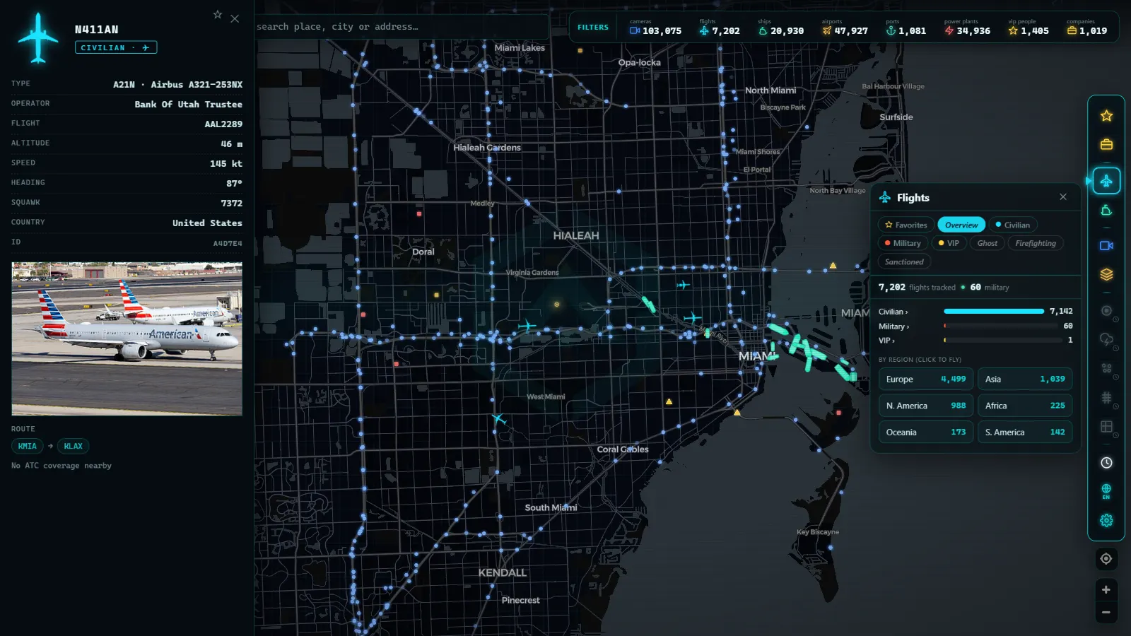
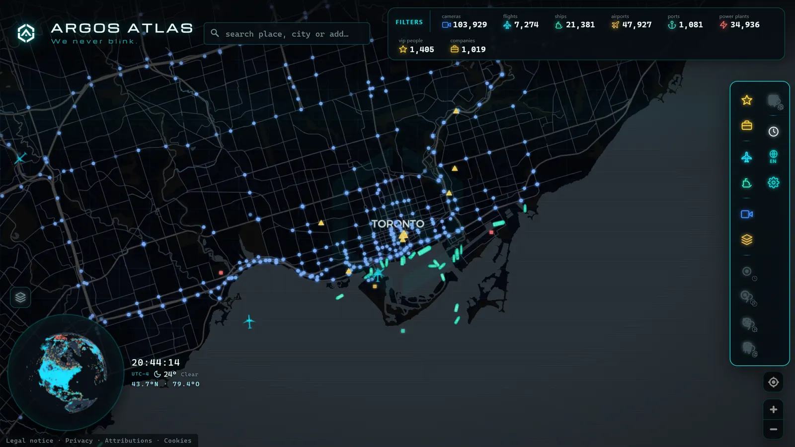
Open the ARGOS ATLAS map, switch on flights, and you get live traffic free and without an account: civil airliners, military aircraft and private jets on the same canvas, with no blocking filter deciding what you are allowed to see. That part is table stakes for a good free tracker. The part that is ours is what sits underneath: public traffic and coastal cameras, ships broadcasting AIS, airports, ports and power infrastructure, all on the same screen.
That combination changes the kind of question you can answer. A flight diverts, and instead of watching a lonely icon turn around you can open the destination airport, check the aircraft holding around it and pull up a public camera on the road nearby. A carrier group's support flights come and go, and the ships are right there on the same map. A jet lands at a small coastal airfield and the port two kilometres away tells you what else is happening that day. Single-purpose trackers show you the aircraft; a context map shows you the situation.
If you are new to the whole idea, the practical walkthrough lives in our guide to watching aircraft in real time.
Use cases: pick the tool for the job
"What is that plane over my house?" Any live map answers this in seconds, and the follow-up (reading the tail number, decoding the callsign, working out who operates it) is a skill worth ten minutes of your life. We cover it in how to identify an aircraft by registration and callsign.
Waiting for an arrival. Use both tools. The airline or airport page owns the gate and the baggage belt; the tracker owns reality, and will show you that the inbound aircraft has not left its origin yet while the board still says "on time".
Military movements. This is where the choice of tracker matters most, because filtering policy decides what you see. Transports, tankers and surveillance aircraft frequently broadcast during routine transits, and our guide to tracking military aircraft in real time explains what typically shows up and how to read it without over-interpreting.
Business and celebrity jets. Same logic, different community. Whether a specific tail appears depends entirely on whether the platform honours blocking requests, as we explain in how to track private jets.
Research and journalism. Prioritise exportable data and clear provenance over interface polish. A screenshot is not evidence; a documented feed with a timestamp is a start.
The honest part: without ADS-B there is no magic
No tracker, paid or free, can show you an aircraft that is not transmitting. This is the single most misunderstood point in flight tracking, and it deserves stating flatly: if the transponder is off, the aircraft is invisible to every civilian platform on earth. Military crews switch it off for operational flights. Older light aircraft and gliders may not carry ADS-B out at all. The full list of reasons is in why some aircraft do not appear on radar.
Three more limits worth internalising:
- Coverage is uneven. Mid-ocean, high desert and sparsely populated regions have fewer volunteer receivers, so tracks can go quiet and then reappear.
- Some feeds are delayed. A short lag is normal and is not a defect.
- Deep history and automation cost money. Storing years of tracks and running an alerting system are real infrastructure. When a platform charges for them, it is charging for something genuinely expensive.
Any guide that promises you a free tool matching every paid feature is not being straight with you.
So which one should you actually use?
If you want a searchable archive and reliable alerts, pay for a subscription, that is what subscriptions are good at, and there is no shame in it. If you want to see what is flying, including the aircraft other platforms hide, a free unfiltered tracker does the job. And if the aircraft is only part of what you are looking at (because you care about the airport, the coast, the port or the road below it) a context map is a better fit than any single-purpose tracker.
Open the map, turn on the flight layer, and give it two minutes over an airport you know. If seeing the aircraft, the runway, the ships offshore and a camera on the access road at once feels more useful than a longer feature list, you have found your alternative.
Frequently asked questions
Is there a genuinely free alternative to Flightradar24?
Yes, several. Most major trackers keep a free tier that shows live positions, and there are open projects and context maps (including the live flight layer on ARGOS ATLAS) that show civil, military and private traffic at no cost. What is rarely free anywhere is deep historical data and advanced alerting.
Why do two flight trackers show different aircraft over the same spot?
Two reasons. First, coverage: each platform depends on its own network of volunteer receivers, so density varies by region. Second, policy: some trackers hide aircraft whose owners requested blocking, while others show everything they receive. Neither behaviour is a bug, it is an editorial choice.
Can I track military aircraft on a free flight tracker?
Often, yes. Many military and government aircraft broadcast ADS-B during routine transits, and trackers that do not apply blocking filters will display them. But crews can switch the transponder off for operational flights, so absence from the map never means absence from the sky.
Do I need an account or an app to track flights live?
No. The ARGOS ATLAS flight layer runs in any browser, free and with no sign-up: open the map, switch on flights and you see live traffic straight away. Paid apps add convenience features, not access to the basic live picture.
What do you actually get for a paid flight tracking subscription?
Mostly four things: long historical archives you can search months or years back, custom alerts when a specific tail number moves, ad-free browsing with extra layers such as detailed weather, and licensed data feeds or APIs for commercial projects. Those are the honest boundaries of the free experience.
- Live Flight and Ship Tracker: Planes and Ships on One Map
- Why Some Aircraft Don't Appear on Online Flight Trackers
- Registration, Callsign, ICAO Hex: How to Identify Any Aircraft Flying Over You
- The World's Busiest Air Routes (and Why Planes Don't Fly in Straight Lines)
- Track Flights in Real Time Over Mexico: A Complete Airspace Guide
- Live Flights Over Argentina: Ezeiza, Aeroparque and the Patagonian Airports