Blog · Critical infrastructure
Poland Airports Live Map: Chopin, Gdansk, Krakow and More
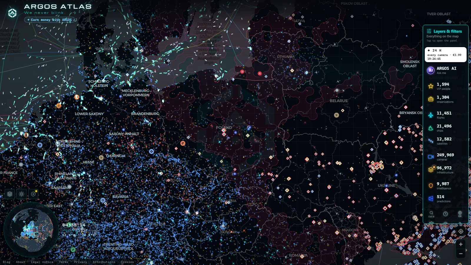
Poland's live airspace is free to watch, needs no account and works in the browser. Open the live map of flights, airports and cameras, pan to Central Europe, and every aircraft broadcasting ADS-B over the country appears as a moving icon: the low cost inbound to Modlin, the LOT departure climbing out of Warsaw Chopin, the transport aircraft orbiting over Greater Poland. Click an aircraft and you get callsign, altitude and heading. Click an airport and you get its ICAO and IATA codes plus whatever is moving around it at that second.
This is not a ranking of European hubs (that one is the busiest airports in Europe). It is a guide to what you can actually look at over Poland today, field by field, with the code you need to type in the search box and an honest note on what the map does not know. Coverage is thick over Warszawa, Gdańsk, Kraków and Poznań, and thin over the military aerodromes inland, and that gap comes from the technology, not from the map.
The essentials, in 20 seconds
- Warsaw Chopin (EPWA / WAW) is the busiest point of the Polish map and the first card most people open.
- Warsaw Modlin (EPMO / WMI) carries the low cost traffic north west of the capital, on a former military field.
- Gdansk Lech Wałęsa (EPGD / GDN) sits minutes from the ports of Gdańsk and Gdynia, so aircraft and ships share one screen.
- 11,486 aircraft were in the air worldwide at the last snapshot, 101 of them flagged as military.
- 47,927 airports are in the catalog, all free to open, with no registration and no trial.
What the Poland airports live map shows right now
Every icon over Poland is an aircraft reporting its own position. That is what ADS-B does: the transponder broadcasts identity, altitude, speed and coordinates, and any receiver in range hears it. No radar, no permission, no fee. In the last worldwide snapshot the map held 11,486 aircraft in the air, 101 flagged as military and 3,391 drawn from an estimated position rather than a fresh report, which is the honest way of saying the aircraft left receiver range and its track is being carried forward.
Over Poland the pattern repeats daily. The corridor from Warszawa to the Baltic stays busy at almost any hour, because the country sits on the road between Western Europe and the Baltic states. Long haul flights cross the north on their way to Asia. Regional jets hop between Gdańsk, Poznań and Kraków. For the mechanics in full, what ADS-B is and how it tracks flights explains the protocol.
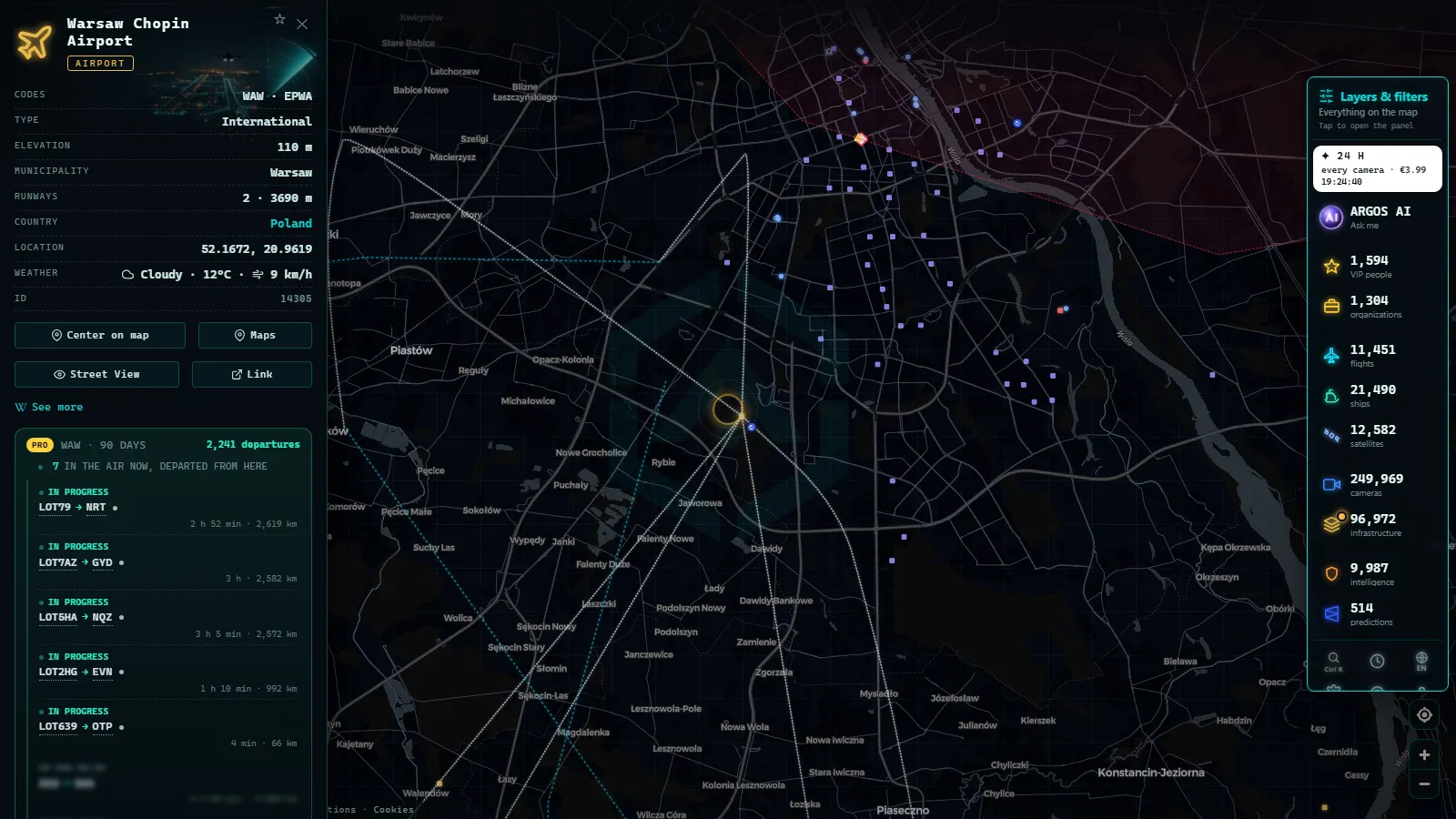
Warsaw Chopin (EPWA / WAW), the one everybody opens
Chopin is the default first click. ICAO EPWA, IATA WAW, in the Okęcie district a short drive south west of the centre, with two crossing runways and a single passenger terminal. It is the home base of LOT Polish Airlines, and that shows on the map: departures leave in waves, so the airport goes from almost empty to crowded within half an hour, then empties again.
The card gives you the codes, the exact position and the aircraft around it at that moment. It does not give you gates, delays or the published schedule, and it never will, because none of that travels inside an ADS-B message. If a flight number matters to you, read it off the callsign and confirm it with the airline.
From the ARGOS ATLAS channel.
Modlin, Łódź and the second tier around Warsaw
Warsaw Modlin Airport (EPMO / WMI) sits north west of the capital, at Nowy Dwór Mazowiecki, on a field the air force used for decades. One runway, one terminal, and a traffic profile that is easy to read: a cluster of arrivals and departures early in the morning, another in the evening, and long flat stretches in between. If you open it at midday and see nothing, the map is not broken.
Further south, Łódź Władysław Reymont Airport (EPLL / LCJ) is the quiet case. Days pass with a handful of movements, and most of what you see near it is en route traffic at cruising altitude rather than anything landing. It is a good airport to watch when you want to learn the difference between an aircraft descending into a field and an aircraft simply crossing above it.
Gdańsk, Gdynia and the Baltic corner
Gdansk Lech Wałęsa (EPGD / GDN) is the most interesting airport of the Polish map, not for its size but for what surrounds it. Inside one screen you get the airport, the port of Gdansk, the port of Gdynia and, a short way east across the border, Kaliningrad. Aircraft, ships and coastline in a single frame.
The camera adds what the icons cannot: weather. A low ceiling over the Tri-City changes how approaches look, with aircraft holding or going around, and a street camera near the field tells you in one frame whether it is fog, rain or a clear Baltic afternoon. Pair it with the ship layer: 21,595 vessels were reporting by AIS worldwide at that same snapshot, and the Bay of Gdańsk is one of the busier corners of the Baltic.
Kraków, Poznań Ławica and the regional fields
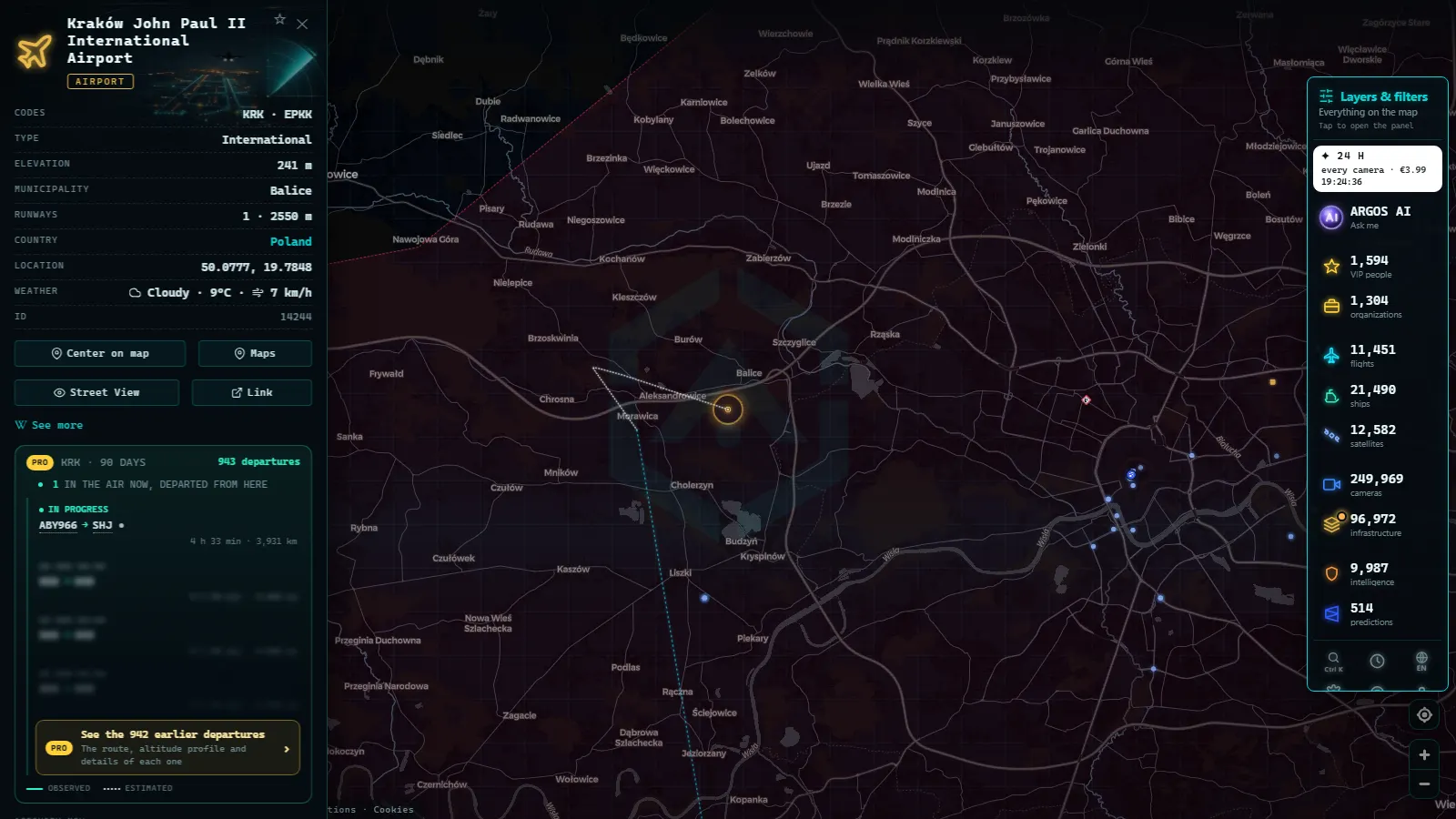
Kraków John Paul II (EPKK / KRK), at Balice west of the city, is the second airport of the country and the one where the holiday pattern is most visible: heavy on Friday evenings and Sunday nights, calmer midweek. Poznań Ławica (EPPO / POZ) is unusual because the runway sits inside the city, so the approach passes low over the western districts and the aircraft is visible from the street.
Add Wrocław Copernicus (EPWR / WRO), Katowice Pyrzowice (EPKT / KTW) and Rzeszów Jasionka (EPRZ / RZE) and you have the working map of Polish aviation. Jasionka is the one to watch when something happens east of the border, because it is the closest large field to Ukraine and the movements are visible even when the details are not.
The points in this guide
50 km
The military aerodromes inland
This is where the map has to be honest. Poland keeps a dense network of military fields, Powidz, Łask, Mińsk Mazowiecki, Dęblin and others, and most of what flies from them never appears. Military aircraft often broadcast without identity, or do not broadcast at all, so a base can look dead on a day when it is anything but. 101 aircraft were flagged as military worldwide in the snapshot above, out of 11,486 in the air, and that ratio tells you how much of this world stays off the public feed.
What does show up: transports, tankers and training flights that keep their transponders on, plus the occasional NATO mission filed as civil. When you catch one, the callsign is the giveaway, not the airline name. Treat an empty military field as no information at all rather than as evidence of a quiet day.
Polish airports at a glance
| Airport | ICAO / IATA | What it handles | What to look for |
|---|---|---|---|
| Warsaw Chopin | EPWA / WAW | Full service hub, LOT base | Departure waves, open it first for a busy screen |
| Warsaw Modlin | EPMO / WMI | Low cost, former military field | Early morning and evening clusters, flat midday |
| Gdansk Lech Wałęsa | EPGD / GDN | Baltic gateway next to two ports | Aircraft and ships in one frame |
| Kraków John Paul II | EPKK / KRK | Second airport of the country | Weekend holiday peaks |
| Poznań Ławica | EPPO / POZ | Regional, runway inside the city | Low approaches over the western districts |
| Łódź Reymont | EPLL / LCJ | Very light traffic | Telling an approach from an overflight |
Three moves on the Poland airports live map
First, search by code and not by name. EPWA or WAW lands on Chopin in one step, while a city name typed in Polish or in English can return several results. Second, click the aircraft and not just the airport: callsign, altitude and heading tell you whether it is descending into the field or crossing at cruise, and that single distinction removes most of the confusion for a new reader.
Third, use the layers together. An airport card next to a street camera and a port gives context that no single feed provides. If you want the general method instead of the Polish case, how to watch planes in real time walks through it, and the same three moves work over any country.
Ports, power and street cameras in the same view
Poland is not only runways. The map carries 34,936 power facilities worldwide and the Polish coal fleet is part of them: Kozienice II, Pątnów I and EC Siekierki in Warsaw each have their own card. Put a plant next to the aircraft overhead and you get a decent picture of the Vistula corridor on any afternoon.
Street cameras fill in the rest. The worldwide catalog holds 200,000+ cameras (count as of September 2026), and the Polish ones are city and road views rather than airport feeds.
For the road side of the country, traffic cameras in Poland covers Warszawa, the A4 and Gdańsk in detail.
What you won't see
- No video. Public cameras deliver still frames that refresh, not a stream. If nothing moves, wait for the next frame.
- No people or number plates. The resolution is not there, and using these feeds to try is neither useful nor legal.
- No gates, delays or schedules. ADS-B carries position and identity, not the airline's operations data.
- No complete military picture. What does not broadcast does not exist for the map, and a good deal over Poland does not broadcast.
- Night gaps. Unlit roads and airfields go dark on camera, and some feeds drop for hours and come back on their own.
- No aircraft with the transponder off. Some private and state flights do exactly that, and no public tool recovers them.
Frequently asked questions
Is the Poland airports live map free, and do I need an account?
Yes. It is free, it needs no account and there is no trial. The map opens in any browser, and the aircraft and airport cards open with a click. The catalog holds 47,927 airports worldwide, and every one of them, in Poland or anywhere else, opens the same way.
Which Polish airport shows the most traffic on the map?
Warsaw Chopin (EPWA / WAW). It is the home base of LOT Polish Airlines, so departures leave in waves and the screen fills and empties several times a day. Krakow John Paul II (EPKK / KRK) is the second busiest, and Gdansk Lech Walesa (EPGD / GDN) is the most interesting one, because ships share its screen.
Why do some aircraft over Poland show no callsign or route?
Because ADS-B only carries what the transponder chooses to broadcast, and identity is optional in practice, so an aircraft can report position without a callsign. Others appear from an estimated position: 3,391 of the 11,486 aircraft in the last worldwide snapshot were drawn that way, carried forward after leaving receiver range.
Can I watch Polish military aircraft on the map?
Sometimes, but never completely. Only 101 of the 11,486 aircraft in the air worldwide at the last snapshot were flagged as military, because most military flights broadcast without identity or with the transponder off. Transports, tankers and training flights do appear. An empty military field means no data, not no activity.
Do the cameras near Polish airports show live video?
No. They deliver still frames that refresh every few seconds, not video, and they cannot identify people or number plates. They are city and road cameras rather than airport feeds, so they tell you the weather and the traffic around a field, which is usually what you need when approaches look odd.
- India Airports Live Map: Delhi, Mumbai, Hyderabad, Chennai
- Iraq Airports Live Map: Baghdad, Erbil, Kirkuk and Basra
- Colombia Airports Live Map: What El Dorado, MDE and CLO Show
- Data Center Map: 4,072 Sites and What You Can Actually See
- South America Airports Live Map: Bogotá, Lima, Buenos Aires
- Data centers in Mexico: the 4 cities and what you can check