Blog · Traffic cameras
511NY Cameras Live: 1,770 NY Traffic Views on One Map
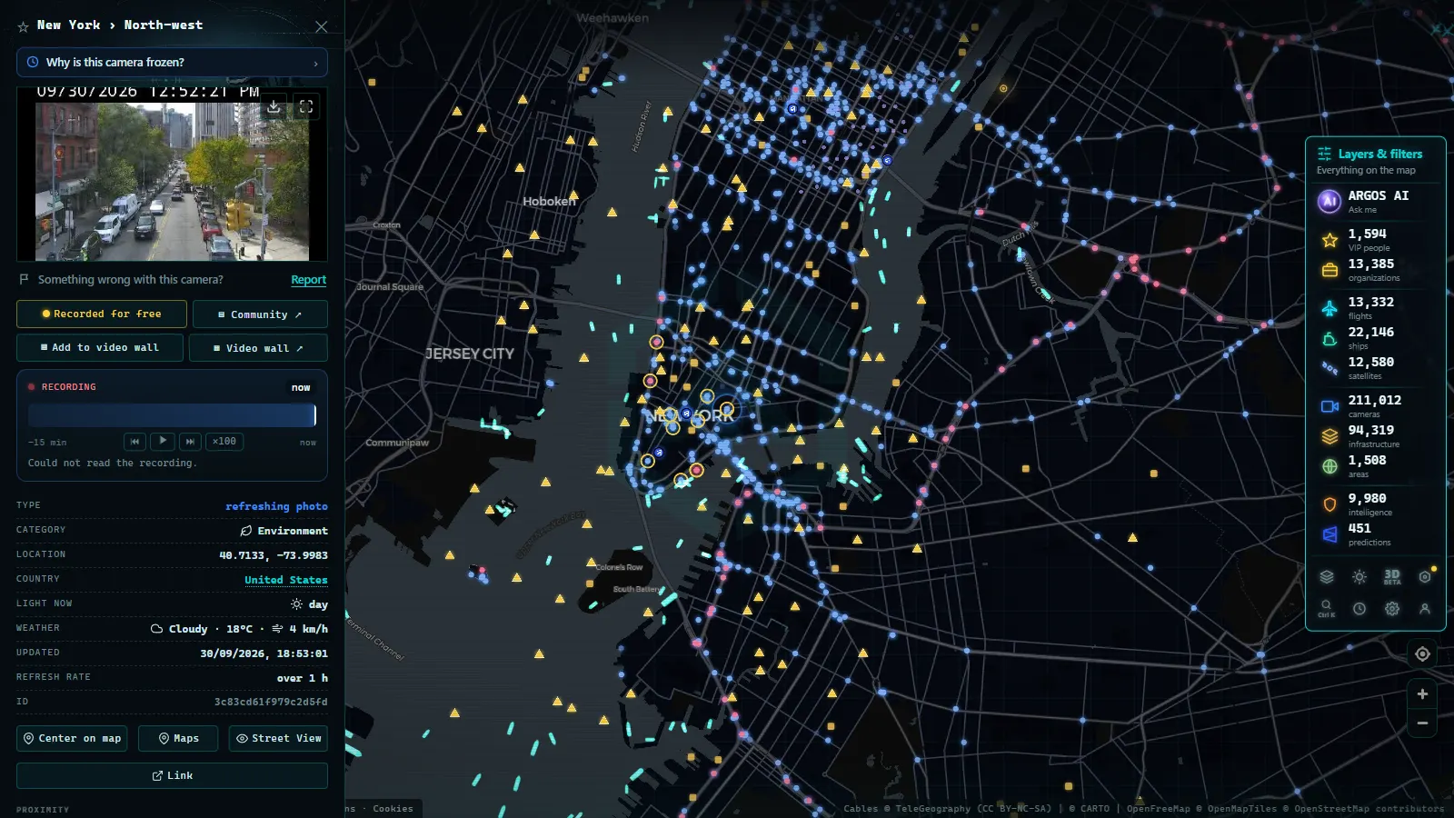
New York is the hardest traffic in America to read from a map, and the easiest to read from a camera. A congestion colour on a navigation app tells you the Cross Bronx is slow, which is roughly as newsworthy as telling you it's August. What you actually need to know is whether it's slow-and-moving or stopped, whether the problem is on the approach or the span itself, and whether the alternative crossing is any better. That's a picture, not a colour.
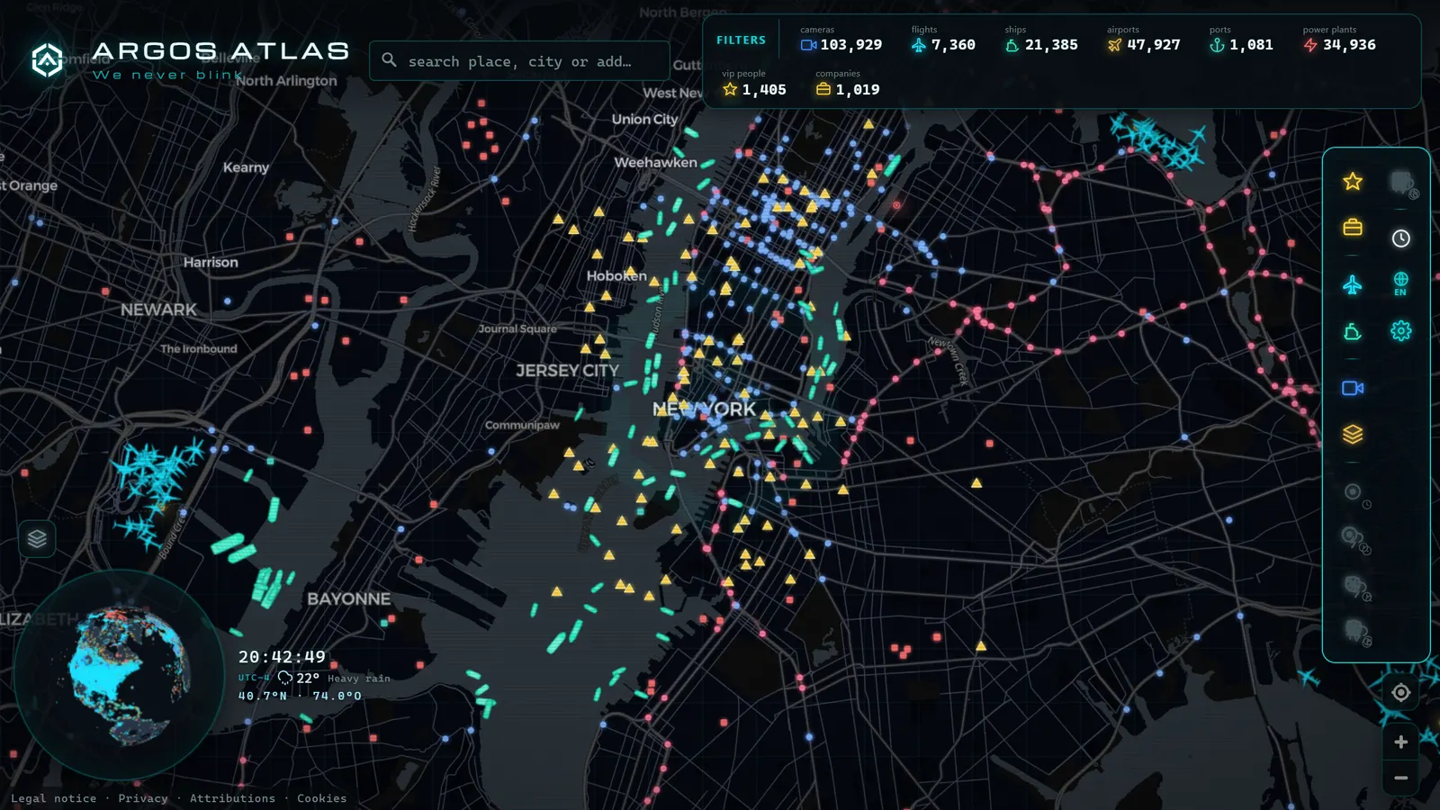
New York State publishes those pictures through 511NY, and the ARGOS ATLAS map plots 1,770 New York cameras statewide (count on the map as of August 2026), 733 of them in the New York City area. The remaining thousand-plus cover Long Island, the Hudson Valley, the Capital Region and the long western half of the state that most people forget is also New York. This guide is about reading all of it.
The essentials, in 20 seconds
- 1,770 cameras: ARGOS ATLAS plots this many 511NY feeds statewide (count on the map as of August 2026).
- 733 cameras: sit in the New York City area, over the bridges, tunnels and expressways.
- 511NY: is the state's traveller information service, folding incidents, closures and camera feeds from several agencies into one map.
- The Thruway (I-87/I-90): carries the statewide network north toward Albany and west to Buffalo, where cameras space out and a closure means long detours.
- The cameras: are still images with no audio, pan or zoom, showing lanes and queues but never plates or faces.
What 511NY cameras are, and who runs them
511NY is the state's traveller information umbrella: incidents, closures, construction, winter road conditions and camera feeds, pulled together under one service. The important structural detail is that it isn't only the state highway network. Around New York City, metropolitan and bridge-and-tunnel agencies operate their own camera systems, and the practical result for anyone looking at a map is a dense mosaic of feeds from several operators covering one metropolitan area.
The cameras themselves are the standard type: wide shots of the roadway, mounted high, low enough resolution that you can see lanes and queues but not plates or faces. No audio, no public zoom, no pan control. They exist so a control room can see whether a road is working, and they're public because that same information is useful to everyone driving on it. How traffic cameras work covers the technical chain if you want it.
The 1,770 511NY cameras, corridor by corridor
Two networks live inside one number: the metropolitan one, which is dense and interconnected, and the statewide one, which is linear and weather-driven.
| Corridor | What it covers | What to watch for |
|---|---|---|
| I-95 | The main north–south spine through the Bronx and up through Westchester | The bridge approaches, where a minor incident propagates for miles |
| FDR Drive | Manhattan's East Side waterfront route | A narrow road with no shoulder, one stall changes everything |
| George Washington Bridge | The Hudson crossing at the north end of Manhattan | Upper and lower level behaviour, and the approach queues on both sides |
| Lincoln and Holland tunnels | The midtown and downtown crossings to New Jersey | Tunnel approaches, where the queue forms long before the portal |
| Long Island Expressway (I-495) | Queens out through Nassau and Suffolk | The long, uniform, famously patient commute east and west |
| Thruway (I-87 / I-90) | North to Albany and the Adirondacks; west to Buffalo | Winter conditions and long-distance closures with distant detours |
| Upstate cities and rural links | Capital Region, Central and Western New York | Lake-driven snow and long spacing between cameras |
Two things stand out when you see it plotted. First, the 733 cameras in the New York City area are packed tightly enough that you can trace a problem across several views and work out where it starts and where it ends. Second, the moment you leave the metro area the logic flips: cameras get further apart and each one starts standing in for a whole region rather than a specific junction.
From the ARGOS ATLAS channel.
NYC traffic cameras live: reading the metro area
The city's camera network rewards a specific habit, never look at one camera in isolation. Manhattan's approaches are a closed system with a small number of ways in and out, so the useful question is never "is the Holland Tunnel busy?" but "is the Holland worse than the Lincoln right now?" That's a two-camera question, and a map that holds every feed on one screen is the only way to answer it quickly.
Some practical patterns:
- Bridges and tunnels fail in sequence. When one crossing backs up, traffic redistributes and the next one degrades within minutes. Check the alternative before you commit, not after.
- The FDR is the fragile one. Narrow, no shoulder, waterfront: an incident there has nowhere to go, and the cameras show a stopped road while apps still show orange.
- The LIE is about direction and hour, not incidents. On the Long Island Expressway you're usually reading a tidal pattern rather than a crash, and the cameras confirm which direction is currently the wrong one.
- The Bronx is the hinge. I-95 through the Bronx connects everything to everything, so if you're going to check one corridor before a trip through the region, check that one.
Crossing to New Jersey and beyond the state line
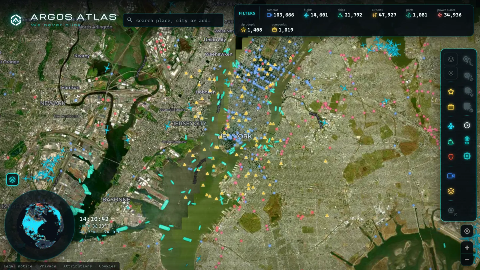
The most useful thing about seeing 511NY on an aggregator map instead of the state's own tool is that state lines stop mattering. Traffic doesn't respect them: a queue at the George Washington Bridge is a New Jersey problem and a New York problem at the same time, and the cameras on both sides belong to different agencies.
The same applies going north. The Thruway runs toward the Canadian border, and drivers heading for Ontario are dealing with two countries' camera networks on one trip, our guide to Ontario 511 cameras covers what's waiting on the other side of the crossing. Going the other direction, the US traffic cameras overview explains how each state's DOT publishes its own feed and why the styles differ so much from one state line to the next.
Thruway cameras and the rest of the state
Upstate New York is not a smaller version of the city, and its cameras don't work the same way. The Thruway is the organising fact: I-87 running north from the metro area toward Albany and the Adirondacks, I-90 running west across the state toward Buffalo. It's a long-distance road, and long-distance roads have long-distance failure modes.
What that means in practice: a closure upstate is a much bigger deal than a jam downstate. In the city, a blocked route costs you twenty minutes and an unfamiliar detour. On the Thruway in February, a closure can mean an hour of backtracking to the previous exit, and the camera you checked before leaving may be the only current image you'll get of the next fifty miles.
This is also where lake-driven snow does its work. Western New York can get a narrow, brutal band of snow while the road an hour east stays merely cold, a distinction that regional forecasts flatten and a camera makes obvious in one frame.
Nor'easters, winter and the construction season
Three seasonal patterns make the New York network worth bookmarking.
Nor'easters. When a coastal storm sets up, the useful signal from the cameras isn't the snow total, it's the surface. Bare and wet is a normal commute. Snow-covered with tracks is a slow one. Snow-covered without tracks means nobody is driving on it, and you shouldn't be the first.
Deep winter upstate. Different problem, same tool. Here you're checking whether the road exists, not whether it's fast.
Construction season. The summer counterpart, and in New York it's genuinely comparable in disruption. Lane closures on bridge approaches and tunnel portals reshape the whole metropolitan flow, often overnight and often on weekends. A camera tells you what a closure schedule can't: whether the work is actually up and running right now.
For the opposite seasonal profile (hurricanes, flooding, and a state where the weather risk peaks in late summer) Florida's traffic cameras make an interesting comparison, since the network design is similar and the reasons for checking it are completely different.
What 511NY cameras can't do
Being clear about limits is what makes the rest useful:
- They're stills, not streams. Frequent refresh, but not continuous video. Good for decisions, not for watching events unfold.
- You can't control them. No public pan, tilt or zoom. Some views are permanently pointed at something less useful than you'd like.
- Coverage is uneven by design. Very dense in the metro area, sparse across large rural stretches.
- Feeds break. Frozen frames, dead cameras, views blocked by a truck parked in exactly the wrong place. Always check the timestamp before trusting the image.
- They're not enforcement, and they're not recordings you can request. Different systems entirely.
Watching all of New York on one map
Open the ARGOS ATLAS map and centre it on the city: the 733 metro-area cameras appear as a solid mass over the bridges, tunnels and expressways, with the FDR, the LIE and I-95 clearly traceable. Zoom out and the state stretches away to the west along the Thruway, the density dropping as the distances grow.
Three habits worth adopting:
- Timestamp first, image second. A frozen frame from forty minutes ago looks exactly like live information and isn't.
- Compare crossings, don't inspect one. The value of a full map is the comparison it makes possible.
- Use the other layers. Live flights over the metro airports and AIS ship traffic in the harbour are on the same map, and on a storm day all three tell parts of the same story.
New York's traffic is famously unforgiving, but the information about it is unusually generous. Open the map, find the crossing you actually use, and look at it before you leave, the picture will tell you in five seconds what the colour on the app never quite says.
Frequently asked questions
What is 511NY?
511NY is New York State's traveller information service. It gathers road conditions, incidents, construction and transit alerts for the whole state, and it publishes a large public camera network that combines state highway cameras with feeds from metropolitan agencies in and around New York City.
How many 511NY cameras are there?
The ARGOS ATLAS map plots 1,770 New York cameras statewide (count on the map as of August 2026), of which 733 are in the New York City area. That leaves a little over a thousand spread across Long Island, the Hudson Valley, the Capital Region and the whole western half of the state.
Can I watch NYC traffic cameras live?
You can watch them in near real time. Most of the network publishes still images that refresh every few seconds to a couple of minutes rather than continuous video. For checking whether a bridge approach is jammed, a fresh still does the same job as a stream.
Are New York traffic cameras free to watch without an account?
Yes. They are public information feeds paid for with public money, and aggregator maps let you open them without registering or paying. You can browse them next to cameras from neighbouring states in the same view.
Do these cameras record or issue tickets?
No. Traffic-management cameras give wide, low-resolution views intended to show flow and conditions, not to identify vehicles or people. Enforcement in New York (speed, red light, bus lanes, tolling) runs on separate systems with their own legal framework and their own hardware.
- London Traffic Cameras: 776 TfL JamCams on a Live Map
- Barcelona traffic cameras: the ring roads and AP-7 live
- Chicago Traffic Cameras: 1,114 Live Views on One Map
- Miami Traffic Cameras: 928 Live Views of I-95 and Beyond
- Andalusia Traffic Cameras: 1,246 Live Cameras on One Map
- Michigan Traffic Cameras: MDOT's Live Feed on One Map