Blog · Traffic cameras
London Traffic Cameras: 776 TfL JamCams on a Live Map
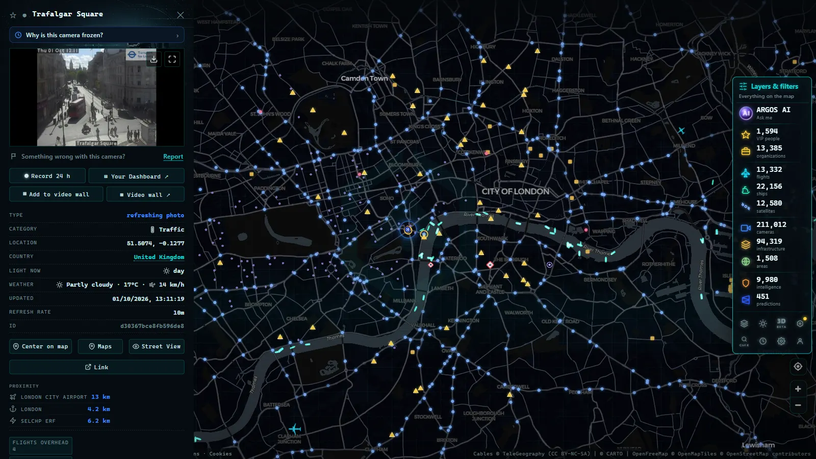
Transport for London runs the most watchable urban traffic camera network in Europe, and most of the people who drive through it every day have never opened one. The JamCams (TfL's public cameras on the capital's main roads, big junctions and tunnel approaches) are free to look at, refresh constantly, and sit precisely where London traffic tends to break. On the ARGOS ATLAS map there are 776 TfL JamCams, part of roughly 1,390 public cameras in the London area (map count, August 2026).
The gap between those two figures is what this guide is about. TfL is the biggest single source in the capital, but it is not the only one: the motorway ring and the trunk approaches beyond the boroughs belong to other road operators, and there are cameras around ports, estuary roads and river crossings that never appear on a TfL page. Put them on one map and you get the city plus its approaches in a single view, inside a UK-wide set of around 3,700 public cameras.
What TfL JamCams actually are
A JamCam is a traffic-management camera, not a surveillance camera. The framing is the giveaway: a wide shot of a carriageway or a junction, shot from a pole or a gantry, at a resolution that shows you queue length and lane blockages but nothing about the people in the cars. That is a design decision, not a technical limitation.
Their job inside TfL is operational. Signal timing, incident response, deciding whether a lane closure needs a diversion, checking that a reported collision is where the report says it is. Publishing them is a by-product of that job, and a generous one: very few European cities open their entire urban camera estate to the public the way London does. If you want the mechanics of how these networks are built and why the images look the way they do, we have a full explainer on how traffic cameras work.
Two honest caveats before you go looking:
- They are not continuous live video. JamCams serve short clips and stills that refresh on a cycle. For deciding a route this is functionally identical to video, but if you were expecting a broadcast stream you will be disappointed.
- The number online moves. Cameras drop out for maintenance, roadworks, power cuts or comms faults. A count is a snapshot, never a promise.
London traffic cameras by corridor and zone
London's camera map only makes sense once you think in corridors rather than boroughs. These are the ones worth knowing:
| Corridor or zone | What it covers | Why it matters |
|---|---|---|
| Central London and the Congestion Charge zone | The core street network inside the charging boundary | Traffic behaviour visibly changes by time of day and day of week |
| North Circular (A406) | The northern orbital route through the suburbs | The default cross-town road for the north half of the city |
| South Circular (A205) | The southern counterpart, mostly ordinary streets | Slower and less predictable than its northern twin |
| Thames bridges and crossings | The river crossings that stitch north to south | The classic London bottleneck: few crossings, huge demand |
| Blackwall Tunnel | The eastern under-river crossing | When it closes, all of east London reroutes at once |
| A40 and the Westway | The western approach into the centre | The corridor from the west and the motorway network |
| A13 | The eastern corridor towards the docks and Essex | Freight-heavy, and the route to the eastern river crossings |
The pattern that emerges is simple. London is a radial city with an orbital overlay and a river cutting through the middle, and the camera network follows exactly that shape: dense in the centre, threaded along the two circulars, and clustered hard at every point where the road has to cross water.
Beyond the boroughs: 3,700 public cameras across the UK
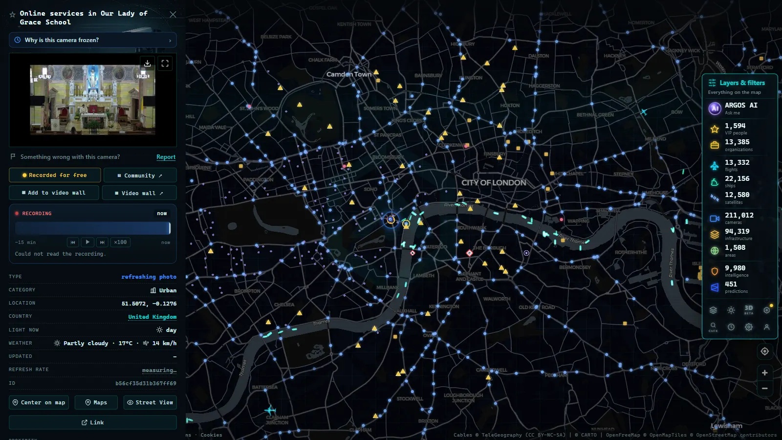
TfL's remit stops at the edge of Greater London, and traffic does not. The motorway ring and the trunk approaches into the capital belong to National Highways, which runs its own camera network along the motorway network in England, the gantry cameras you see over the carriageway on the busiest sections. Scotland, Wales and Northern Ireland have their own operators again, and several English cities run municipal cameras alongside the national ones.
Added together, that is around 3,700 public cameras across the United Kingdom. The distribution is what you would expect: heavily weighted towards the south-east and the big conurbations, thinner along the rural trunk roads, and clustered at the predictable pinch points, estuary crossings, port approaches, motorway interchanges and the sections that carry freight to and from the Channel.
For a driver this matters in one practical way. A journey out of London passes from one operator to another without any warning, and each has its own portal. On a single map the handover is invisible: the cameras simply continue. The national picture, operator by operator, is in our guide to traffic cameras in the United Kingdom.
From the ARGOS ATLAS channel.
What London traffic cameras cannot show you
This is the part most guides skip, so let us be blunt about it.
Enforcement cameras are not public. The ANPR network that runs the Congestion Charge and the Ultra Low Emission Zone, the bus lane cameras, the yellow box cameras and the speed cameras are all separate systems with their own legal framework, their own retention rules and no public feed. Nobody watches them from a browser. If a website claims to show you "live ANPR", it is not showing you ANPR.
Nor is anything private. Shopping centre CCTV, station platforms, office lobbies, residential doorbells, none of that belongs to the public layer, and none of it appears on a legitimate aggregator. The distinction between traffic imagery and surveillance imagery is worth understanding properly, and we cover it in the guide to traffic video surveillance and what it is for.
And the resolution is not investigative. You can see that a lorry is jack-knifed across two lanes. You cannot read its livery, and you certainly cannot identify a driver. That limit is the reason the images can be published at all.
Reading the JamCams like a Londoner
A few habits turn a wall of thumbnails into a genuinely useful tool:
- Check the timestamp first, the image second. An empty road at 08:40 is information. An empty road from a frame that froze at 06:15 is noise.
- The Congestion Charge zone shows on camera. The central cameras look different inside charging hours than outside them, and different again at weekends. Once you have watched the same junction a few times, you can read the clock off the traffic.
- Go to the crossing before the route. For any north-south journey, look at the bridge or tunnel first. If the crossing is backed up, nothing you do with the approach roads will help.
- Tunnels are the fuse. An incident in an under-river tunnel propagates outwards faster than any app can repaint, because the diversion has to travel miles to the next crossing.
- Event days redraw the map. A marathon, a major protest, a state occasion or a big stadium fixture closes streets that no routing engine expects to be closed. The cameras show the barriers and the empty carriageway long before the traffic layer catches up, this is the single best use case for looking at an image instead of a coloured line.
- A cluster going dark means something. If several cameras along one corridor stop updating at the same moment, suspect a power or comms failure in that area rather than a coincidence.
If you want the general version of this, applicable to any city, our guide to watching traffic live in real time covers the method rather than the geography.
Watching London traffic cameras live on the map
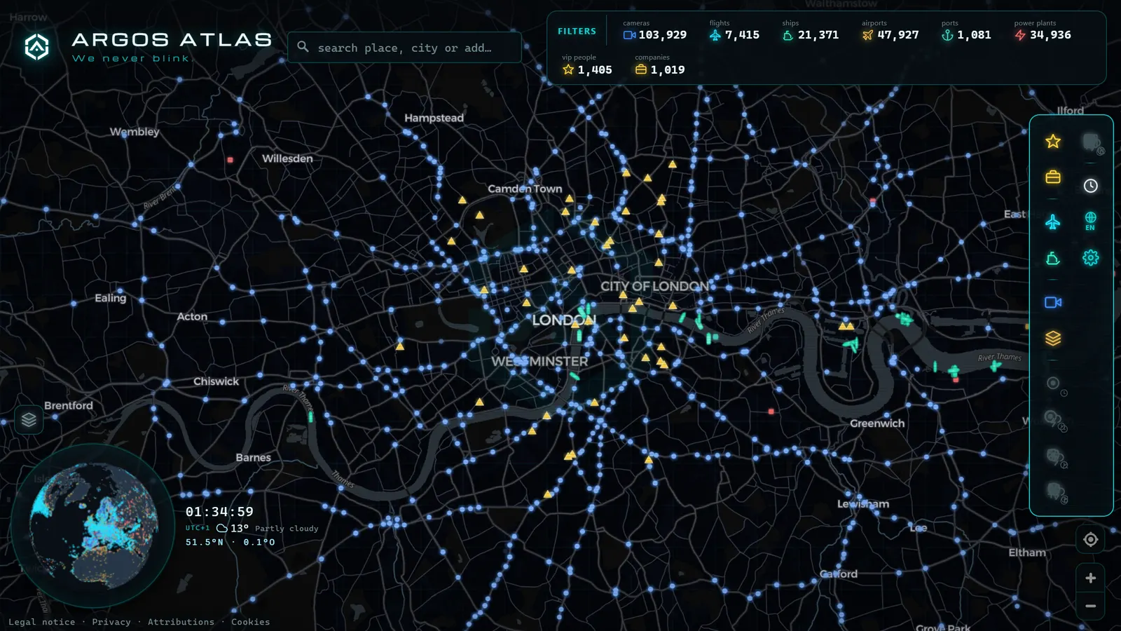
Open the ARGOS ATLAS map, centre it on London and zoom in: the cameras appear over the real city, so the river, the two circulars and the radial approaches organise themselves visually without you having to know any road numbers. Click any marker and you get the latest frame with its timestamp; zoom out and the capital dissolves into the wider UK network.
Two things you get here that a single operator's portal cannot give you. First, continuity across boundaries: the moment your journey leaves TfL's remit for the motorway ring, the cameras keep going, because the map does not care which agency owns the pole. Second, the other layers (aircraft on approach into the London airports, ships moving up the Thames estuary) which turn a traffic check into a picture of how the city is actually operating on a given morning.
And if you want to see how London compares with Paris, Berlin or Madrid in terms of what each country actually publishes (because the differences are large and not always where you would expect) the country-by-country guide to European traffic cameras is the wider frame.
London gives away more of its traffic imagery than almost any comparable city, and it costs nothing to use. Before your next drive across town, open the map, find the crossing you were planning to use, and let the picture decide the route.
Are TfL traffic cameras actually "live"?
TfL's own JamCams page (and this map, which pulls the same feed) calls the network "live traffic cameras," but "live" here does not mean continuous video. Each of the 776 JamCams captures a still image and refreshes it on an interval, not a streaming feed you can scrub or rewind. That is the single most common confusion behind searches for TfL live cameras: people expect a video wall and get a frame that updates every so often.
This matters for how you use them. If a JamCam shows a clear road, that was true the moment the image was captured, not necessarily thirty seconds ago. For a corridor you are about to drive, refresh the image once more before you commit rather than trusting the first load. For a corridor you are watching for an event (a closure, a protest route, a stadium crowd), load several JamCams on the same corridor and refresh them in sequence: the gap between frames on adjacent cameras tells you how fast something is moving, which a single static image cannot.
"TfL cameras," "TfL traffic cameras" and "TfL JamCams" are the same network under three names. TfL's technical documentation and API use "JamCam"; general traffic reporting and most drivers just say "TfL traffic cameras" or "TfL cameras." There is no second, separate TfL camera system hiding under one of these names, so whichever term brought you here, you are already looking at the right feed.
| Term | Who uses it | What it points to |
|---|---|---|
| JamCam / JamCams | TfL's own branding, the API | the 776-camera network |
| TfL traffic cameras | general public, traffic reports | same network |
| TfL cameras | shorthand, search queries | same network |
Where this map differs from loading TfL's feed directly is aggregation: instead of picking one camera at a time from a list, you get all 776 JamCams plotted on the UK camera map alongside the other 3,700 public cameras covering the rest of the country, so a corridor that crosses a borough boundary does not mean switching sources mid-route.
Frequently asked questions
What are TfL JamCams?
JamCams are Transport for London's public traffic cameras: wide, low-detail views of main roads, junctions and tunnel approaches across the capital. They exist so that TfL's control room and the public can see whether a road is moving, and they are deliberately not detailed enough to identify people or number plates.
How many traffic cameras are there in London?
The ARGOS ATLAS map holds 776 TfL JamCams and around 1,390 public cameras in the London area in total, counting other road operators alongside TfL (map count, August 2026). Across the whole of the United Kingdom the figure is roughly 3,700.
Are London traffic cameras live video streams?
Not continuous video. JamCams publish short clips and stills that refresh regularly, which is all you need to judge whether a corridor is flowing. Treat the timestamp as the important part: a recent image tells you more than a longer feed from ten minutes ago.
Can I watch London traffic cameras for free, without signing up?
Yes. These are public information cameras, and an aggregator map lets you browse them with no account and no cost, alongside the rest of the UK network and cameras worldwide.
Are the Congestion Charge and ULEZ cameras public too?
No. Enforcement cameras (ANPR for the Congestion Charge and ULEZ, bus lane cameras and speed cameras) are separate systems on separate legal footing, and their images are never published. Everything you can watch openly is traffic-management imagery.
- Barcelona traffic cameras: the ring roads and AP-7 live
- Chicago Traffic Cameras: 1,114 Live Views on One Map
- Miami Traffic Cameras: 928 Live Views of I-95 and Beyond
- Andalusia Traffic Cameras: 1,246 Live Cameras on One Map
- Michigan Traffic Cameras: MDOT's Live Feed on One Map
- Jakarta Traffic Cameras Live, on a Map