Blog · Ships & AIS
MarineTraffic alternatives: what free AIS tracking really does
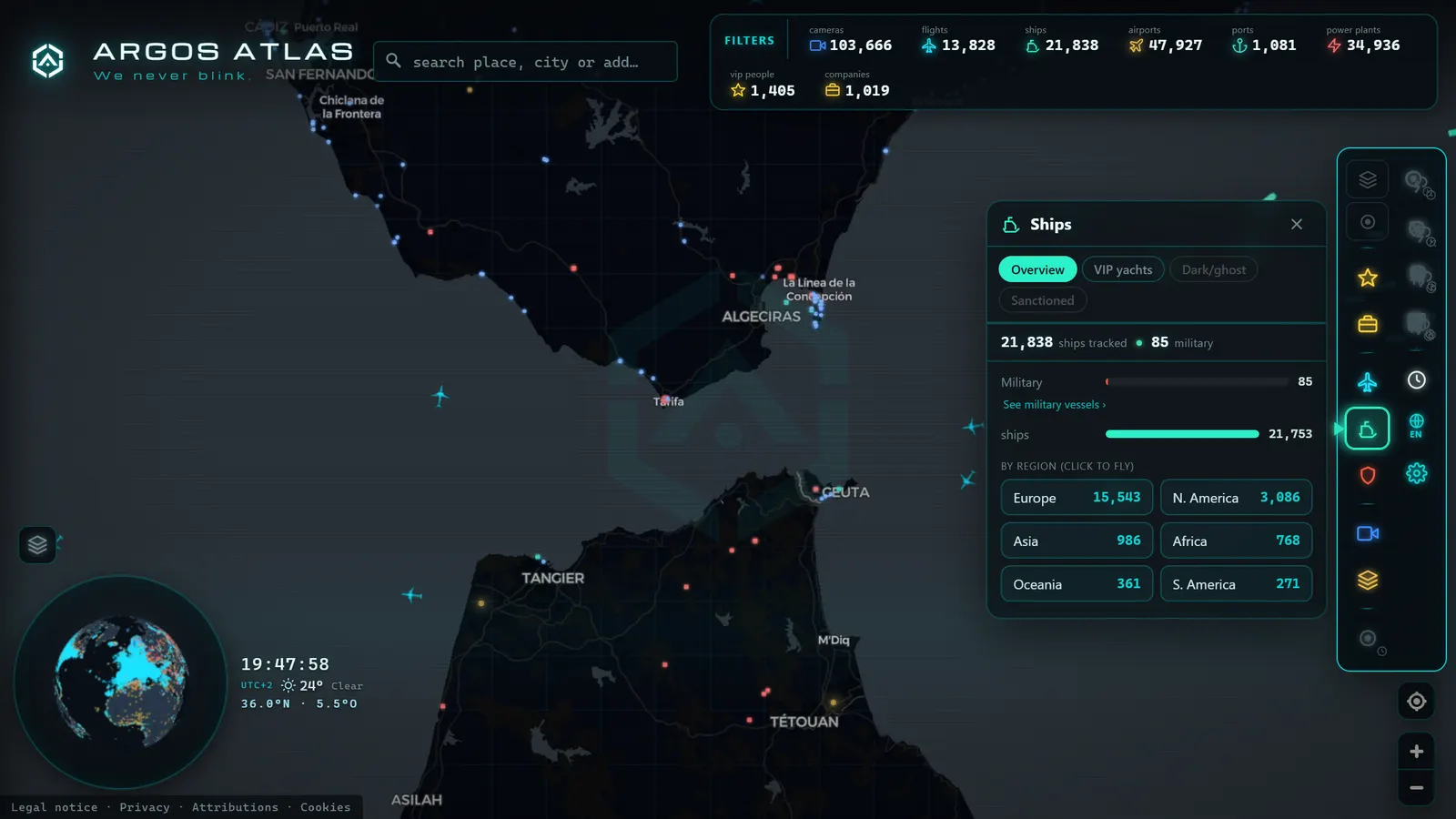
Anyone who has tried to follow a ship online has arrived at the same place. You search, you land on MarineTraffic, you see the vessel, and then you hit a wall: the detail you wanted is behind a plan, or the ship vanishes once it leaves the coast. From there the search becomes "MarineTraffic alternatives", and the results are a mix of genuinely useful tools and sites that dress up the same free data with more advertising.
This guide is an attempt to be straight about the whole landscape, including our own position in it. What free AIS tracking can honestly do, what it cannot, why the limit exists at all, and which use cases justify paying for a professional service. Spoiler for the impatient: for most curious, journalistic and enthusiast use, free is enough, and for a small set of serious needs, it genuinely is not.
The essentials, in 20 seconds
- MarineTraffic: the reference tracker, built on a large receiver network, historical archives and a professional layer on top.
- AIS (Automatic Identification System): a maritime radio standard, ships broadcast their own identity, position, course and speed.
- Terrestrial AIS: picked up by coastal receivers within tens of nautical miles of shore, where every free tracker is strong.
- Satellite AIS: the only way to see a ship in open ocean, and it costs money on every platform, MarineTraffic included.
- ARGOS ATLAS: a live AIS map, free with no account, that puts the same ship alongside public cameras, flights, ports and airports.
How ship tracking actually works
Everything downstream depends on one fact: ships broadcast their own positions. AIS, the Automatic Identification System, is a maritime radio standard that makes commercial vessels transmit identity, position, course, speed, declared destination and draught on a continuous loop. It exists for collision avoidance, not for public curiosity, the public maps are a happy side effect. Our explainer on what AIS is and how it works covers the mechanics properly.
The critical distinction, and the one that explains almost every difference between free and paid services, is who is listening.
Terrestrial AIS is picked up by receivers on the coast. It is a VHF signal, so it works within radio horizon of the shore, a range measured in tens of nautical miles, extended by high antenna sites. Coastal receivers are cheap, and enthusiast networks have covered most inhabited coastlines. This is why free ship maps are excellent near land and around ports.
Satellite AIS is picked up by spacecraft. It covers the open ocean, it requires a constellation, and someone has to pay for the constellation. This is not a policy choice by any particular website: satellite AIS costs money everywhere, on every platform. Any service showing you a ship in the middle of the South Atlantic is paying for that data one way or another, and passing the cost on.
So the honest headline: free ship tracking is strong at the coast and weak in deep ocean, on every platform, always. A tool that promises full global coverage for free is either using very sparse data or not telling you the whole story.
What MarineTraffic does, and why it is the reference
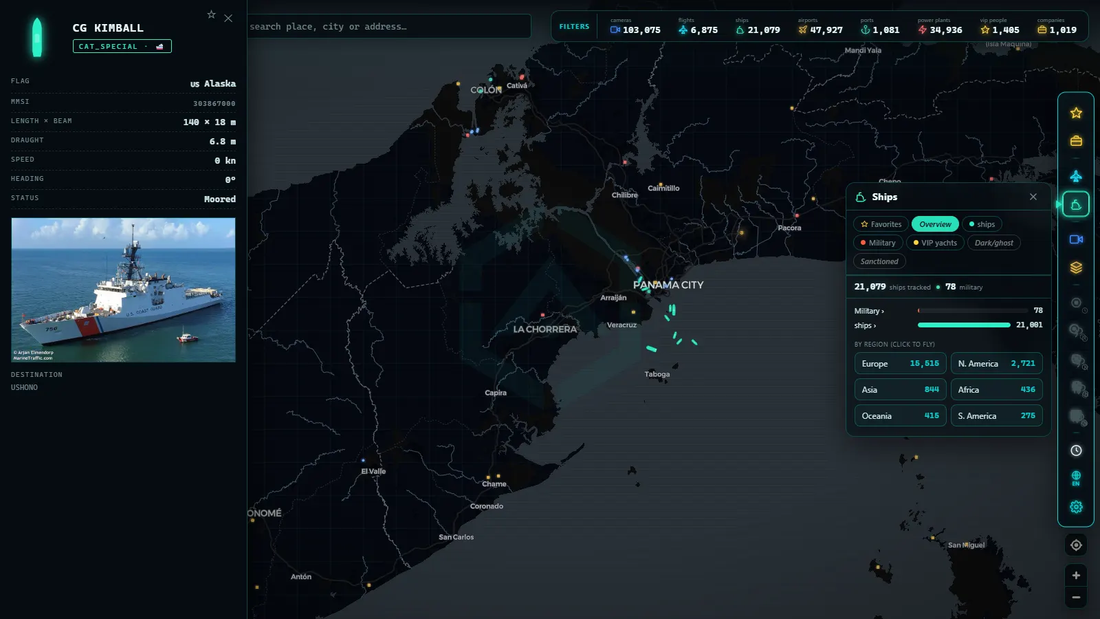
Credit where it is due. MarineTraffic became the default name in vessel tracking because it built something genuinely hard: a large receiver network, a deep vessel database, historical archives, port call records and a professional product layer on top of a consumer-facing map. When people say "look it up on marine traffic", they are using the name the way people say "search it" and mean a specific search engine.
For a professional (a chartering desk, a port operator, a compliance team, a shipping journalist working with archives) that combination is hard to replace, and the subscription buys real work. Naming it as the reference is not a knock on the alternatives. It is the baseline the alternatives are measured against.
What sends people looking elsewhere is usually one of three things: the free tier does not include the specific detail they want, they only need an occasional look and cannot justify a plan, or they want the ship in context with something else entirely.
From the ARGOS ATLAS channel.
What free MarineTraffic alternatives give you
Speaking generally rather than ranking brands, the free vessel trackers out there (VesselFinder and several others among them) share a common shape.
- Live coastal and port positions. This is the strong suit everywhere, because the underlying terrestrial receiver networks are broadly similar and often overlapping.
- Basic vessel identity. Name, type, flag, IMO and MMSI numbers, and usually a photo from a community archive. Enough to be sure you are looking at the right ship. If you want to work from a hull number rather than a name, IMO ship tracking explains why that identifier is the reliable one.
- A recent track. Where the vessel has been over the last hours or days, which is normally all you need to understand what it is doing now.
- Sensible free limits. Almost universally, the cut comes at historical depth, alerts, API access and satellite coverage. Those are the products being sold.
That is a genuinely useful toolkit, and it is the reason free options cover most people's needs. The differences between free trackers are mostly interface, receiver density in your particular region, and how aggressively they push you towards an upgrade.
What our map adds: context instead of a bigger dot
Here is where we should declare our own hand, because there is no point writing an honest comparison and then quietly selling.
The ARGOS ATLAS map does not claim better AIS data than the established maritime services. It has the same origin (the ships themselves) and the same physical limits at sea. Our AIS layer is live, free and available with no account, which matters, but it is not the differentiator.
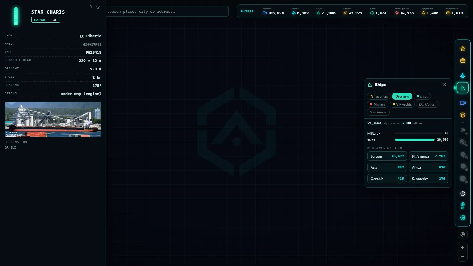
The differentiator is context. On most vessel trackers, a ship is a dot on a nautical chart with other ships around it. On ours, the same ship sits on a map that also carries public cameras, live flights, ports, airports, power infrastructure and other layers, all switchable together. That changes what a single question can answer.
Concretely: you can watch a ferry approach a port on AIS and open a public camera pointing at the same stretch of coast, in one place. You can look at an anchorage full of stationary vessels and check what the weather looks like there through a nearby webcam. You can see a port and the aircraft moving above it at the same time. For anyone doing verification work, that cross-layer view is worth more than another decimal place of positional accuracy.
It is a different product philosophy, not a better AIS feed, and it suits some jobs and not others.
Free vs paid AIS tracking, capability by capability
Rather than compare brands, compare needs. This is the table that actually decides your choice:
| What you need | Free option | Typical paid option |
|---|---|---|
| See what is moving off a coast or in a port right now | Fully covered, live | Same, with richer vessel data sheets |
| Identify a specific vessel by name, MMSI or IMO | Covered, with basic registry details | Validated records, ownership, fleet and sister ships |
| Position in mid-ocean, far from any coast | Patchy to absent | Satellite AIS, priced by coverage |
| Track from the last few hours or days | Usually available | Available, with finer resolution |
| Voyage history from months or years back | Rarely, and shallow | Deep archives, exportable |
| Alerts when a ship enters or leaves an area | Uncommon | Standard, with email and webhooks |
| Port call lists, ETAs and berth data | Partial, from crew-declared fields | Curated, cleaned, contract-grade |
| Bulk data or API access | Generally not offered | The core commercial product |
| Cross-checking a ship against cameras, flights and infrastructure | Available on our map | Not usually part of the offering |
Read it as a diagnostic. If your needs sit in the top half, no subscription is going to change your life. If several of your needs sit in the bottom half, stop shopping for free workarounds and buy the right tool.
Three real cases
Following a ferry. The easiest case and the most common. Short route, coastal the whole way, permanently within receiver range. Free tracking handles this perfectly: you see the vessel leave, cross and berth. Our walkthrough on how to follow a ship live covers the workflow. No paid service adds anything meaningful here.
Watching an anchorage. Also comfortably in free territory, because anchorages are by definition near the coast. What matters is interpretation rather than data: a bay full of motionless ships is normal port behaviour, not a crisis, and the distinctions between waiting for a berth, refuelling and awaiting orders are explained in our piece on what it means when a ship is anchored.
Investigating a vessel that goes dark. This is the case where the honest answer gets complicated. A ship switching off its transponder is a documented tactic, and spotting it requires exactly what free tools are weakest at: historical tracks, gap analysis and open-ocean coverage. You can begin the work for free (noticing a gap, checking the last known position, watching for a reappearance) and our guide to dark ships that switch off AIS explains the method. But a rigorous investigation, the kind that ends in a published report, generally needs paid satellite data or specialist analytical services.
When you should actually pay
The clean version of the advice, with no hedging.
Pay if you need reliable open-ocean positions, if you need voyage history going back months or years, if you need automated alerts or an API, if you need port call data you can put in front of a client, or if the answer you produce has commercial or legal consequences. That is a real product solving a real problem, and it is priced accordingly.
Do not pay if you want to know when the ferry gets in, if you enjoy watching a busy strait, if you are teaching someone how maritime trade works, if you are checking whether a viral video matches the coastline it claims, or if you want to see what is moving off your local port this afternoon. That is most people, most of the time, and free tools cover it completely.
The one thing worth avoiding in both directions is the middle ground of sites that repackage free AIS behind ad walls and upgrade prompts while offering nothing the open tools do not. If you are going to accept limits, accept them on a tool that is upfront about them.
Open the map, switch on the ship layer and put it over a coast you know. Add the camera layer on top and watch the same water twice, from two kinds of source at once. That combination is the reason we built it, and finding out whether it fits how you work takes about two minutes and costs nothing.
Frequently asked questions
Is there a genuinely free alternative to MarineTraffic?
Yes, for live coastal tracking. Several free vessel maps, ours included, show AIS positions in real time without a subscription. The honest limit is the same everywhere: deep-ocean coverage and long historical archives are the paid part of this industry.
Why do ships disappear in the middle of the ocean on free maps?
Because standard AIS is a short-range radio signal picked up by coastal receivers. Beyond that range, only satellites hear it, and satellite AIS is a commercial product. A gap mid-ocean is usually coverage, not concealment.
Do I need to register to track ships on your map?
No. The AIS layer is free, live and open without an account, alongside cameras, flights, ports and other infrastructure layers. There is no trial period and no query limit.
Can free AIS tracking show me a ship's history from months ago?
Generally not in depth. Free tools focus on the live picture and, at most, recent tracks. Multi-month or multi-year voyage history, port call archives and downloadable datasets are where commercial services earn their subscription.
Which is more accurate, a free tracker or a paid one?
The underlying AIS data is broadcast by the ships themselves, so the raw positions are the same. Paid services differ in coverage breadth, refresh rate, historical depth, validated vessel records and API access, not in inventing better positions.
- Pescara Port Live: 6 Ship Types on the Adriatic AIS
- Malta ship traffic live: what crosses between Sicily and Africa
- Panama Canal Ship Traffic Live: Read Both Queues on the Map
- Argentina Ports Live: Buenos Aires, Rosario, Bahía Blanca
- Dark Vessels: Why Some Ships Turn Off Their AIS Transponder
- Types of Ships: How to Tell Container Ships, Tankers, and Fishing Vessels Apart on the Map