Blog · Ships & AIS
Argentina Ports Live: Buenos Aires, Rosario, Bahía Blanca
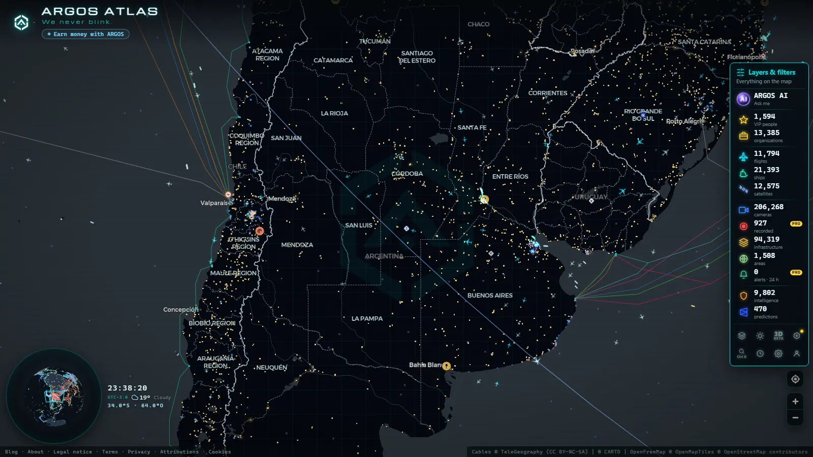
You can watch Argentina's ports live right now, free and without an account: open the map and every vessel broadcasting AIS inside the Río de la Plata, the lower Paraná and the Bahía Blanca estuary appears with its name, its speed and its position, which is what tells you whether it is anchored, under way or alongside a berth. 21,352 ships are on the map and 36,093 have been tracked in the recent window (figures as of October 2026), inside a catalogue of 1,081 ports.
This is not the continental round up. Each terminal is looked at one at a time: Buenos Aires as the container gate, Dock Sud as its oil and chemical neighbour, Rosario as the loading front of the Paraná grain belt, and Bahía Blanca as the deep water exit where cargoes the river cannot float get finished. For the whole continent first, the list of South American ports covers it country by country.
The essentials, in 20 seconds
- 21,352 ships visible now and 36,093 tracked in the recent window (figures as of October 2026), positions straight from AIS.
- Buenos Aires moves most of the country's containers from Puerto Nuevo, right against the city on the Río de la Plata.
- Dock Sud sits immediately south: refinery and chemical jetties plus Exolgan, its container terminal.
- Gran Rosario is the grain front, a string of private terminals up the Paraná from Timbúes down to San Nicolás.
- Bahía Blanca is open water, so a bulker can sail at a draft the dredged river channel will never give it.
Buenos Aires: Argentina's container gate
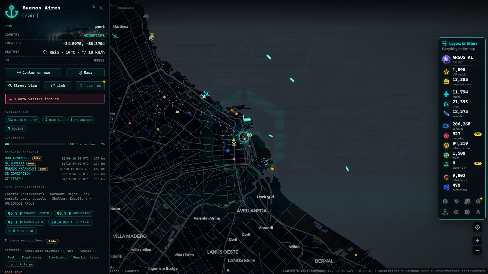
Puerto Nuevo sits north of Retiro, a row of parallel basins where the box terminals work ships that come up the Canal Emilio Mitre from the outer estuary. The Río de la Plata is enormous and shallow, which is the first thing to understand about the whole system: almost every metre of water a ship uses here is dredged and maintained, not natural.
On the map the port reads in two layers. Alongside the quays you get the boxships, usually a handful at a time. Out in the estuary you get the waiting room: vessels at anchor off the channel, some holding for a berth, some for a pilot, some for paperwork. Just downriver, La Plata takes cargo that does not fit the city berths, and up the Paraná de las Palmas, Zárate and Campana handle car carriers and bulk.
Dock Sud, the oil and chemical neighbour
Cross the Riachuelo and the traffic changes character. Dock Sud is the country's main liquid bulk cluster: refinery jetties, product tankers, chemical berths, and Exolgan, a container terminal that competes directly with Puerto Nuevo for boxes.
Tankers behave differently from boxships, and it shows. A container ship wants its slot and leaves; a tanker often sits at anchor in the outer estuary for a long stretch until a jetty frees up, and its reported draft changes between arrival and departure, the clearest public hint that something was loaded or discharged. The basin is tight, so movements are slow and pilot assisted. For the mechanics of the signal behind all of this, see what AIS is and how ships are located in real time.
From the ARGOS ATLAS channel.
Rosario and the Paraná grain front
Rosario gives its name to Gran Rosario, which is not one port but a string of private terminals along the Paraná, from Timbúes and Puerto General San Martín above the city down through San Lorenzo, Villa Constitución and San Nicolás. Soy meal, soy oil, maize and wheat leave from here, and most of Argentina's farm exports cross these berths rather than the capital's.
Watch it for a day and the rhythm is obvious. Bulkers come up the river in daylight, moving at river speed, then stop dead at a terminal for days while the belts run. The city cameras on the Rosario waterfront show the river itself, the bridge towards Victoria and the sandbanks, not the loading gear, so the AIS layer is what tells you which berth is actually working.
Why the Paraná draft decides the size of what leaves
The Paraná is a river doing a seaport's job, and that sets a ceiling nothing else can lift. The navigation channel is dredged and its available depth is declared stretch by stretch, deeper below Rosario and shallower above it, so a bulker loading at Timbúes cannot fill its holds the way it could at a coastal berth. It sails part loaded.
What happens next is the part most port lists leave out. The ship tops off, at a deeper Argentine port or at a transfer anchorage, until it reaches a sea draft that makes the ocean leg worth it. When the river runs low, declared drafts get cut, loadings shrink, and the map shows it: more vessels waiting, longer berth stays, more top off calls south. Draft, not crane capacity, is the real constraint here.
Bahía Blanca, the deep water exit
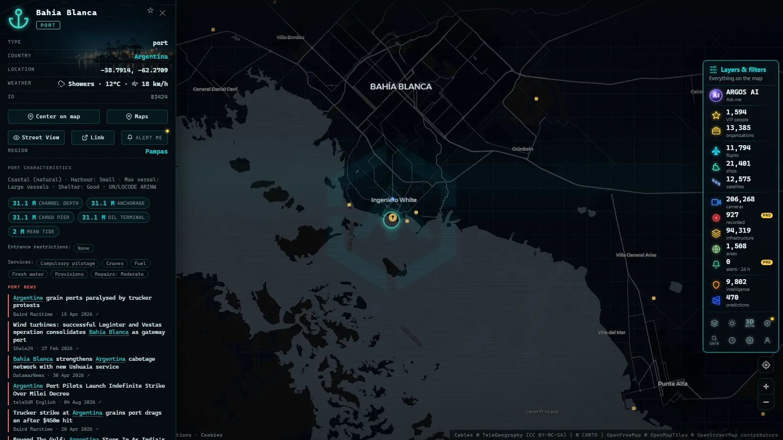
Bahía Blanca is the answer to the river's ceiling. The estuary opens onto the Atlantic in the south of Buenos Aires province, and its ports, Ingeniero White and Puerto Galván, work in natural deep water instead of a dredged inland channel. Grain, fertiliser, petrochemicals and fuel move through, and part loaded bulkers arrive from the Paraná to finish their cargo.
The bay is worth opening as an area rather than a point: the approach channel, the anchorages and the berths are spread out, and a ship can be well inside the estuary and still hours from a quay. Further south, Puerto Quequén at Necochea plays the same role on a smaller scale, which is why a grain bulker leaving the river sometimes shows a second Argentine call before heading out.
Anchored or loading: how to tell them apart
Four fields do almost all the work: speed, position, reported draft and destination.
- 0.0 knots inside a marked anchorage means waiting, not working. The piece on what a ship at anchor actually means explains why that matters commercially.
- 0.0 knots alongside a quay means cargo operations, or a vessel that has finished and not sailed yet.
- Reported draft is typed in by the crew, so take it as a strong hint rather than gospel: a big change between arrival and departure says the ship was loaded or emptied.
- Destination and ETA are also typed in, often stale and sometimes wrong. A bulker leaving Timbúes with a European port in the field may still have a top off call to make.
Ship type matters too, and the guide to telling cargo ships, tankers and fishing vessels apart helps you read a cluster of hulls at a glance.
Argentina ports live: the four terminals side by side
| Port | Main traffic | Water | What to look for |
|---|---|---|---|
| Buenos Aires (Puerto Nuevo) | Containers, cruise calls | Dredged river channel | Boxships in a row alongside, plus the queue at anchor in the estuary |
| Dock Sud | Crude, products, chemicals, boxes at Exolgan | Dredged, tight basin | Tankers at 0 knots offshore holding for a jetty |
| Gran Rosario (Timbúes, San Lorenzo) | Grain, soy meal, vegetable oil | Paraná channel, the shallowest link | Bulkers moving upriver by day, then parked at a berth for days |
| Bahía Blanca (Ingeniero White) | Grain, fertiliser, gas, fuel | Open estuary, the deepest of the four | Part loaded ships arriving from the river to top off |
Argentina ports live: reading a terminal in two minutes
- Open the live map of ships and ports and zoom to the Río de la Plata.
- Click a port marker to see its berths and the vessels currently inside the area.
- Sort out the anchorage: the cluster sitting still offshore is the waiting list, and its size is the congestion signal.
- Pick one hull, note its reported draft, then check it again when it sails.
- Jump upriver to Rosario and compare: fewer movements, longer stays, bigger consequences per ship.
Done in that order, the picture builds fast. Congestion at Buenos Aires shows as a crowd at anchor; congestion at Gran Rosario shows as vessels stacked up along the river waiting for a declared draft.
The points in this article
50 km
What the local cameras actually show
The catalogue holds 206,268 public cameras (count as of October 2026), but Argentina's share is small and road focused. What exists looks at avenues, bridges and the river frontage, which is still useful context: weather over the water, visibility in the channel, traffic on the access roads.
Use them as a weather and light check, not as a terminal monitor. No public feed in Argentina points at a container crane or a grain belt, and that gap is permanent as far as open sources go.
What you won't see
- Still frames, not video. Public cameras publish an image that refreshes on their own schedule, from seconds to several minutes.
- No people and no plates. Resolution and framing are road oriented, and nothing here identifies anyone.
- Night is night. Argentina runs on UTC minus 3, so a European afternoon is still daylight there, but after sunset most feeds go dark or useless.
- AIS gaps upriver. Reception thins out away from the coast and the big cities, so a vessel high on the Paraná can go quiet for a while.
- No cargo data. AIS carries no manifest, no tonnage and no price. Draft and destination are typed in by the crew and can be wrong.
- Feeds disappear. Operators move, rename and retire cameras without notice, and a port's public coverage can drop to nothing overnight.
Frequently asked questions
Is it free to watch Argentina's ports live?
Yes, free and with no account. The map reads AIS positions broadcast by the ships themselves, so Buenos Aires, Dock Sud, Rosario and Bahía Blanca open without a login, a trial or a paywall. You can click any vessel for its name, speed and reported destination at no cost.
How do I know if a ship is anchored or loading?
Check speed over ground and position. A vessel at 0.0 knots inside a marked anchorage off the Río de la Plata is waiting; the same reading alongside a quay at Puerto Nuevo or Ingeniero White means it is working cargo. Berth stays usually run for days, anchorage waits can run longer.
Why do grain ships leave the Paraná only part loaded?
Because the dredged channel is shallower than the open sea. Terminals at Timbúes, Puerto General San Martín and San Lorenzo load to the draft the river allows that week, then the ship tops off at a deeper port such as Bahía Blanca or Quequén before crossing the Atlantic.
Are there port cameras in Buenos Aires or Rosario?
A few public feeds point at the waterfront, but they are road and city cameras, not terminal cameras. You get the Río de la Plata frontage, the riverside avenues and the bridges, not the container cranes. For what is happening on the berths, the AIS layer is the reliable source.
Which Argentine port is the busiest to watch?
Buenos Aires for ship movements, Gran Rosario for tonnage. Puerto Nuevo and Dock Sud show constant container and tanker traffic plus a visible anchorage queue, while the upriver grain terminals move fewer, bigger vessels that sit at a berth for days. Bahía Blanca falls in between and runs year round.
- What is AIS: how ships are tracked in real time
- How to track a ship in real time: name, MMSI, and IMO explained
- Dark Vessels: Why Some Ships Turn Off Their AIS Transponder
- Types of Ships: How to Tell Container Ships, Tankers, and Fishing Vessels Apart on the Map
- Straits and Canals: The Chokepoints of World Trade
- Anchored Ship: See Which Vessels Are Waiting Right Now