Blog · Ships & AIS
Malta ship traffic live: what crosses between Sicily and Africa
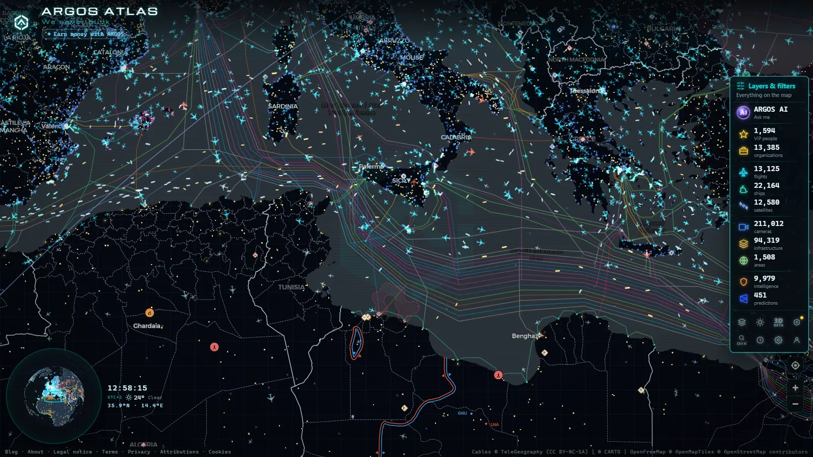
Malta ship traffic live comes down to one narrow stretch of water. The Malta Channel, between the island and southeastern Sicily, is where most traffic between the western and eastern Mediterranean passes, and you can watch it free and without an account on the live ARGOS map: ferries running to Pozzallo, tankers holding position offshore, container ships waiting their turn for Marsaxlokk. Every position comes from AIS, the transponder large vessels broadcast continuously, so what appears on screen is the ship's own report of where it is and what it is doing.
The map carries a live position for 20,996 vessels worldwide and has tracked 41,038 of them (count as of September 2026). Around Malta you will usually see a handful under way and a bigger cluster sitting perfectly still. The still ones are the interesting part. In this channel a stopped ship is rarely lost: it is bunkering, waiting for a berth, or parked until a charter tells it where to go.
The essentials, in 20 seconds
- Malta Channel: the passage between Malta and Sicily, the default route for traffic crossing the Mediterranean east to west.
- Marsaxlokk holds the container terminal and the anchorage; Grand Harbour at Valletta takes cruise ships, ferries and naval visits.
- 20,996 vessels show a live position on ARGOS and 41,038 have been tracked in total (count as of September 2026).
- AIS is self reported: name, destination and status are entered by the crew, so they can be stale or plain wrong.
- Free, live, no registration: the map opens on the channel and updates as new positions arrive.
Where Malta ship traffic live actually happens
Malta is a small country, roughly 316 km² of land and 574,250 residents, and the water around it does more work than the ground. The channel runs north toward the Sicilian coast between Licata and Siracusa, and the traffic inside it is not spread evenly. It sorts itself into two rough bands: a northern one that hugs Sicily, used by coasters, fishing boats and the fast ferries, and a southern one closer to Malta, used by deep sea ships routing toward Suez or Gibraltar. Pan the map to that rectangle, wait a minute, and the two bands separate on their own as the arrows redraw. The southern band is where the large tankers and container ships sit, often for days at a time, because the Maltese anchorage is one of the cheapest places in the central Mediterranean to stop, take on fuel and carry on.
Where these points sit
50 km
Marsaxlokk, the port that sets the rhythm
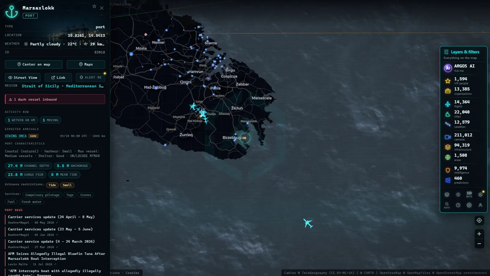
Marsaxlokk, on the southeastern corner of the island, is the reason Malta appears on shipping dashboards at all. It is a transhipment port: boxes arrive on a large ship from Asia or the Gulf, get lifted onto smaller ones, and leave again for Italian, North African or Adriatic destinations. Almost nothing stays on the island. That shapes what you see on the map, because vessels arrive, sit for a day or two and leave on a completely different heading. When the terminal is busy, the water offshore fills with ships showing at anchor in a loose arc, and the number of hulls in that arc is a better congestion signal than any published statistic, because you are counting the ships themselves.
From the ARGOS ATLAS channel.
What each ship status means
The status field is the most useful thing on a vessel card and also the one most often misread. It describes what the ship is doing right now, not where it is going or what it carries. These are the ones you will meet in this channel:
| Status | What it really means | What to look for |
|---|---|---|
| Under way using engine | Moving under its own power | Speed above a few knots and a steady heading |
| At anchor | Stopped, anchor down, usually waiting | Clusters offshore from Marsaxlokk, swinging slowly around a fixed point |
| Moored | Tied up at a berth or quay | Position inside the harbour outline, speed at zero |
| Restricted manoeuvrability | Cannot get out of the way easily | Dredgers, cable ships and tows near the port entrance |
| Not under command | Cannot steer, and not by choice | Rare here; check whether the track drifts with the current |
| Under way sailing | Moving without engine | Yachts and training ships around Gozo in summer |
There is more on the stopped ones in our guide to what a ship at anchor tells you about a port.
Following one ferry across the channel
Pick the ferry first, then follow it. The fast passenger ships between Valletta and Pozzallo cross in a couple of hours, which makes them the easiest thing in the channel to watch from beginning to end. Click the vessel, note its MMSI (the nine digit identity that stays the same throughout a voyage) and keep the card open. You will see the speed climb as it clears the breakwater, hold flat across the open water, then drop in steps as it lines up for the Sicilian coast. The destination field is typed by the crew and is often abbreviated or left over from a previous leg, so trust the track and the speed over the text. The full method, including how an IMO number differs from an MMSI, is in our guide on how to follow a ship live by name, MMSI or IMO.
Watching from shore: Valletta and Gozo
A camera will not show you a container ship at anchor several miles out, but it will give you light, weather and sea state, which is what decides whether a ferry sails at all. The Valletta waterfront view covers the city side of Grand Harbour, and the hill camera above Victoria on Gozo looks over the northeastern part of that island, useful when the Gozo Channel turns choppy and the inner ferries start bunching up.
Use them as a second source, never as the main one. If the picture shows whitecaps and flat grey light while the map shows three vessels holding outside the harbour instead of entering it, you have your explanation without needing a forecast.
Why so many ships sit still off Malta
Bunkering, mostly. Malta sells fuel, and the anchorage southeast of the island is a recognised place to stop for it, so ships with no cargo reason to be here still show up. A second group is waiting for orders: chartered tankers with no confirmed next port park somewhere cheap and legal until a broker fixes the voyage. A third group is simply queueing for the terminal. From the map you can often tell them apart by how they sit. Bunkering ships pair up, two hulls almost touching for a few hours. Waiting ships hold wide spacing and do not move for days. Queueing ships creep toward the port entrance in the hours before they berth. And if a vessel vanishes from the map altogether, that is a different story, covered in why some ships switch off their AIS.
Malta ship traffic live: a five minute routine
A routine beats scrolling. Check the clock first, because the channel has a rhythm and a ship stopped at four in the morning local time means something different from one stopped at midday.
Local time in Valletta
- Open the map on the channel and let the arrows settle for half a minute before judging anything.
- Count the hulls in the anchorage arc southeast of Marsaxlokk. That number is your congestion reading.
- Click one moving vessel and note its type, speed and declared destination.
- Compare with a shore camera for weather and light.
- Save the MMSI of anything you want to follow across several days.
Done in order, that takes five minutes and gives you a picture you can repeat tomorrow and compare. If the acronyms are new, start with what AIS is and how ships broadcast their position.
What you won't see
- Vessels without AIS. Small fishing boats, most pleasure craft and some naval ships either do not transmit or transmit intermittently. The channel is always busier than the map.
- Cargo contents. AIS reports a ship type, not what is inside it. A tanker card will never say whose oil it carries.
- Live video. The Malta cameras send still frames on a refresh cycle, not a stream, and the frames are not stored for you to scrub back through.
- People or number plates. These are wide public scenes at street and hillside scale. Faces are not readable, and identifying anyone is not what the feeds are for.
- A usable picture at night. Shore cameras go dark or grainy after sunset and some drop offline for maintenance. AIS keeps running; the pictures do not.
- Deliberate gaps. A ship that switches its transponder off stops existing on the map until it comes back on.
Where Malta fits in the Mediterranean
Malta is one node, and it reads better alongside its neighbours. The same traffic shows up hours later off Licata or Siracusa, and the ships heading east are past Crete before anyone in Valletta notices they have gone. ARGOS maps 1,081 ports worldwide (count as of September 2026), which makes it quick to jump from the anchorage here to the terminal a given ship is actually aiming for. For the panoramic view of the whole basin, with the cruise and ferry seasons laid out, read our piece on ships in real time across the Mediterranean. Then come back to this channel when you want detail, because this is where the basin narrows and the reading gets precise.
Frequently asked questions
Is Malta ship traffic live free to watch?
Yes, and without an account. The ARGOS map opens directly on the Malta Channel, shows every vessel broadcasting AIS in range and lets you click any of them for speed, heading and status. There is no trial, no card and no registration wall. Camera views of Valletta, Spinola Bay and Gozo are open on the same map.
How often do the ship positions update?
Positions refresh as new AIS messages arrive, which for a moving ship is a matter of seconds to a few minutes, and for an anchored one can stretch to several minutes because the transponder reports less often when the vessel is stationary. Coverage depends on receivers within range, so a ship far offshore may update more slowly.
Why are so many ships anchored off Marsaxlokk?
Mostly for fuel and for berth queues. Malta's anchorage is a standard bunkering stop in the central Mediterranean, so ships call there with no cargo to load. Others wait for a slot at the container terminal, and a third group sits without orders until a charter is fixed. All three show the same at anchor status.
Can I see the ferry between Malta and Sicily in real time?
Yes. The fast ferries between Valletta and Pozzallo carry AIS like any other vessel, so you can follow the whole crossing on the map: departure, speed across open water and the approach to the Sicilian coast. The destination text is typed by the crew, so read the track and the speed rather than the label.
Do the Malta cameras show live video of the ships?
No. The cameras deliver still frames that refresh on a cycle, not continuous video, and they look at the shore rather than the anchorage, which is miles out. Use them for light, sea state and weather, and use AIS for the vessels themselves. At night most of these views go dark or unusable.
- Panama Canal Ship Traffic Live: Read Both Queues on the Map
- Argentina Ports Live: Buenos Aires, Rosario, Bahía Blanca
- Dark Vessels: Why Some Ships Turn Off Their AIS Transponder
- Types of Ships: How to Tell Container Ships, Tankers, and Fishing Vessels Apart on the Map
- Straits and Canals: The Chokepoints of World Trade
- Anchored Ship: See Which Vessels Are Waiting Right Now