Blog · Ships & AIS
Types of Ships: How to Tell Container Ships, Tankers, and Fishing Vessels Apart on the Map
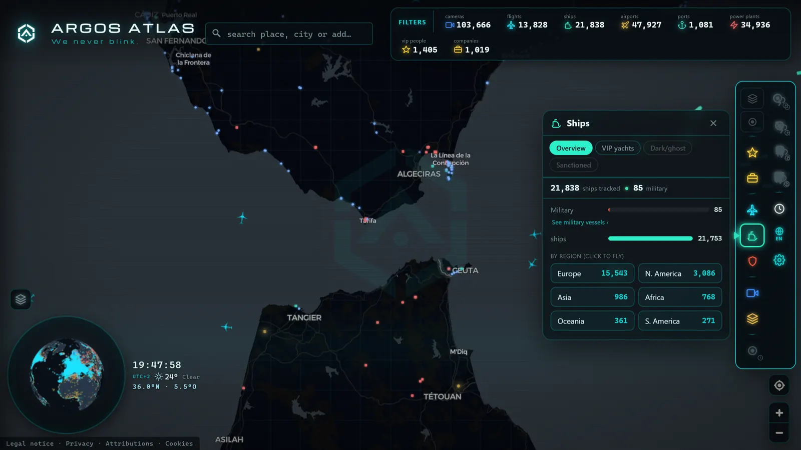
You open a live maritime map and see hundreds of points moving across the ocean. They all look alike, but they are not: out there are oil tankers the size of three football pitches, ferries on their daily run, fishing boats tracing zigzags, and container ships loaded with half of what you will buy this year. Knowing the types of ships is what turns that cloud of dots into a readable story. This guide covers the major families of merchant vessels, what each does, and how to recognise them when you see them navigating live.
Why it matters to know what ship you are looking at
An AIS map without context is just geometry in motion. With context, it is an X-ray of the global economy: each type of ship tells a different story. A string of tankers traces the routes of energy. A line of container ships marks the highways of consumption. A cluster of fishing boats signals a fishing ground. The ship type is the first clue to answering the question that really matters: what is happening there?
Type also determines behaviour. A ferry repeats the same route several times a day; a bulk carrier may spend weeks at anchor waiting for cargo; a tugboat rarely leaves its port. Knowing what each dot is lets you distinguish the routine from the notable, the foundation of any informed observation. If you are still unsure where those dots come from, start with what is AIS and how it enables live ship tracking.
The major families of merchant vessels
Container ships: the conveyor belt of commerce
These are the protagonists of globalisation. They carry cargo in standardised containers (the metal boxes that then travel by truck or train without their contents being touched) and connect the world's major ports on regular services, almost like bus lines. They are recognisable by their stacked decks of colourful containers and their direct, constant routes: they move from terminal to terminal on scheduled calls. The largest exceed 20,000 containers in capacity and are among the longest vessels afloat.
Bulk carriers: mineral, grain, and coal in bulk
Bulk carriers haul loose dry cargo in holds: iron ore, coal, grain, bauxite, fertilisers. They are the pack mules of raw materials. Their profile is unmistakable close up (flat deck with hatches and cranes, superstructure at the stern) and their map behaviour is distinctive too: routes between mining or agricultural ports and industrial zones, with long waits at anchorages because they typically operate on demand rather than fixed schedules.
Tankers and chemical carriers: liquid energy
Tankers transport crude oil or refined products in tanks; chemical carriers carry speciality chemicals requiring smaller, more specialised tanks. The largest crude oil supertankers are among the biggest moving objects ever built. On the map, their routes link producing regions (the Gulf, West Africa, Latin America) with refineries and import terminals, threading through some of the most monitored choke points on the planet, as explored in straits and canals: the world trade choke points.
Gas carriers: spheres and tanks at extreme temperatures
LNG (liquefied natural gas) and LPG (liquefied petroleum gas) carriers are a category of their own. They transport chilled or pressurised gas in insulated tanks, and some sport the characteristic semi-submerged spheres on deck that make them instantly recognisable. Their routes connect liquefaction plants in exporting countries with regasification terminals in importers: if you see gas carriers arriving regularly at a coastline, there is a regasification terminal at work.
Ro-ro and car carriers: floating boxes full of vehicles
Ro-ro stands for roll-on/roll-off: cargo drives on and off via ramps, with no cranes required. The star of the family is the car carrier or PCTC, that enormous floating block, tall and almost windowless, which can carry thousands of cars on stacked decks like a multi-storey car park. There are also mixed ro-ro vessels that combine trucks, trailers, and containers. They link vehicle factories with their markets worldwide.
Passenger vessels: ferries and cruise ships
Ferries are the easiest to spot on the map: they repeat the same line between two ports over and over, on clockwork schedules. Cruise ships, by contrast, draw tourist itineraries with day-call ports and nights at sea. Both must carry AIS (the SOLAS convention requires it for all passenger ships) so they are a well-represented category on any viewer.
Fishing vessels: the dot-tracers
While a merchant vessel draws straight lines from A to B, a fishing vessel on active grounds traces erratic patterns: parallel passes, circles, zigzags at low speed. This behaviour is so characteristic that analysts use it to infer the fishing gear being employed. On the map you will see them clustered in fishing grounds and fish banks, often in groups.
Tugs and service vessels
These are the workers of the port and the offshore industry: tugs that assist large vessels during manoeuvres, pilot boats, platform supply vessels, support craft. They operate in short radii and at variable speeds. If you see a small dot hugging a large one at a port entrance, it is almost certainly a tug at work.
Special vessels: cable layers, dredgers, and research ships
A miscellaneous but fascinating category. Cable-laying ships install and repair the submarine cables through which internet traffic travels, navigating slowly over very precise tracks. Dredgers maintain depth in ports and channels, moving in repetitive patterns over specific areas. Oceanographic research vessels run scientific surveys on courses that seem to make no sense, until you understand they are sweeping a grid of the seabed.
How AIS declares a ship's type
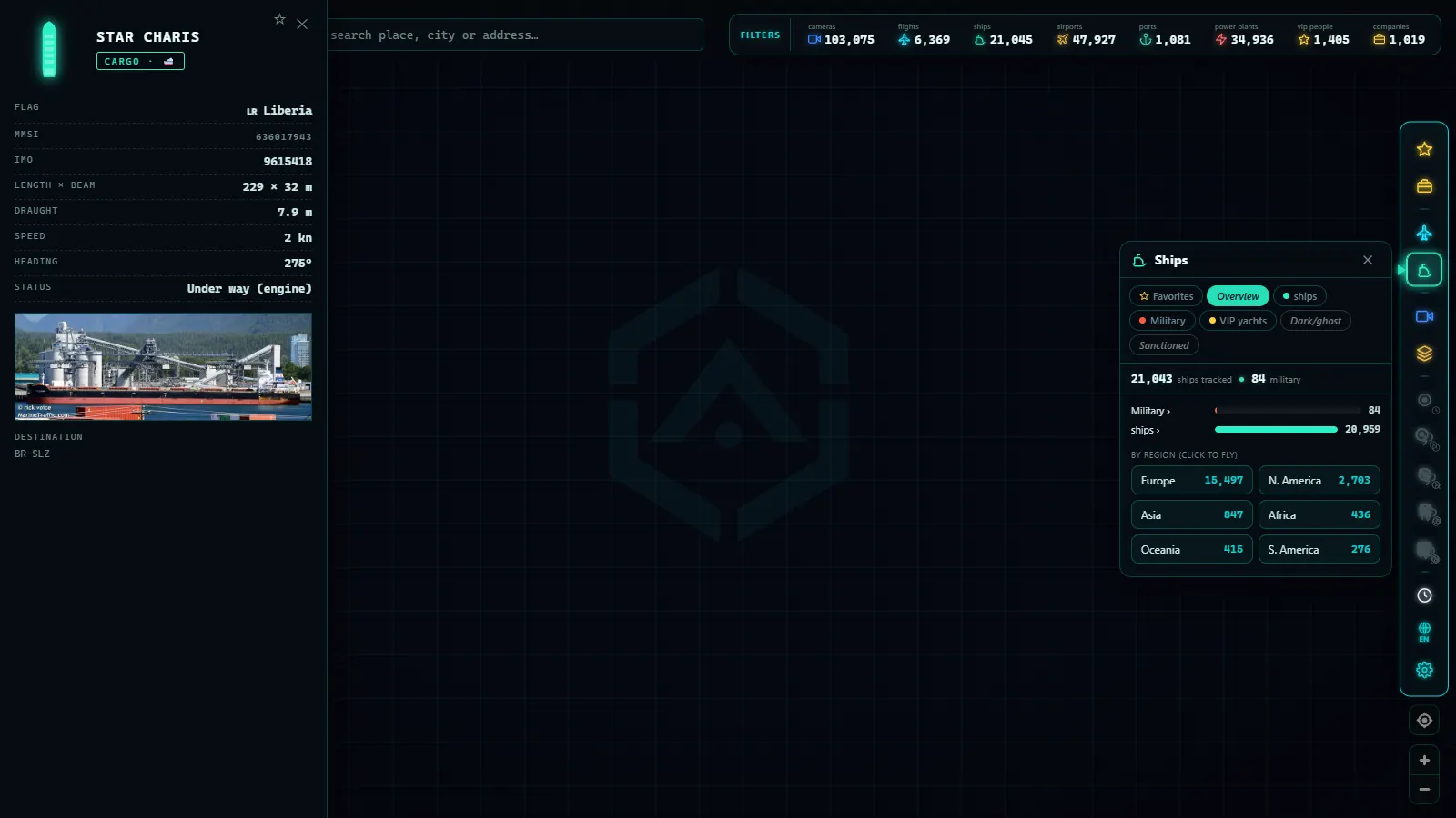
There is no mystery here: the vessel itself declares its type. The AIS message has two parts. The dynamic portion is transmitted every few seconds and includes position, heading, and speed. The static portion is sent less frequently and contains the vessel's identity: name, call sign, dimensions, draught, declared destination, and a numeric ship-type code.
That code follows a standardised table with categories such as cargo, tanker, passenger, fishing, towing, and high-speed, some with subdivisions. Viewers read that field and translate it into colours or icons so you can distinguish families at a glance.
Two things worth knowing. First: the field is configured by the ship's operator, so errors and outdated entries exist, a converted vessel that still declares its old type, for example. Second: AIS categories are coarser than reality; "cargo" encompasses everything from a small coastal freighter to a giant container ship. Even so, for the observer it is an invaluable tool: it tells you, in essence, what role each dot plays in the overall picture.
From the ARGOS ATLAS channel.
Named sizes: Panamax, Suezmax, and the rest
In the maritime world, sizes have surnames, and the canals assign them. Panamax designates the maximum vessel that could fit through the original Panama Canal locks; when the canal was expanded, Neopanamax was coined for the new locks. Suezmax is the largest tanker that can transit the Suez Canal at full load. Vessels that exceed all limits are called post-Panamax or, for supertankers, VLCC and ULCC (Very Large Crude Carrier and Ultra Large Crude Carrier).
Canals do not only shorten routes: they baptise entire generations of ships. Each lock expansion redefines what the industry considers "large."
You do not need to memorise the full table. The key takeaway is this: when you read that a vessel is Panamax or Suezmax, you are being told where it can and cannot go, which directly shapes its routes on the map.
What the ship type tells you about a zone
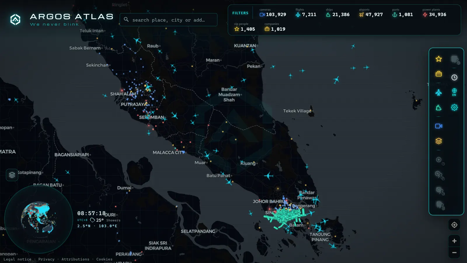
Here is the payoff for all of the above: ship types are a language, and the zones on the map speak it.
- Bulk carriers concentrated off a coastline point to ore, coal, or grain terminals: mines and farmland have their echo at sea.
- Gas carriers arriving regularly at a location reveal a regasification terminal; departing, a liquefaction plant.
- Fishing vessels clustered mark active fishing grounds, and their seasonal density tells you when each fishery is open.
- Ferries crossing like pendulums identify passenger corridors between islands, shores, or neighbouring countries.
- Tankers in convoy trace the arteries of energy, especially visible at the major straits.
With a little practice, looking at a region on the map and reading its economy becomes almost automatic. It is pure visual literacy: the same map, but now with subtitles.
Seeing them by category on Argos Atlas
All this theory is more enjoyable with the map open. In Argos Atlas you can see ships live from open-source AIS positions, filter them by category and region, and check each vessel's speed. It is the most direct way to practise what you have learned: choose a zone with dense traffic, activate the ships layer, and start distinguishing families. You will see how cargo vessels draw their straight lines, ferries repeat their pendulum, and fishing boats scrawl their grounds. If you want a practical guide to following a specific vessel from start to finish, you will find the step-by-step walkthrough in how to track a ship live.
Frequently asked questions
What is the most common type of ship?
It depends on how you count. In the world merchant fleet, general cargo ships, bulk carriers, and tankers are among the most numerous categories. If we widen the lens to all vessels, fishing boats are one of the most abundant classes on the planet, though many are small and not required to transmit AIS, so their presence on viewers is lower than their real number. On your screen, what you will see most on ocean routes are cargo ships and tankers; closer to shore, the mix diversifies considerably.
How do I know what type a ship is on the map?
The vessel declares it: the AIS static message includes a type code that the operator configures in the transponder. Viewers read that field and translate it into visual categories, usually colour-coded or with different icons for cargo, tanker, passenger, or fishing vessels. Clicking on any ship shows its declared type alongside its name, heading, and speed. Keep in mind that the data is entered by the operator, so it can occasionally contain errors or be out of date.
What is a ro-ro ship?
A roll-on/roll-off vessel: cargo drives on and off via ramps, without the need for cranes. They handle trucks, trailers, and above all vehicles. Their most impressive version is the car carrier, that enormous floating block with smooth sides and almost no windows that functions like a multi-storey car park and can transport thousands of vehicles between factories and their markets across the globe.
What does Panamax mean?
It is the size category defining the maximum vessel capable of transiting the original Panama Canal locks. After the canal's expansion the term Neopanamax was coined for the new locks, and Suezmax exists for the largest tanker able to traverse the Suez Canal at full load. They are practical labels: they tell you at a glance which of the world's choke points a vessel can navigate, which directly conditions its commercial routes.
Conclusion
Knowing the types of ships completely changes the experience of looking at a maritime map: where there were once anonymous dots, there are now tankers bound for a refinery, ferries on their usual run, and fishing boats combing a fishing ground. It is knowledge that consolidates with practice, and the practice is a click away: open the map, find a coast with movement, and start putting a name (and a trade) to each vessel you see pass.
Frequently asked questions
What is the most common type of ship?
By number of vessels, general cargo ships and bulk carriers are among the most numerous in the world merchant fleet, alongside tankers. If all vessel categories are counted, fishing boats are one of the most abundant classes worldwide, although many do not appear on AIS viewers because of their small size and the exemption threshold.
How do I know what type a ship is on the map?
The vessel declares it in the static data of its AIS message, and the viewer translates this into categories, usually colour-coded or with distinct icons. Clicking on any ship shows its declared type alongside its name, heading, and speed.
What is a ro-ro ship?
A roll-on/roll-off vessel: cargo drives on and off via ramps rather than being lifted by cranes. Car carriers (those enormous floating boxes that transport thousands of vehicles across oceans) are the most recognisable version, with their nearly windowless, multi-deck hull.
What does Panamax mean?
It is the maximum size of vessel that could fit through the original locks of the Panama Canal. Canals name size categories: Neopanamax designates ships sized for the expanded locks, and Suezmax the maximum tanker that can transit the Suez Canal at full load, among others.
- Anchored Ship: See Which Vessels Are Waiting Right Now
- Live Ships in the Caribbean Sea: Cruise Liners, Container Ships and Island Traffic
- Live Ships in the South Pacific: Routes Connecting Chile, Peru and Ecuador to Asia
- Live Ships in the Mediterranean Sea: Ferries, Cruise Liners and Container Ships
- Live Ships in the Strait of Malacca, the World's Busiest Shipping Lane
- Live Ships in the North Atlantic: Europe to North America Trade Routes