Blog · Ships & AIS
Panama Canal Ship Traffic Live: Read Both Queues on the Map
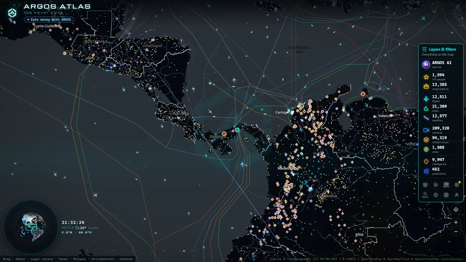
Open the map over Panamá and the picture resolves into three things: a cluster of ships sitting still in the Pacific off Balboa, a second cluster in the Caribbean off Cristóbal and Colón, and a thin line of vessels moving in single file between them. That is what panama canal ship traffic live looks like when it comes from raw AIS instead of a press release: free, no registration, updated as the transponders report. ARGOS carries 21,268 ship positions on the map and 31,182 vessels tracked in the live window (figures as of October 2026).
What you get is position, course, speed over ground and the navigational status each ship broadcasts about itself. What you do not get is the canal's own booking system, so the question everybody asks first (when does that ship enter the locks?) is the one AIS cannot answer. Here is how to read both queues anyway, and where the honest limit sits.
The essentials, in 20 seconds
- Two separate queues: ships wait off Balboa on the Pacific side and off Cristóbal and Colón on the Caribbean side, and on the map the two clusters never blend into one.
- Speed over ground is the tell: at or near zero with an at anchor status means waiting, a low steady speed on a locked heading means a transit already under way.
- The Pacific waiting room is the wide open anchorage of the Golfo de Panamá, while the Caribbean side packs its ships much closer to the breakwater.
- Three public lock cameras (Miraflores, Pedro Miguel and Cocolí) show the chambers as refreshed still frames, never video.
- AIS never carries the slot assignment, the authorised draft of the day or the toll paid, so no tracker anywhere has them.
What "Panama Canal ship traffic live" means on the map
Every merchant ship above a modest size broadcasts its identity, position, course and speed on VHF, and coastal stations and satellites pick it up. That is the entire mechanism, and it pays to know its shape before trusting it: what AIS is and how ships are located in real time covers the gaps. Open the live map of ships, ports and cameras, zoom on Panamá, and the canal reads itself: two static crowds and one moving thread.
The useful part is that nothing here is curated. You are looking at the same raw feed a port agent sees, minus the commercial layer on top. A ship that has held the same spot for two days is genuinely sitting there. A ship that disappears for an hour has probably lost receiver coverage, not its anchor.
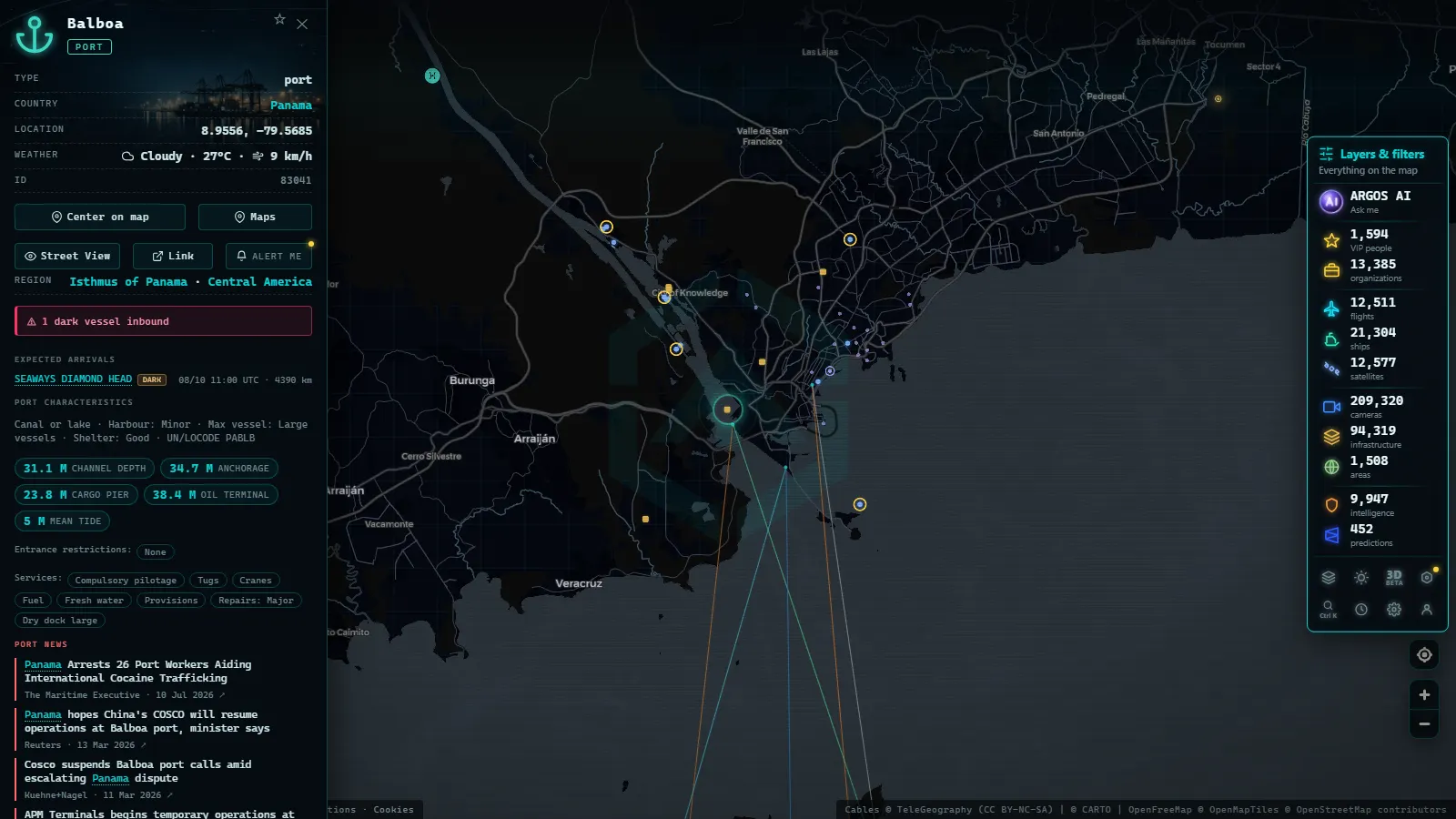
The Pacific queue: Balboa and the Golfo de Panamá
On the Pacific side the anchorage is generous, and that changes what you see. Ships spread over a wide arc south of Balboa, headings pointing every which way because each one swings on its cable with the current. Zoom out a notch and the cluster looks like scattered dust, which is exactly how you recognise an open roadstead instead of a berth line.
Balboa itself is a working container terminal, so do not read every ship near it as a canal waiter. The ones alongside the quays are loading, the ones out in the gulf are waiting their turn. The distinction matters everywhere, and the short version is in what "at anchor" means and how to see it live.
From the ARGOS ATLAS channel.
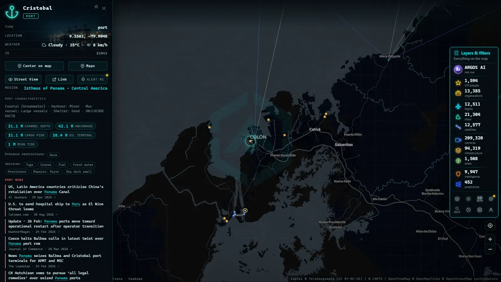
The Atlantic queue: Cristóbal and Colón
The Caribbean entrance is tighter. Cristóbal sits behind a long breakwater with Colon and its free zone immediately inland, and the waiting ships hold closer in, so the cluster looks denser and more ordered than the Pacific one. Terminal traffic and canal traffic overlap visually here more than anywhere else on the route.
Two habits sort it out. First, check whether a ship's heading runs parallel to its neighbours: a row of parallel hulls usually means berths, a scatter means anchors. Second, look at the same screen twice, an hour apart. Berthed ships stay exactly put, anchored ships drift a few hundred metres and swing.
Transit or waiting: reading speed and AIS status
Two fields do almost all the work: speed over ground and navigational status. Status is typed in by the crew, so it is the weaker of the pair, and when the two contradict each other, believe the speed.
| What the map shows | Speed over ground | AIS status | What to do with it |
|---|---|---|---|
| Loose cluster off Balboa, headings scattered | At or near zero | At anchor | Count the cluster to gauge the Pacific wait |
| Ship on the canal axis in the cut | Low and steady | Under way using engine | Follow it, a transit is in progress |
| Vessel stopped at a lock approach | Near zero, heading fixed | Under way or restricted manoeuvrability | Check the lock camera at that moment |
| Ship leaving the anchorage, heading swinging | Rising from zero | Under way using engine | Its turn has come, watch the next hour |
| Hull drifting outside the anchorage | Low, heading wandering | Moored (clearly wrong) | Distrust the status, trust the speed |
The signature of a transit starting is the boring one: speed lifting off zero and a heading that stops wandering and locks on. From there the ship holds a single-digit speed for hours, with pauses at each lock flight.
Which ship types dominate each queue
Panama Canal ship traffic is not a random mix, and the queues sort themselves by trade. The newer, larger locks carry the big boxes and the gas carriers, the older ones take a long tail of dry bulk. If you want to name a hull before clicking it, how to tell cargo ships, tankers and fishing vessels apart on the map is the field guide.
| Type | Where you notice it | What to look for |
|---|---|---|
| Container ships | Moving, rarely parked long | A locked heading on the axis, steady speed |
| Dry bulk carriers | The patient majority in both anchorages | Days in the same spot, at anchor status |
| Gas and product tankers | Scattered through the Pacific arc | Declared type on the vessel card |
| Car carriers and reefers | In waves, tied to their trades | Several near-identical hulls arriving together |
The lock cameras: Miraflores, Pedro Miguel, Cocolí
The canal is one of the few chokepoints where a camera sits right next to the AIS track. Miraflores is the classic view, Pedro Miguel is one flight up the Pacific stairway, and Cocolí belongs to the newer locks built for the larger ships. The catalogue holds 209,319 public cameras (count as of October 2026) and only a handful of them look at this canal, so treat these as precious rather than plentiful.
Use them as confirmation, not discovery. You find the ship on AIS, you see it stop at the chamber, then you open the camera and watch a hull you already identified fill the frame. Working the other way round, trying to name a ship from a still frame, almost never succeeds.
When to look at Panama Canal ship traffic
Panamá keeps one clock all year, which makes this easy to plan. Daylight local time is the only window where the lock cameras are worth opening, while the AIS layer is indifferent to the hour and just as readable at three in the morning.
Hora en Balboa
Queues also breathe on a weekly rhythm that you can see for yourself: watch the same two clusters at the same local hour for a week and the growth or the thinning becomes obvious without any published statistic. The canal is one of the handful of places where this works so cleanly, and the rest of them are listed in the chokepoints that carry world trade.
Following one ship from one ocean to the other
Pick a hull in the Pacific anchorage, note its identifiers, and you can watch the whole crossing in a few checks across the day: the lift off zero, the run up the cut, the pauses at the flights, then a new position in the Caribbean. Identifiers are the part people get wrong, and how IMO numbers identify a ship for life explains why the IMO beats the name.
The map carries 1,081 ports, so the same method extends to either end of the voyage: follow the ship out of Cristóbal, and its next call is usually a port already on the map.
What you won't see
- The transit slot. Booking order, assigned time and queue priority live in the canal authority's system. AIS has no field for them.
- The authorised draft of the day. Draft restrictions change with the lake level and are published as notices, not broadcast by any ship.
- The toll paid, the cargo manifest and the charterer. None of it is in an AIS message.
- Video from the locks. The cameras return refreshed still frames, and at night or during a host outage you get a dark or frozen image.
- People or plates. The frames are wide views of a chamber. Nobody is identifiable in them, and that is the point.
- Ships that choose not to broadcast. A switched-off transponder leaves a hole in the picture, and a silent hull in an anchorage simply is not there as far as the map is concerned.
- A guarantee of coverage. AIS reception around the isthmus is good, but gaps and stale positions happen, so a marker that has not moved in hours may be a stopped ship or a stopped signal.
Frequently asked questions
Can I follow Panama Canal ship traffic live for free?
Yes, free and with no registration. The map draws AIS positions for both sides of the canal, the anchored clusters off Balboa and Cristóbal and the ships moving through the cut, and you can click any one of them for its name, type, speed and navigational status. No account, no trial, no card.
How do I tell a ship waiting for a slot from one in transit?
Speed over ground, first. A waiting ship reads at or near zero and usually broadcasts an at anchor status, while a transiting ship holds a low steady speed with its heading locked on the canal axis. If speed and status disagree, trust the speed: status is typed in by the crew.
Can I see which ship enters the locks next?
No. The transit slot, the booking order and the daily draft limit live in the canal authority's own system, and none of it travels in an AIS message. What you can do is watch for the moment a ship lifts off zero speed and turns onto the canal axis, which means its turn has arrived.
Which ship types fill each queue?
Container ships and gas carriers dominate the newer, larger locks, while dry bulk carriers are the patient majority waiting on both sides, joined by product tankers, car carriers and reefers. Cruise ships appear seasonally. Click a vessel on the map and read its declared type rather than guessing from the hull shape.
Do the Panama Canal lock cameras show live video?
No, they are still frames that refresh, not a video stream. Miraflores, Pedro Miguel and Cocolí give you a usable look at a chamber in daylight, and a dark or frozen frame at night or when the host goes down. They are confirmation for an AIS track, not a surveillance tool.
- Argentina Ports Live: Buenos Aires, Rosario, Bahía Blanca
- Dark Vessels: Why Some Ships Turn Off Their AIS Transponder
- Types of Ships: How to Tell Container Ships, Tankers, and Fishing Vessels Apart on the Map
- Anchored Ship: See Which Vessels Are Waiting Right Now
- Live Ships in the Caribbean Sea: Cruise Liners, Container Ships and Island Traffic
- Live Ships in the South Pacific: Routes Connecting Chile, Peru and Ecuador to Asia