Blog · Ships & AIS
Straits and Canals: The Chokepoints of World Trade
Global trade looks vast and unstoppable, until you look at the map. Underneath the immensity of the oceans lie a handful of passages a few miles wide that carry a disproportionate share of everything the world buys, sells, and burns. Geographers and analysts call them chokepoints, and understanding them is understanding why a single ship run aground can rattle prices thousands of kilometres away. This article walks through the planet's great maritime bottlenecks, what happens when they seize up, and how you can watch them in real time.
What a Chokepoint Is and Why It Concentrates So Much Power
A maritime chokepoint is a narrow passage (natural or artificial) connecting two bodies of water for which there is no practical alternative. Geography is the governing force: if you want to move oil from the Persian Gulf to Asia, you go through Hormuz; if you want to link Europe and Asia without circumnavigating Africa, you go through Suez. Alternatives exist, but they add days of sailing and significant fuel costs, so traffic gravitates toward the shortest route.
That concentration has two faces. The efficient face: short, predictable, well-charted routes. The fragile face: any single incident (an accident, a conflict, a blockage, even weather) instantly affects a massive portion of world commerce. Straits have therefore been, for centuries, an obsession of empires, navies, and insurers alike. Whoever controls the passage conditions the flow.
A Tour of the Planet's Great Passages
Malacca: Asia's Gateway
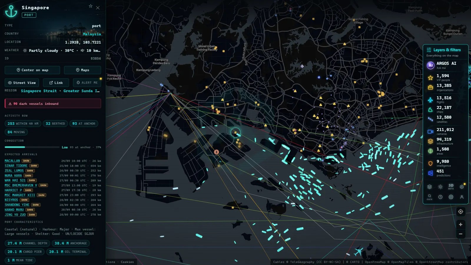
Squeezed between the Malay Peninsula and the island of Sumatra, the Strait of Malacca connects the Indian Ocean to the South China Sea. It is the natural shortcut between the Middle East, Europe, and Africa on one side and the economies of East Asia on the other. The strait is consistently ranked among the world's busiest: a substantial share of the oil feeding East Asian industry passes through it, alongside a relentless procession of container ships moving between the region's major ports, Singapore, Port Klang, and the vast Chinese terminals beyond. At its narrowest, the funnel tightens to dimensions that demand careful, regulated navigation. When Malacca sneezes, Asia catches cold.
Hormuz: The Oil Artery
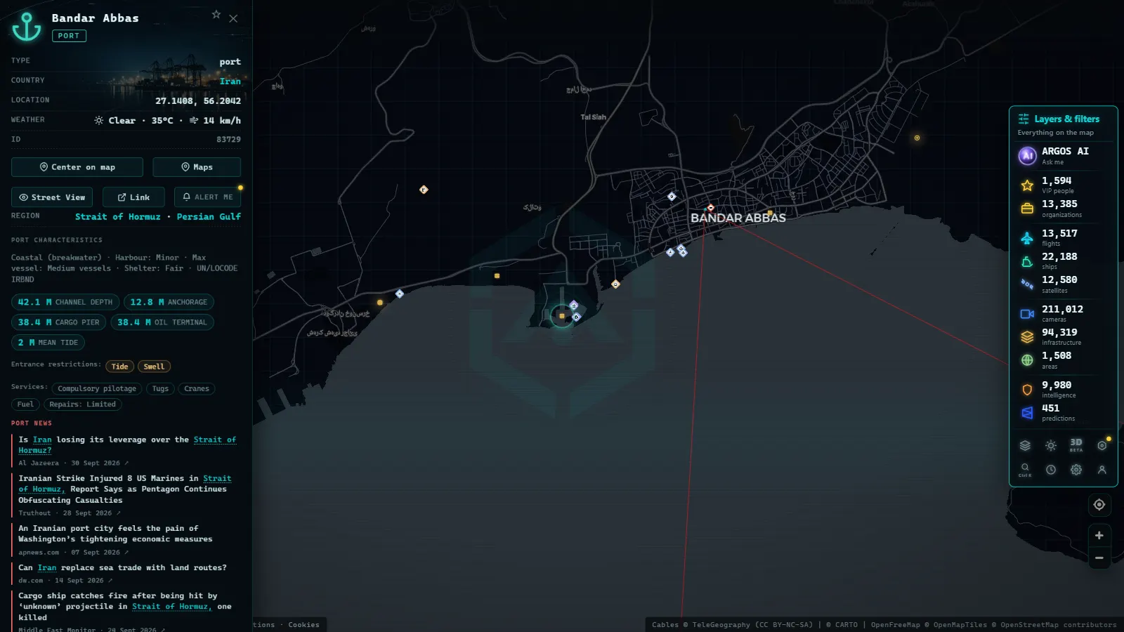
The Strait of Hormuz, between the Arabian Peninsula and Iran, is the sole maritime exit from the Persian Gulf. Its importance reduces to a single sentence: a very significant share of the world's seaborne crude oil and liquefied natural gas passes through here. Tankers and LNG carriers cross it in constant procession bound for markets in Asia, Europe, and the Americas. It is also one of the most geopolitically sensitive points on earth: every episode of tension in the region translates almost instantly into jitteriness in energy markets and a jump in maritime insurance premiums.
Suez and Panama: The Artificial Shortcuts
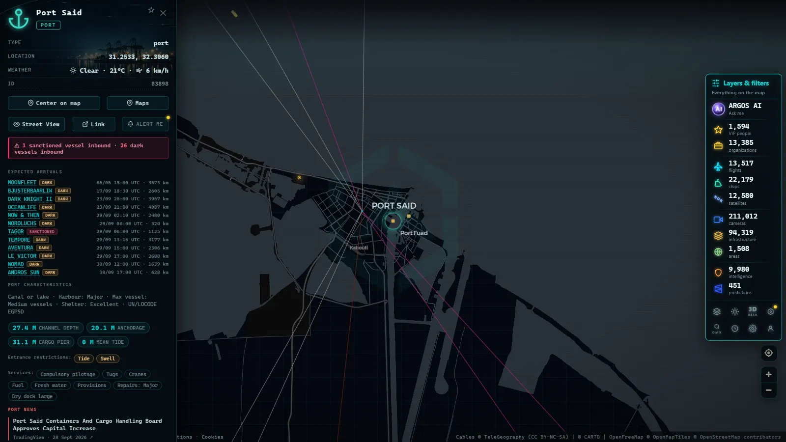
The two great canals are proof that when geography refuses to cooperate, humanity digs. The Suez Canal links the Mediterranean to the Red Sea, saving ships the entire circumnavigation of Africa, it is the backbone of trade between Europe and Asia. The Panama Canal connects the Atlantic to the Pacific across the Central American isthmus via a lock system that lifts and lowers ships through successive chambers; without it, the alternative is rounding South America. Both canals are so central to shipping that they have given their names to vessel size categories (Panamax, Neopanamax, Suezmax) as we explore in types of merchant ships: how to identify cargo vessels, tankers, and fishing boats on the map.
Gibraltar: The Mediterranean's Gatekeeper
The Strait of Gibraltar, between southern Spain and Morocco, is the only natural connection between the Mediterranean and the Atlantic. Just a few miles separate Europe from Africa, and through that corridor passes all traffic entering or leaving the Mediterranean from the west: container ships on the Asia–northern Europe route via Suez, tankers, ferries crossing between the two shores, and heavy local traffic. It is one of the most congested and monitored passages in Europe, with traffic separation schemes that organise flows like a two-lane motorway.
The Bosphorus: A Strait with a City on Top
The Bosphorus cuts literally through Istanbul and, together with the Dardanelles, links the Black Sea to the Mediterranean. It is the maritime exit for all the countries bordering the Black Sea, including a significant share of the grain and energy exports from the region. Its peculiarity is twofold: it is narrow, winding, and subject to tricky currents, and it bisects a metropolis of millions, complete with bridges and a busy local ferry network. Transit is governed by long-established international conventions and managed with an exceptionally strict choreography.
Bab el-Mandeb: The Gate of Tears
At the southern end of the Red Sea, between the Arabian Peninsula and the Horn of Africa, Bab el-Mandeb is Suez's inseparable companion: everything crossing the canal to or from the Indian Ocean also passes through here. Its Arabic name is traditionally rendered as "Gate of Tears," and recent history has given it cause to live up to that name. Instability along its coastlines has turned the strait, at various moments, into a high-risk zone for commercial navigation, forcing shipping lines to weigh alternatives that add weeks to a voyage.
When the Bottleneck Jams: The Ever Given
The fragility of chokepoints stopped being theory on 23 March 2021, when the Ever Given (one of the world's largest container ships) ran aground sideways in the Suez Canal. For six days, the canal was completely blocked: nothing could pass in either direction.
The consequences were immediate and viscerally visible. Hundreds of ships piled up in queues at both ends of the canal, sitting at anchor and waiting. Shipping lines had to choose between holding position or diverting vessels around the Cape of Good Hope, adding roughly ten days to a voyage. Supply chains already strained by the pandemic took weeks to absorb the accumulated delays. And the entire world, watching the refloating operation unfold almost in real time, discovered just how much depended on a ditch through the Egyptian desert.
A single hull lodged across the wrong stretch of water was enough to remind the world that global commerce rests on a few kilometres of water.
The episode has become the textbook example of what a chokepoint actually means: you do not need a conflict or a catastrophe. A gust of wind and a bad manoeuvre will do.
From the ARGOS ATLAS channel.
What a Strait Looks Like on a Live AIS Map
This is where theory becomes spectacle. Ships broadcast their positions via AIS, and on a live chart a busy strait appears as a river of dots moving in formation: two parallel streams flowing in opposite directions, vessels holding their spacing like cars on a motorway.
That is not coincidence. The world's busiest passages are organised through traffic separation schemes, internationally established lanes that direct inbound and outbound flows, with precautionary zones at crossing points. On the map, you can read the lanes even when the viewer does not draw them, because the discipline of the traffic makes the rules visible.
Around the river of dots there is more to read. Ferries crossing perpendicular between the two shores. Pilots and tugs manoeuvring near the entrances. Fishing vessels working the margins. And, in the approaches, clusters of ships sitting still, waiting their turn.
What to Watch as a Curious Observer
If you develop a habit of watching straits on the map, three signals tell you more than anything else.
- Flow density. Every passage has its normal pulse. After a few visits you will learn to recognise it, and then any anomaly, an unexpectedly empty lane or a sudden build-up, will catch your eye on its own.
- The anchorages at the entrances. Ships waiting to transit a canal or enter a port anchor in designated holding areas. An anchorage far fuller than usual is the first visible symptom that something is moving slowly further in. We explain how to read these situations in what it means when a ship is at anchor.
- The mix of vessel types. Whether a strait is dominated by tankers, container ships, or LNG carriers tells you what kind of commerce it sustains. Changes in that mix reflect changes in real economic flows.
An honest caveat: observing is not diagnosing. A crowded anchorage may reflect a storm, a local public holiday, or pure coincidence. The satisfaction is in looking with curiosity and caution in equal measure.
Watching Straits in Argos Atlas
Everything above can be practised without leaving your desk. Argos Atlas shows live vessels sourced from open AIS feeds, filterable by category and region, with each ship's speed displayed alongside a worldwide port layer that puts every passage in geographic context. Open the map over Gibraltar on a weekday afternoon and the river of dots is immediately there; jump to Malacca or the Suez approaches and compare the pulse of each. It is economic geography in real time, with no account required and no cost.
For ships that switch their AIS transponders off (which does happen around sensitive straits) see our article on dark vessels and AIS deactivation.
Conclusion
Straits and canals are the fine print of world trade: almost no one notices them until a ship runs aground or a conflict flares nearby, at which point it turns out that half the world's economy was threading through that very passage. The good news is that you no longer need to be a logistics analyst to observe them. The traffic crossing these straits broadcasts its position every minute, and anyone can look. Open the map, centre it on Gibraltar, Malacca, or Hormuz, and spend five minutes watching the river of dots. Very few images explain how the world actually works as well as this one does.
Frequently asked questions
Which strait carries the most traffic in the world?
The Strait of Malacca is consistently cited as one of the busiest waterways on the planet. It links the Indian Ocean to the South China Sea and channels a substantial share of trade between Asia and the rest of the world. The Strait of Dover, Gibraltar, and the Danish straits also rank among the world's most congested passages.
What happens when a canal like Suez is blocked?
A planetary traffic jam. The grounding of the Ever Given in 2021 kept Suez closed for days, with hundreds of ships queuing at both ends and shipping lines weighing whether to reroute around the Cape of Good Hope, a far longer voyage. Supply chains took weeks to absorb the backlog.
Can you watch live traffic through a strait?
Yes. Ships broadcast their positions via AIS, and open maritime viewers display them on the map in near-real-time. A busy strait appears as a river of dots moving in formation, often sorted into inbound and outbound lanes thanks to traffic separation schemes.
Why are they called chokepoints?
Because they concentrate enormous flow through a very narrow passage, just like a bottleneck throttles the liquid leaving a container. If the passage closes or becomes difficult, the global flow of goods is immediately affected. That combination of outsized importance and physical fragility is precisely what defines a chokepoint.
Which chokepoint handles the most oil?
The Strait of Hormuz is the single most critical oil chokepoint: it is the only maritime exit from the Persian Gulf, and a very significant share of the world's seaborne oil passes through it. Every spike in tension in the region sends insurance premiums and energy markets into immediate reaction.
- Live Ships in the Caribbean Sea: Cruise Liners, Container Ships and Island Traffic
- Live Ships in the South Pacific: Routes Connecting Chile, Peru and Ecuador to Asia
- Live Ships in the Mediterranean Sea: Ferries, Cruise Liners and Container Ships
- Live Ships in the Strait of Malacca, the World's Busiest Shipping Lane
- Live Ships in the North Atlantic: Europe to North America Trade Routes
- Port of Santos Live: Sugar Terminals & Congestion Tracker