Blog · OSINT & verification
Turkey live map: Bosphorus ships, flights and road cameras
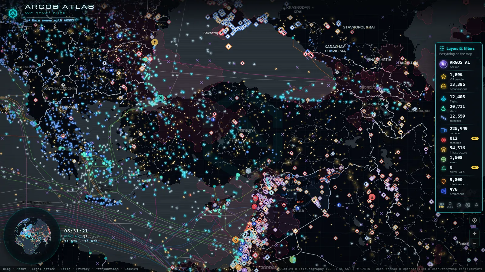
Turkey on one live map means four layers running at once: AIS ship traffic through the Bosphorus and the Dardanelles, ADS-B flights into Istanbul and Ankara, public road cameras in central Anatolia, and an infrastructure layer with power plants, dams and ports. It is free, it opens in a browser, and there is no account to create.
Coverage over Turkey is uneven, and that is worth saying first. The sea and the air are dense. The road cameras are not where almost anyone expects them. And some of what you would want on a national map (city CCTV, railways, border crossings) is simply not there. Knowing which layer rewards the click is most of the value.
The essentials, in 20 seconds
- 225,448 cameras are catalogued worldwide (count as of October 2026); the Turkish ones are municipal road feeds in Yozgat and Aksaray, not in Istanbul.
- 20,645 ships are broadcasting AIS at any given moment, and the Turkish Straits are one of the densest lines on that layer.
- 12,732 flights are tracked live, Istanbul Airport, Sabiha Gökçen and Ankara Esenboğa included.
- 34,936 power plants, 5,356 dams and 1,078 ports sit in the infrastructure layer, Turkish hydro and gas among them.
- No sign-up and no app: every layer toggles from the rail on the side of the map.
What a Turkey live map actually shows
A live map is not a satellite picture. Everything on it is a signal that somebody publishes: a transponder, an AIS transceiver, a municipal camera server, a public infrastructure register. Turkey scores well on the first two and poorly on the third.
Open the country card and the view frames the whole territory, from Edirne on the Greek border to Kars near Armenia, with Ankara marked as the capital. From there the rail turns layers on and off one at a time. The sequence that works for Turkey is ships first (the straits are the best thing on the map), then flights, then infrastructure, and cameras last, because that is the layer that disappoints anyone who opens it expecting Istanbul.
The Bosphorus is the busiest line on the ship layer
The Bosphorus is a narrow corridor between the Black Sea and the Sea of Marmara, and on the AIS layer it looks like a queue, because it is one. Tankers heading south, bulk carriers coming down from the Danube ports, car ferries crossing sideways between the European and Asian banks, all of them broadcasting position, speed and heading.
Zoom in and click any vessel: name, type, flag, declared destination and the track it has drawn over the last hours. Do the same at the Dardanelles, off Çanakkale, and you have the other half of the same corridor. 1,539 sanctioned vessels are flagged across the ship layer worldwide, and the Turkish Straits are one of the places where they turn up.
Two caveats before anyone draws conclusions: AIS is self-reported, and the destination field is typed by hand on the bridge. How AIS tracking works covers what the signal does and does not prove, and the chokepoints of world trade puts these straits alongside Suez, Hormuz and Malacca.
From the ARGOS ATLAS channel.
Istanbul and Ankara on the flight layer
Istanbul Airport (IST) and Sabiha Gökçen (SAW) keep Turkey permanently near the top of the ADS-B layer, and Ankara Esenboğa (ESB), Antalya and İzmir fill in the rest. Click an aircraft and you get callsign, type, altitude, ground speed and the route it has flown since entering coverage.
47,927 airports are in the catalogue worldwide, from intercontinental hubs down to grass strips, so the markers across Anatolia include plenty of regional fields nobody has heard of. That turns out to be useful: a diversion into Konya or Kayseri is visible on the map before it is news anywhere.
Military traffic has its own counter (260 aircraft flagged as military worldwide at a given moment) and it is incomplete by design, because many state aircraft do not broadcast at all. Read the flight layer as a very good sample, never as a census.
Road cameras: Yozgat and Aksaray, not Istanbul
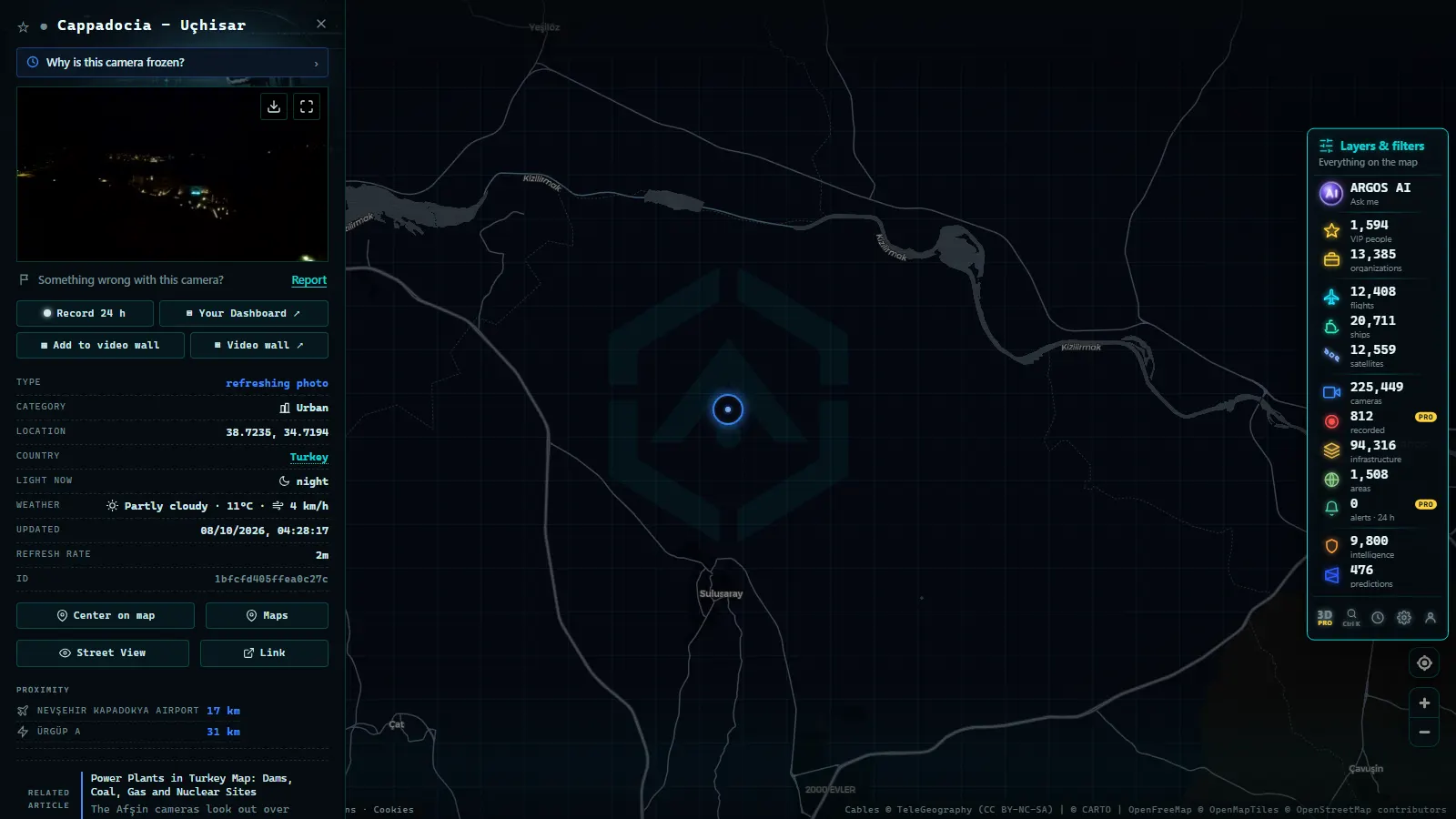
Here is where the honest version earns its keep. Turkey's presence on the camera layer comes from municipal feeds in central Anatolia, essentially Yozgat and Aksaray. There is no public Istanbul traffic camera feed in the catalogue, and none for Ankara either.
What you do get is genuinely useful for the road: the junction by the Yozgat clock tower, the approaches at Güzelyurt in Aksaray province (the gateway to the Ihlara valley), and winter conditions on the Anatolian plateau. What you do not get is a national network.
For scale, Spain alone has 11,665 catalogued cameras and the London area has 2,143 (counts as of October 2026). Turkey has a handful. How traffic cameras work, and why they are public explains the difference, and it is a transport-agency policy decision far more than a technical one.
Power plants, dams and the ports behind the traffic
After air and sea, infrastructure is Turkey's best covered layer. Hydro dominates, with the big dams on the Euphrates and Tigris; gas clusters around the Marmara basin; coal sits on the Aegean and Black Sea coasts. Each marker opens a card with type, operator and installed capacity where the operator publishes it.
The ports deserve as much attention as the plants, because they explain the AIS traffic you were just watching. Ambarlı, Mersin, İzmit and Samsun are where the stationary ships are stationary. Click a port and the vessels at berth stop being anonymous dots.
Worldwide the same layer also carries 4,072 data centres, the piece most people never think to switch on and the one that shows where a country's connectivity physically lands.
Turkey's power plants on the map, and what is missing is the long version, including which units carry capacity data and which are only a point.
Events, video and the southeastern border
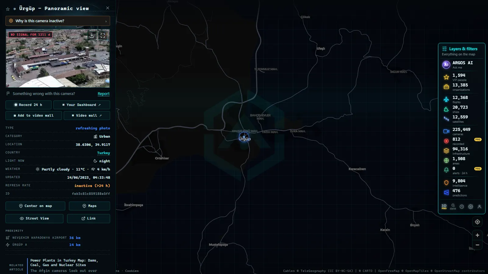
The OSINT layer is the one newcomers underestimate. It holds 1,752 geolocated items from the last 90 days, 1,303 of them video, each pinned where it was verified rather than where it was posted. Over Turkey itself it is thin, which is informative in its own right: the density sits across the borders, in Syria, Iraq and around the Black Sea.
The same layer carries 70 GPS interference zones. The eastern Mediterranean and the Black Sea are among the places where ship and aircraft positions go visibly strange. If a vessel appears to jump across a peninsula near the straits, check the interference zones before calling it spoofing: the likelier explanation is a jammed receiver, not a dark fleet manoeuvre.
Layer by layer on the Turkey live map: what to open and when
| Layer | What it shows over Turkey | When to open it |
|---|---|---|
| Ships (AIS) | Continuous traffic through the Bosphorus and Dardanelles | When you want the single best live view of Turkey |
| Flights (ADS-B) | IST, SAW, ESB plus dozens of regional fields | To check a delay, a diversion or who is airborne over Anatolia |
| Road cameras | A few municipal feeds in Yozgat and Aksaray | To read plateau weather and road conditions, not city traffic |
| Power and dams | Euphrates and Tigris hydro, gas around Marmara | To find out what generates where, with type and operator |
| Ports | Ambarlı, Mersin, İzmit, Samsun | To understand why ships are sitting still at a given point |
| Events (OSINT) | Thin inside Turkey, dense across the southeastern border | To check whether something reported nearby has been geolocated |
Reading the Turkey live map in five minutes
- Open the live map of Turkey and zoom to the Sea of Marmara.
- Switch everything off except ships. The strait draws itself within seconds.
- Add flights and watch the approach into Istanbul, two airports pulling traffic from opposite sides of the same city.
- Add infrastructure, then click a port and a power plant to see what the cards actually carry.
- Add cameras last, and zoom inland to Yozgat and Aksaray rather than to the coast.
What ARGOS sees right now
Nothing here asks for a form. The rail remembers what you left switched on, so a second visit starts where the first one ended.
What you won't see
- No video. Public cameras publish still frames that refresh every few seconds or minutes. There is nothing to rewind and no archive to browse.
- No faces or plates. Road cameras are framed and compressed so that people and number plates are not identifiable, which is the condition under which they get published at all.
- No Istanbul or Ankara street cameras. The Turkish feeds in the catalogue sit in central Anatolia. Nothing points at the Bosphorus bridges.
- Night gaps. Unlit rural cameras return black frames after dusk, and some operators stop refreshing them entirely until morning.
- No dark traffic. Aircraft and vessels with their transponders switched off vanish from the map. Absence of a track is not evidence of absence.
- No rail, pipelines or border crossings. Those layers do not exist for Turkey today, and no amount of zooming will produce them.
- The counts are worldwide. Every figure quoted above is a global total as of October 2026, not a Turkish one, and a catalogued camera can still be offline the moment you click it.
Frequently asked questions
Is the Turkey live map free?
Yes, free and with no registration. The map opens in any browser, every layer toggles from the side rail, and nothing asks for an email address. There is no app to install and no trial that expires. The only limits are the ones the public sources impose, mainly how often each camera or feed refreshes.
Can I watch ships crossing the Bosphorus in real time?
Yes. AIS positions update continuously, so the Bosphorus and the Dardanelles show live vessel traffic with name, type, flag and heading on every click. Worldwide the layer carries 20,645 ships broadcasting at a given moment. Remember that AIS is self-reported: the declared destination is typed by the crew and is not verified.
Are there live traffic cameras in Istanbul?
No. The Turkish cameras in the catalogue are municipal feeds in central Anatolia, mostly Yozgat and Aksaray, so there is nothing covering Istanbul streets or the Bosphorus bridges. For comparison, Spain alone has 11,665 catalogued cameras (count as of October 2026). Turkish coverage depends on which municipalities publish, and most do not.
Does the map show flights landing at Istanbul Airport?
Yes, arrivals and departures at Istanbul Airport, Sabiha Gökçen and Ankara Esenboğa appear on the ADS-B layer with callsign, aircraft type, altitude and speed. Worldwide 12,732 flights are tracked live at a given moment. Aircraft without a transponder signal, including many military ones, never appear, so the layer is a sample rather than a census.
What else does the map hold for Turkey besides ships and planes?
Infrastructure, mainly. Power plants, dams, ports and data centres each have a card with type, operator and capacity where it is published, which covers the Euphrates and Tigris hydro complex and the gas cluster around Marmara. The OSINT layer adds geolocated events from the last 90 days, dense across the southeastern border rather than inside Turkey.
- ARGOS ATLAS vs God's Eye View: No Install, No API Keys
- God's Eye View Alternatives That Run in Your Browser
- How to Install God's Eye View: Requirements, Keys and Steps
- God's Eye View vs World Monitor: Differences and Which to Pick
- ARGOS ATLAS vs World Monitor: Live Cameras, Ships and Events
- World Monitor Alternatives: 7 Live Maps and OSINT Dashboards