Blog · Energy & grids
Power Plants in Turkey Map: Dams, Coal, Gas and Nuclear Sites
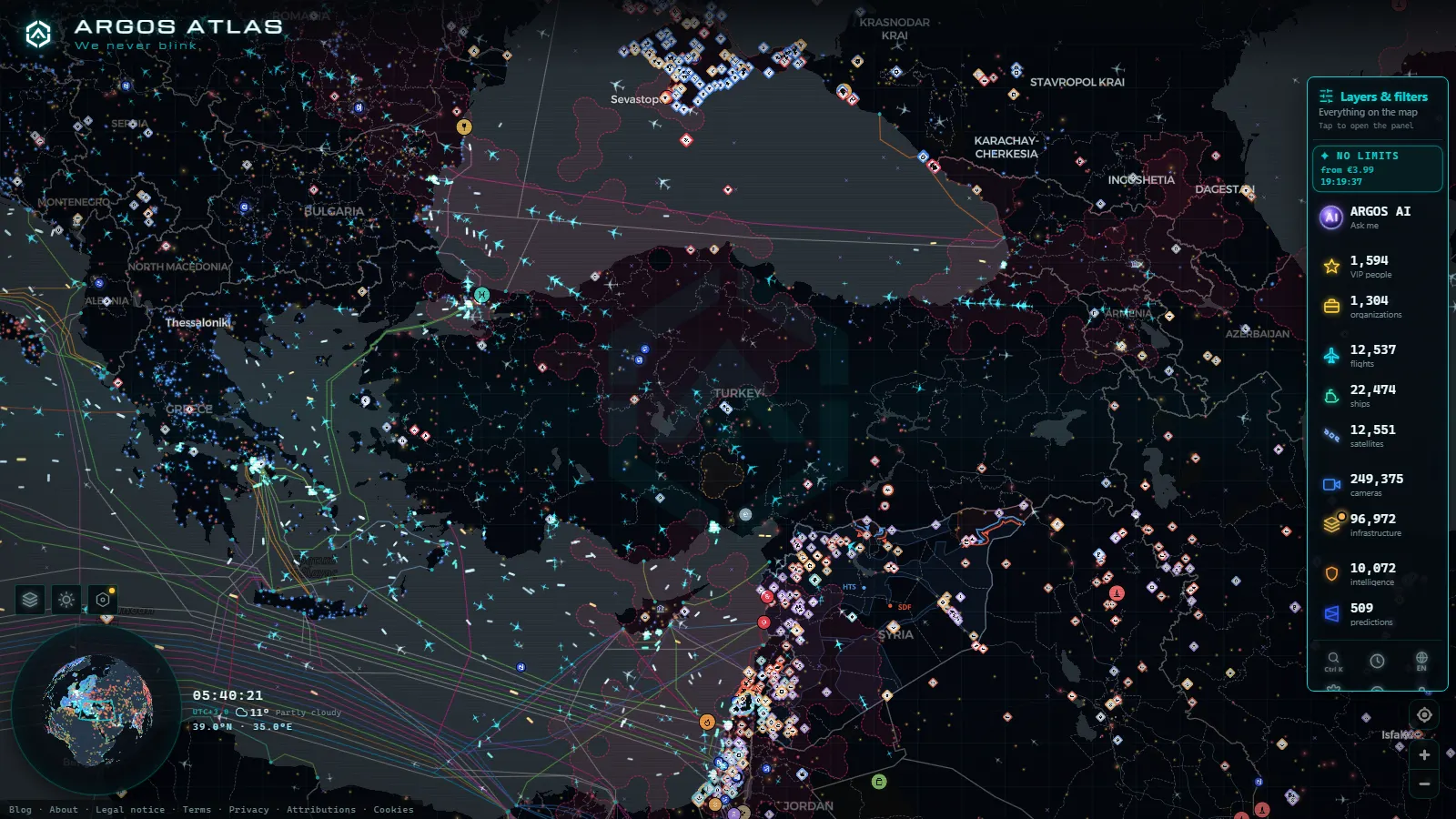
Turkey's electricity sits in four places you can point to on a map: the dam chain on the Euphrates in the southeast, the lignite basin at Afşin-Elbistan in Kahramanmaraş, a ring of gas plants around the Sea of Marmara and Istanbul, and the nuclear station at Akkuyu on the Mediterranean coast. ARGOS ATLAS plots 34,936 power installations worldwide, Turkey's among them, free and without an account.
One caveat before you click. A plant marker is a site card (position, fuel, the capacity the source reports), not a live feed. The live pictures come from road and city cameras, a few of which stand in the same valleys and streets as the plants. The card tells you what is built there; the camera tells you what the light, the weather and the traffic look like right now.
The essentials, in 20 seconds
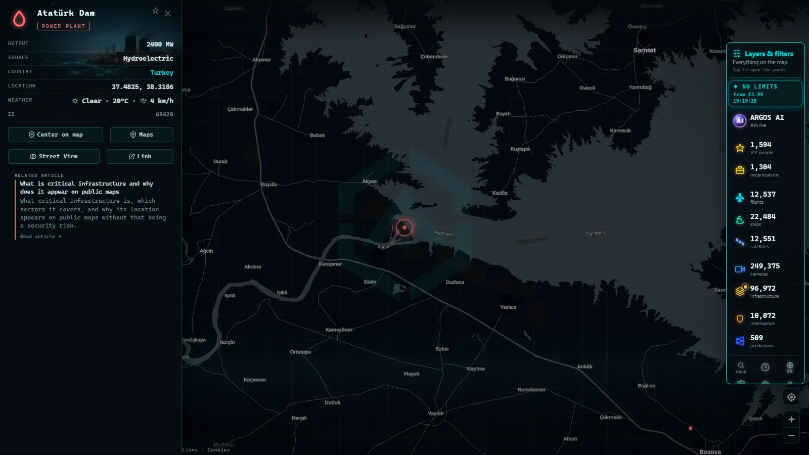
- Atatürk Dam (Şanlıurfa province) heads the Euphrates chain and is the largest hydroelectric plant in the country.
- Afşin-Elbistan, in Kahramanmaraş, is the biggest coal complex: lignite dug next door, thermal units burning it on top of the pit.
- Gas is the Marmara story: Ambarlı in Istanbul, Hamitabat in Kırklareli and Bandırma on the southern shore, fed by pipeline and by LNG.
- Akkuyu, in the Gülnar district of Mersin, is the first Turkish nuclear plant, and its first unit has entered the system.
- The map carries 34,936 power installations and 200,000+ cameras worldwide (count as of September 2026): plant markers are cards, cameras are stills.
What the power plants in Turkey map shows when you open it
The power layer draws installations as points coloured by fuel. Click one and you get the card: name, fuel, the capacity the source reports, coordinates and country. The catalogue is global (34,936 installations), so Turkey sits in the same layer as its neighbours and you read both sides of a border without changing tools. Search by name works: type Atatürk, Karakaya or Akkuyu and the card comes up.
Two other layers earn their place here. Ports (1,081 in the catalogue) matter because coal and LNG arrive by ship, so the Marmara and Mediterranean terminals are part of the power story. The camera layer matters for the opposite reason: it is the only thing on screen that updates by itself. For the worldwide version of the same layer, the live world energy map explains how the points are built.
The Euphrates dams, with Atatürk at the head
The Euphrates (Fırat) is where Turkish hydro concentrates. Atatürk Dam, on the river north of Şanlıurfa, is the flagship of the Southeastern Anatolia Project (GAP): a rockfill wall, a reservoir large enough to read as an inland sea on any satellite basemap, and the largest hydroelectric plant in Turkey. Its card gives fuel hydro plus the capacity the source reports, which is the figure to quote instead of whatever a forum says.
Zoom out one step and the logic of the chain appears: the dams are staircased, so water leaving one powerhouse reaches the next. That is why a dry year in eastern Anatolia shows up in national generation within months, and why the reservoirs get watched as closely as the turbines. What the map will not tell you is how full the lake is today.
Karakaya, Keban and the rest of the southeastern chain
Upstream of Atatürk the same river carries Karakaya Dam, between Diyarbakır and Malatya, and above it Keban, the oldest of the big three. Downstream sit Birecik and Karkamış, lower and flatter, close to the Syrian border. On screen they read as a line of hydro points following the water, the clearest visual argument for how this system was designed: one basin, several steps, one purpose.
The Karakaya card is a good example of what a site card does and does not do. It confirms the plant exists, what it burns (nothing), where exactly it stands and the capacity attributed to it. It says nothing about whether those turbines are spinning tonight. Anyone claiming that a public map shows live output for a Turkish dam is selling something.
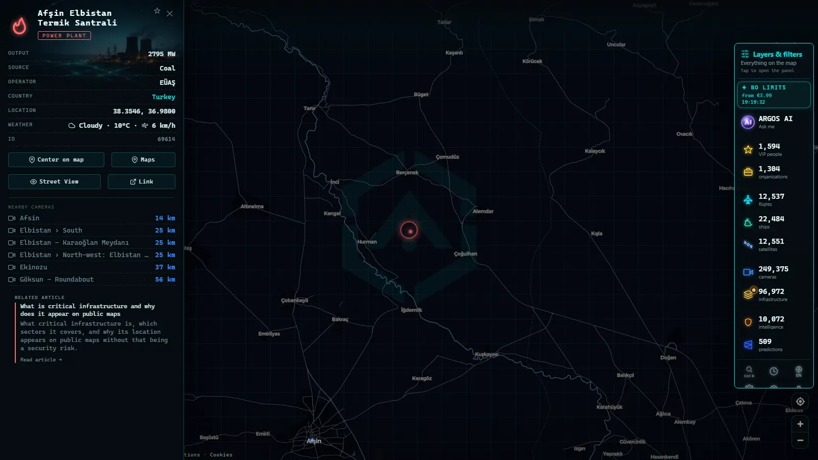
Afşin-Elbistan: the lignite basin in Kahramanmaraş
Afşin-Elbistan is the one place in Turkey where the fuel and the power station share a postcode. The lignite lies in a shallow basin in Kahramanmaraş province and the thermal units stand on top of it, so the coal travels by conveyor instead of by train.
This is also the rare case where a live image adds something. The road cameras around Afşin, Elbistan and the villages of the basin show the plateau the plant sits on: snow in winter, haze in summer, and the weather that decides how the open pit works. The camera at Caglayancerit watches a mountain road on the way in. None of them points at the chimneys, and that is the honest version of what public cameras give you here.
The cited points, side by side
50 km
Gas around Istanbul and the Sea of Marmara
Around Istanbul the fuel changes. Marmara is the gas region: Ambarlı on the European shore of the city, Hamitabat inland in Kırklareli, Bandırma across the water in Balıkesir, and combined-cycle plants along the Gebze and Adapazarı industrial corridor, wired into the demand they sit inside. The gas arrives by pipeline from the east and the north, and as LNG through Marmara Ereğlisi in Tekirdağ, which is why port markers belong on an energy map and not only on a shipping one.
The live images here are city cameras, never plant cameras. They are still worth opening: a gas plant follows the load of the city around it, and the traffic on screen is that load made visible.
Akkuyu: the nuclear plant that just entered the system
Akkuyu sits on the Mediterranean in the Gülnar district of Mersin province, and it is the newest element of the Turkish system: the first nuclear plant in the country, built with Russian VVER reactors, its first unit now connected to the grid and the remaining units at different stages of construction. On the map it looks like what it is, a coastal site with a large intake, far from the industrial west.
Nuclear is the type most often misread on a public map. The marker gives you the site and the declared capacity of the reactor. It does not say whether a unit is at power, refuelling or tripped, and no open camera in the area frames the buildings. For the reporting chain these sites answer to, how nuclear plants are supervised worldwide is the background piece.
Wind on the Aegean, solar in Konya
The rest of the mix shows up on the coast and on the plateau. Wind clusters on the Aegean around Çeşme, Balıkesir and the İzmir hinterland, where the summer meltem blows daily and the turbine rows follow the ridgelines. Solar concentrates inland, above all at Karapınar in Konya province: flat steppe, high irradiation, cheap land.
These are the sites where the marker says most and the picture says least. They are unmanned, they look identical in every frame, and nothing about them changes visibly from hour to hour. If what you want to understand is what happens to a grid when the wind drops and a large unit goes offline, why blackouts happen and how the grid is watched is the piece to read next.
Live camera or site card on the power plants in Turkey map
Two things look alike on screen and behave nothing alike. Here is how to tell them apart before drawing a conclusion from either.
| What you click | Where it is | What you get | What to do with it |
|---|---|---|---|
| Atatürk Dam marker | Euphrates, Şanlıurfa | Site card: hydro, reported capacity, coordinates | Quote the capacity, then check operator bulletins for output |
| Afşin Elbistan marker | Kahramanmaraş basin | Site card: coal, reported capacity | Place the lignite basin before reading any news about it |
| Afsin camera | Afşin, Kahramanmaraş | Still frame that refreshes | See the weather and the light on the plateau right now |
| Istanbul cameras | Esenkent, Cihangir | Still frame that refreshes | Read the city's load, the demand the gas plants follow |
| Istanbul port | Marmara shore | Port card with the traffic around it | Follow the LNG and the coal feeding the Marmara plants |
What you won't see
- No live video: Turkish public cameras deliver still frames that refresh, not a stream, and no card plays footage.
- No camera aimed at a power plant. The images near Afşin-Elbistan or Akkuyu are road and city cameras: none frames a turbine hall, a chimney or a reactor building.
- No real-time output. Neither generation in MW nor the state of a unit (running, refuelling, tripped) exists in any open layer.
- No reservoir levels for the Euphrates dams, and no water release schedule.
- Nothing after dark in much of the network: many cameras have no illumination, so the frame goes black or grainy at dusk and returns at dawn.
- No people and no plates. The framing and the resolution are built for traffic, so identifying anyone from these frames is not possible.
- Uneven coverage. Cameras are dense in Istanbul and along the main roads, thin in the east: a plant with no camera nearby simply has no picture.
Three ways to use the power plants in Turkey map tonight
Start at a site, not at the country. Search Atatürk Dam, follow the line of hydro points down the river, and the southeast fits in one screen. Then jump to Afşin-Elbistan and switch the camera layer on to see the plateau the lignite comes from. Finish in the Sea of Marmara, where gas plants, ports and city cameras overlap inside the same few kilometres, which is as close as an open map gets to showing a power system at work.
All of it is one click away on the live map of power plants and cameras, free and without registration, and the layer behaves the same way in every country: for a comparable read with the same method, see the power plants of Russia on the map.
Frequently asked questions
Is the power plants in Turkey map free, live and without registration?
Yes, free and with no account. The plant markers load instantly and the camera layer refreshes on its own. What is live are the camera frames, not the plants: a marker for Atatürk Dam or Akkuyu is a site card with position, fuel and reported capacity, and nothing on it changes minute to minute.
Which is the largest power plant in Turkey?
Atatürk Dam, on the Euphrates north of Şanlıurfa, is the largest hydroelectric plant in the country and the centrepiece of the Southeastern Anatolia Project. Afşin-Elbistan, in Kahramanmaraş, is the largest coal complex, and Akkuyu in Mersin province will be the largest single site once all of its reactor units are running.
Can I watch the Akkuyu nuclear plant live?
No. No public camera frames the Akkuyu site, and the map gives you the site card only: its position on the Mediterranean coast in the Gülnar district of Mersin, the reactor type and the declared capacity. Power level, refuelling windows and unit status come from the operator and the regulator, never from an open layer.
Where are Turkey's gas power plants?
Mostly around the Sea of Marmara. Ambarlı sits on the European side of Istanbul, Hamitabat inland in Kırklareli, Bandırma across the water in Balıkesir, and combined-cycle plants line the Gebze and Adapazarı corridor. They burn imported gas that arrives by pipeline and as LNG through the Marmara Ereğlisi terminal in Tekirdağ.
Do the cameras near the plants show the plants themselves?
No, they show roads and streets. The camera at Afşin looks at the town on the lignite plateau, not at the thermal units, and the Istanbul cameras watch traffic. They are still worth opening: they give you the weather, the light and the traffic in the same valley or city as the plant.
- Poland Power Plants Live Map: 4 EC Plants That Heat Cities
- World map of dams and reservoirs: 5,356 points you can open
- South America Power Plants: Country by Country on the Map
- Norway power plants on the map: hydro, dams and live views
- Why Blackouts Happen and How Power Grids Are Monitored 24/7
- Nuclear power plants around the world: where they are and how they are monitored