Blog · Ships & AIS
Live Ships in the Strait of Malacca, the World's Busiest Shipping Lane
The world's most congested corridor
There is a place on the map where an ocean narrows to just 65 kilometres wide. In that bottleneck (between the Malay Peninsula to the north and the island of Sumatra to the south) flows one of the densest streams of marine traffic on Earth. The Strait of Malacca is not merely a waterway; it is the corridor where much of the global economy physically passes through.
More than 80,000 vessels a year thread these waters. Crude oil tankers loaded in the Persian Gulf bound for South Korean and Japanese refineries. Container ships carrying electronics from Chinese factories toward Europe. Bulk carriers heavy with coal and iron ore. Enormous liquefied natural gas vessels supplying power stations across East Asia. If this passage were closed for a single day, financial markets would register the shock within hours.
ARGOS ATLAS lets you watch that flow in real time. The ship layer on the map displays AIS positions of vessels worldwide, and in the Strait of Malacca the density of icons is so high that the water beneath them almost disappears.
---
What AIS is and why anyone can watch it from home
The Automatic Identification System (AIS) is a transponder that every commercial vessel over 300 gross tonnes is required to carry. Every few seconds, the ship broadcasts its GPS position, heading, speed, cargo type, destination port, and vessel name. Shore stations and satellites pick up these signals and aggregate them into databases that power tracking platforms like ARGOS ATLAS.
The result is a near-complete picture of global maritime traffic. "Near-complete" because some vessels do switch their transponder off (which is itself a red flag for intelligence analysts) but the vast bulk of the commercial fleet sails with AIS on and visible to anyone with an internet connection.
In the Strait of Malacca, terrestrial AIS coverage is excellent thanks to the dense network of shore stations in Singapore, Malaysia, and Indonesia. Ships riding at anchor off the port of Singapore (sometimes dozens of them waiting for a berth) show up as a constellation of stationary dots on the roadstead, motionless for hours or days at a time.
---
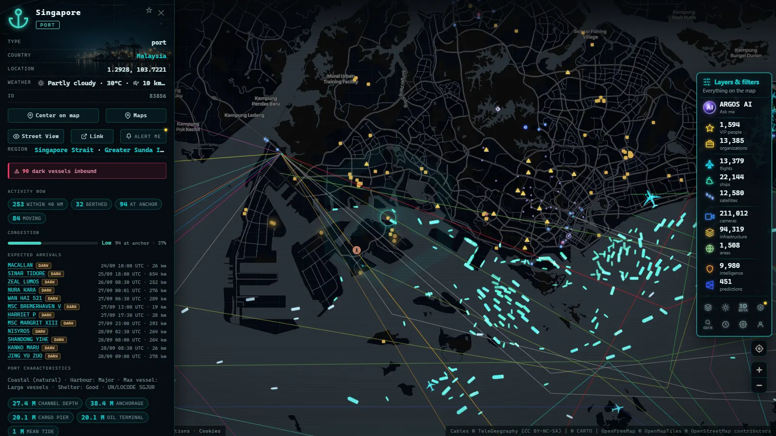
Singapore: the anchor at the southern end
Singapore is not merely the largest port in Southeast Asia; it is the world's second-busiest port by cargo throughput. Its position at the southern tip of the strait makes it the natural transshipment hub for everything entering or leaving the region.
When you open ARGOS ATLAS and zoom toward the strait, the first thing that catches the eye near Singapore is the mass of vessels at anchor in the outer roads. Tankers over 300 metres long waiting to discharge crude at the Jurong Island refineries. Container ships anchored while operators negotiate berth space. Bunker vessels (small fuel-supply ships) weaving between the larger ones selling marine diesel.
Managing this traffic is a feat of logistical engineering. The Maritime and Port Authority of Singapore (MPA) coordinates movements through a vessel traffic service similar to air traffic control. Every hour, dozens of ships enter or leave following segregated routes to prevent collisions in one of the narrowest chokepoints in the world.
The traffic separation scheme
The strait operates under a Traffic Separation Scheme (TSS) established by the International Maritime Organization. Vessels heading northeast (from the Indian Ocean toward the Pacific) use the northern lane. Those heading in the opposite direction use the southern lane. On ARGOS ATLAS you can detect this pattern by watching the direction of ship icons: one stream of arrows pointing northeast, another pointing southwest, moving in parallel like cars on a two-lane highway.
---
From the ARGOS ATLAS channel.
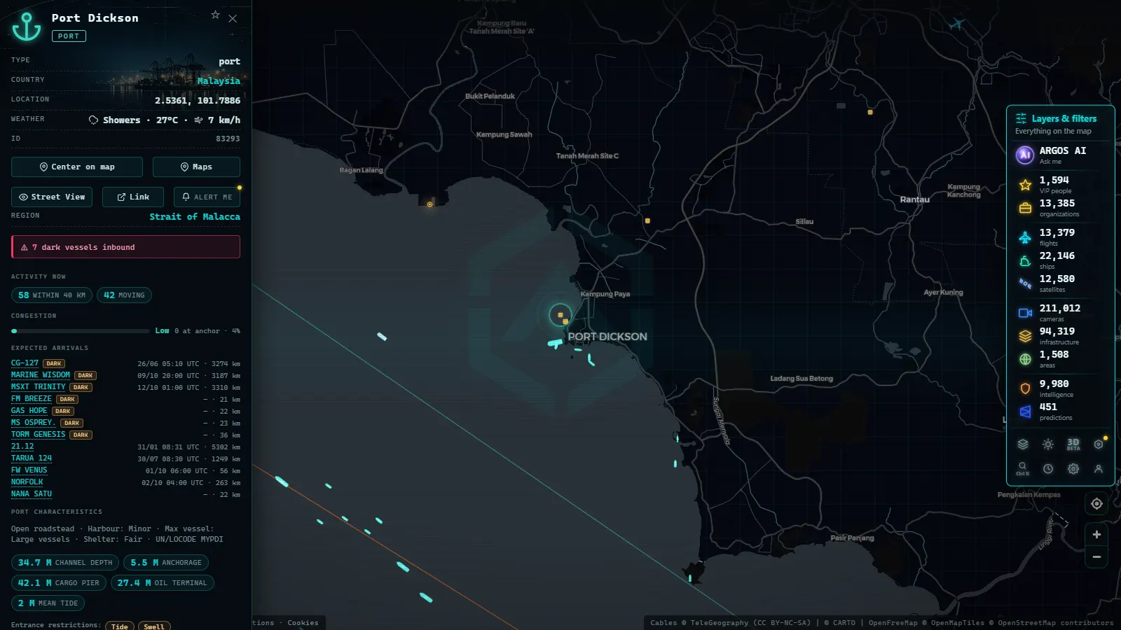
Port Klang: the port that supplies Malaysia
About 40 kilometres northwest of Kuala Lumpur, at the mouth of the Klang River, lies Port Klang, officially Pelabuhan Klang. It is Malaysia's largest port and one of the twenty busiest in the world, specialising in container traffic and manufactured goods.
Much of the electronics, automobiles, and industrial components that Malaysia exports pass through here before reaching markets in Europe, the Middle East, and Africa. Container ships loading at Port Klang appear on the ARGOS ATLAS map moving south through the strait before turning east toward Singapore or west toward the Indian Ocean.
Port Klang handles more than 13 million TEU (twenty-foot equivalent units) per year. A single TEU is a standard 20-foot shipping container. To put that in perspective: the port processes the equivalent of 13 million of those containers every twelve months.
The anchorage area off Port Klang also regularly shows up on the map crowded with bulk carriers waiting their turn to load palm oil (one of Malaysia's chief export commodities) destined for food processing plants from Rotterdam to Mumbai.
---
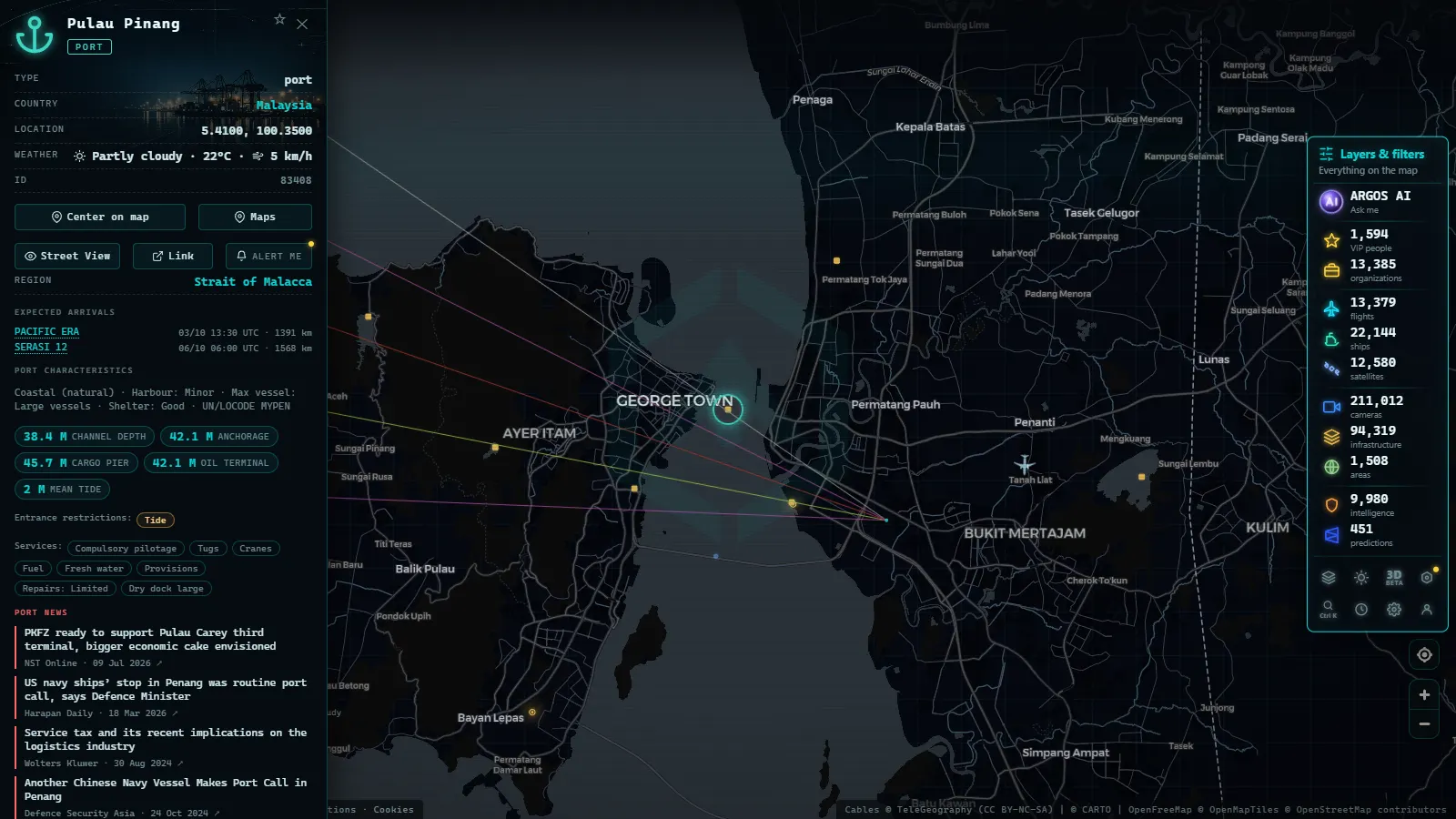
From the Indian Ocean to the South China Sea
The Strait of Malacca is the hinge between two oceans. To the west, the Indian Ocean connects to the Bay of Bengal, the Arabian Sea, and (via the Strait of Hormuz) to the Persian Gulf, where roughly 30% of the world's seaborne crude oil originates. To the east, the South China Sea opens to the Pacific and the great industrial ports of China, South Korea, Japan, and Taiwan.
This geopolitical position gives the strait a strategic value that is difficult to overstate. It is precisely why China has spent years developing what analysts call the "String of Pearls" (a network of ports and logistics infrastructure at Gwadar in Pakistan, Hambantota in Sri Lanka, and Kyaukphyu in Myanmar) designed to reduce dependence on the Malaccan bottleneck in the event of a confrontation.
On ARGOS ATLAS, if you zoom out to take in the full stretch from the Bay of Bengal to the South China Sea, you can watch vessels converging on the strait from every direction, like water draining toward a single outlet.
---
Cargoes that move the world
The variety of ship types transiting the strait mirrors the diversity of the global economy. Among the most common:
Crude oil and refined products
Very Large Crude Carriers (VLCCs) up to 330,000 deadweight tonnes transport Persian Gulf crude toward refineries in China, Japan, and South Korea. They are the largest vessels visible on the map. Their speed (typically 12 to 15 knots) makes them easy to identify in the AIS data stream.
Container ships
Mega-vessels operated by Maersk, MSC, CMA CGM, and their rivals carry Asian manufactured goods toward Europe across the Indian Ocean or toward North America's west coast across the Pacific. Some of the largest ships ever built (with capacity for 24,000 TEU) can be spotted on the map when they pass through the strait.
Liquefied natural gas (LNG)
Indonesia, Malaysia, and Australia are major gas exporters. LNG carriers (recognisable by their spherical or membrane tanks) supply combined-cycle power stations in Japan, China, and South Korea. In ARGOS ATLAS, vessels are identified by type, which makes it straightforward to distinguish LNG ships from conventional tankers.
---
How to track Malacca traffic on ARGOS ATLAS
To explore the Strait of Malacca on ARGOS ATLAS, follow these steps:
- Open the map and enable the Ships layer from the layer menu.
- Navigate toward Southeast Asia, roughly to coordinates 2° N, 104° E.
- Zoom in until you can see the corridor between Sumatra and the Malay Peninsula.
- Click any vessel to see its name, type, flag, speed, heading, and destination port.
- To explore the Singapore anchorage, look for the roadstead south of the island, between the Singapore Strait and the Malacca Strait proper.
The visual effect is striking: watching dozens of vessels move in parallel lanes through a passage less than 65 kilometres wide makes tangible what usually remains an abstraction (global commerce) in economic headlines.
---
A window into the nervous system of world trade
The Strait of Malacca rarely makes news when everything is working. It makes news when something interrupts it: a collision, a geopolitical flare-up, a cyclone in the Indian Ocean rerouting traffic. In those moments, live maritime tracking maps become analytical tools for journalists, supply-chain specialists, marine insurers, and governments trying to understand the knock-on effects.
But even on ordinary days, watching the unbroken flow of vessels through the strait is an applied lesson in economics. Each dot on the map represents a business decision, a freight contract, a supply chain linking a factory in Guangdong to a supermarket in Rotterdam or a gas terminal in Tokyo.
ARGOS ATLAS makes that perspective available to anyone. No analyst credentials are required, no premium data subscription. The map is open, the ships move in real time, and the strait (the world's most consequential 65-kilometre gap of water) is visible to any curious person who wants to understand how the modern world actually functions.
Frequently asked questions
How many ships pass through the Strait of Malacca every day?
More than 80,000 vessels transit the Strait of Malacca annually (roughly 220 ships per day) including tankers, container ships, bulk carriers, and LNG vessels.
Why is the Strait of Malacca so important to world trade?
It connects the Indian Ocean to the South China Sea and Pacific, channeling roughly 40% of global seaborne trade and over 25% of all oil transported by sea each year.
How can I watch ships in the Strait of Malacca in real time?
ARGOS ATLAS displays live AIS positions of thousands of vessels worldwide, including those transiting the Strait of Malacca and anchored off Singapore or Port Klang.
- Live Ships in the North Atlantic: Europe to North America Trade Routes
- Port of Santos Live: Sugar Terminals & Congestion Tracker
- IMO Ship Tracking: Look Up Any Vessel Live, Free
- South America Ports List: The Major Ports, Country by Country
- Ceuta Live Camera: 7 Feeds & Real-Time Ship Traffic
- Strait of Gibraltar crossing operation 2026: watch it live