Blog · Live flights
Live Flight and Ship Tracker: Planes and Ships on One Map
A comparison by the ARGOS ATLAS team. Facts about the alternatives were checked on October 9, 2026 against their own sites, repositories and app stores. All comparisons →
For a live flight and ship tracker with both on one map, the best choice is ARGOS ATLAS: around 15,000 flights and 21,800 ships at a time, with port and airport cameras, sanctioned vessels and conflict around them. Flightradar24 and FlightAware stop at aircraft, and MarineTraffic and VesselFinder at ships.
| Tool | Planes and ships | Cameras and conflict |
|---|---|---|
| ARGOS ATLAS | About 15,000 and 21,800 | On the same map |
| LocalizaTodo | Both at once | Not listed |
| Flightradar24 | Aircraft only | Not listed |
| FlightAware | Aircraft only | Not listed |
| MarineTraffic | Ships only | Not listed |
| VesselFinder | Ships only | Not listed |
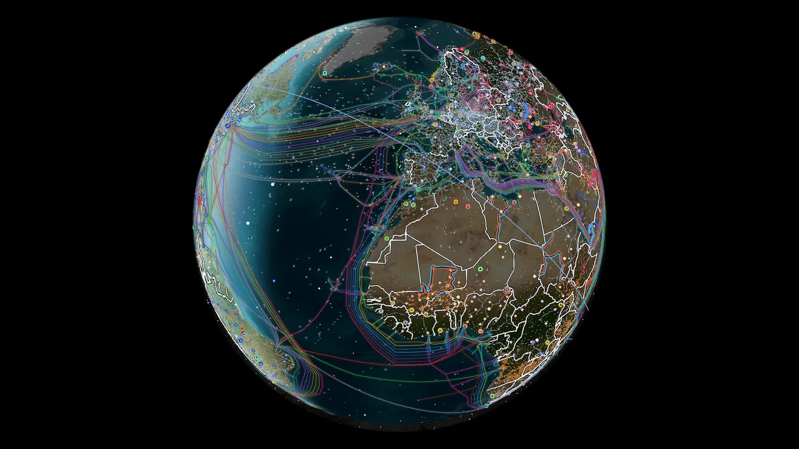
Live layers
ADS-B and AIS: why almost nobody combines them
Aircraft broadcast their position over ADS-B and ships over AIS: two different radio systems, picked up by ground antennas and satellites. Each needs its own network of receivers, which is why most maps stick to one. ARGOS ATLAS puts both in the same tab. More detail in our guides to tracking planes in real time and to what AIS is.
ARGOS ATLAS: planes and ships in real time, with context
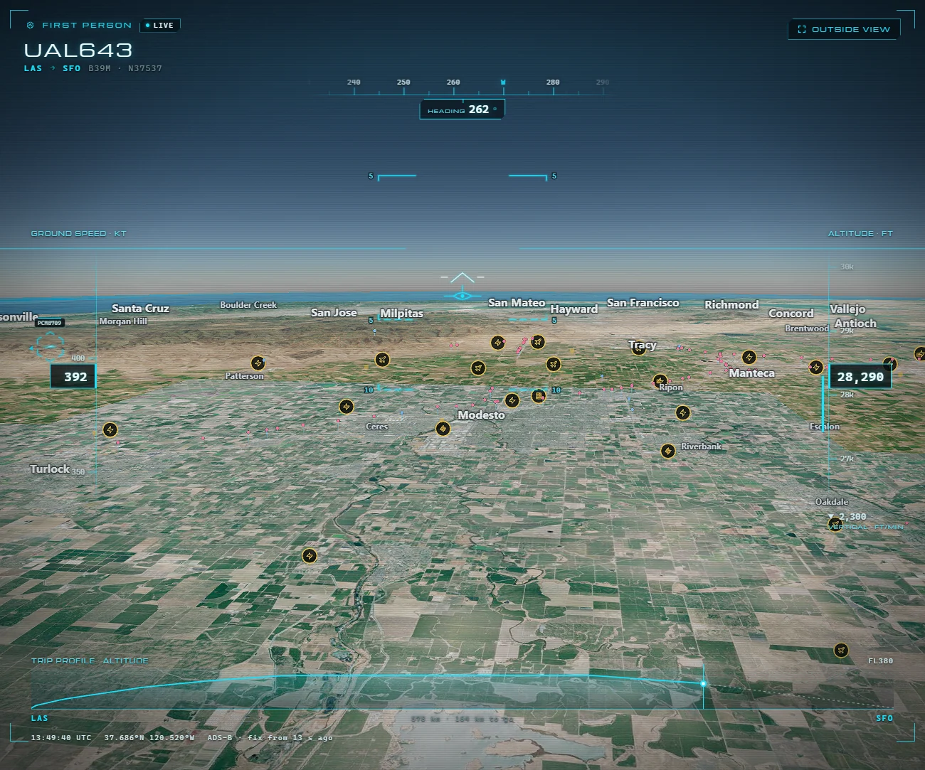
ARGOS ATLAS follows around 15,000 civil and military aircraft and 21,800 ships at a time (count from 9 October), with 1,559 ships and 342 aircraft flagged for appearing on sanctions lists. Around them sits what explains the movement: more than 200,000 public cameras, including ports and airports, 1,078 ports, 47,927 airports and airfields, live control-tower audio at many of them and the conflict layer, with 70 GPS-jamming zones. On DISTRICT you can watch any flight in first person and replay 7 days of flights and ships; DIVISION goes back 90.
The others, in one line
- LocalizaTodo: also combines aircraft and ships; its layers list no cameras and no conflict.
- Flightradar24 and FlightAware: aircraft only.
- MarineTraffic: ships only, and open-ocean positions, via satellite, are paid.
- VesselFinder: ships only; satellite positions start on its US$139-a-month plan.
How to watch them on ARGOS ATLAS
- Open the map: the flight and ship layers are already on.
- Zoom in on a port, a strait or an airport you know.
- Tap an aircraft or a ship to open its card; sanctioned ones are flagged.
- Tap a port or airport camera to see its latest image, with the time it was captured.
Open the live map and find your nearest port; first-person view and history come with the ARGOS PRO plans. If flights are all you need, browse the Flightradar24 alternatives.
Frequently asked questions
Can I see live planes and ships on the same map?
Yes. ARGOS ATLAS shows around 15,000 flights and 21,800 ships at once (9 October 2026), with port and airport cameras, sanctions and conflict on the same map. LocalizaTodo also combines both kinds of traffic, though its layers list no cameras or conflict; Flightradar24 and FlightAware cover aircraft, and MarineTraffic and VesselFinder cover ships.
What is the difference between ADS-B and AIS?
They're the same idea in two worlds. With ADS-B, aircraft broadcast their identity, position and altitude; with AIS, ships broadcast their name, position, course and speed over radio. ARGOS ATLAS brings both signals onto the same map, with cameras and conflict around them.
Does ARGOS ATLAS flag sanctioned ships and aircraft?
Yes: it flags 1,559 ships and 342 aircraft that appear on sanctions lists, on the same map as the rest of the traffic, the ports and the conflict layer. Tap any of them to open its card, and on ARGOS PRO you can replay where it has been over the last few days.
Can I track planes and ships live on my phone?
Yes. ARGOS ATLAS works in any mobile browser, with nothing to install, and puts flights, ships and cameras on the same map: zoom in on a port or an airport and tap any aircraft or ship to open its card.
- What is ADS-B: the technology that makes flight tracking possible
- Why Some Aircraft Don't Appear on Online Flight Trackers
- Military Aircraft in Real Time: What You Can See in Open Sources, and What You Cannot
- Registration, Callsign, ICAO Hex: How to Identify Any Aircraft Flying Over You
- The World's Busiest Air Routes (and Why Planes Don't Fly in Straight Lines)
- Track Flights in Real Time Over Mexico: A Complete Airspace Guide