Blog · Traffic cameras
Traffic Cameras in Uruguay and Montevideo: A Complete Guide
How Uruguay Monitors Its Roads: A Two-Tier Camera System
Uruguay does not have the sprawling megacities of its larger neighbors, but it does have a road network that funnels nearly half its population through the department of Montevideo and channels enormous tourist traffic toward the Atlantic coast during summer months. To manage that flow, the Uruguayan state operates two overlapping camera systems: one run by the Ministry of Transport and Public Works (MTOP) covering national highways, and one managed by the Intendencia de Montevideo (IM) within the metropolitan area.
Understanding how each system works, what stretches it covers, and how that information can be accessed is the purpose of this guide. At the end, you will find how ARGOS ATLAS integrates these sources to give you a unified view of Uruguayan traffic conditions.
MTOP and National Highway Surveillance
The Ministry of Transport and Public Works is the governing body for road infrastructure outside urban perimeters. Through its National Directorate of Roads, MTOP manages cameras at strategic points across the national highway network: city access roads, conflict-prone intersections, high-accident segments, and concession toll plazas.
MTOP cameras serve a dual function. On one hand, they feed speed control and infringement detection systems. On the other, they serve as an operational monitoring tool for coordinating road closures, detours during construction works, and emergency response, particularly during the severe summer storms that periodically batter the Atlantic coastline.
"Real-time information about road conditions is as valuable to the driver planning their journey as it is to the engineer coordinating incident response.", Core principle of Intelligent Transportation Systems (ITS) programs adopted across the region.
MTOP has progressively expanded its monitoring infrastructure under the terms of highway concession contracts. Companies that operate toll plazas on routes such as Ruta 1 (toward Colonia del Sacramento), Ruta 5 (toward Rivera), and Ruta 8 are contractually required to install and maintain cameras on their concession segments, with the resulting data subject to ministerial oversight.
The Intendencia de Montevideo: The City Under Watch
Within the department of Montevideo, the Intendencia operates its own camera network, integrated into the municipal traffic management system. This system covers the capital's main arteries: Avenida 18 de Julio, Bulevar Artigas, Avenida Italia, the port access roads, and, particularly relevant for both residents and visitors, the Rambla de Montevideo.
#### The Rambla Sur: 22 Kilometers of Coastline Under Monitoring
The Rambla Sur is one of Montevideo's most iconic thoroughfares. Stretching from the Barrio Sur neighborhood to Buceo, it hugs the bay and the Rio de la Plata estuary, connecting the historic center with the eastern coastal neighborhoods. For thousands of Montevideans it is the backbone of daily life: morning walks, cyclists, runners, and the steady flow of vehicles connecting the city from west to east.
The Intendencia has installed cameras along this corridor to monitor traffic density, detect vehicles illegally stopped on the carriageway, and accelerate incident response. On summer weekends, when the Rambla becomes the preferred access route toward Carrasco and the eastern coastal strip, monitoring intensity increases significantly.
Images captured at these points are not always immediately available to the public, but the Intendencia has advanced open data initiatives that allow developers and citizens to access aggregated information about traffic conditions on the network.
The Ruta Interbalnearia: Uruguay's Most Pressured Seasonal Corridor
If there is one road in Uruguay that concentrates the heaviest seasonal traffic load, it is the Ruta Interbalnearia. This term covers the segments of Ruta 10 and Ruta 8 connections that link Montevideo with the main resort towns in the department of Canelones and continue through to Punta del Este in Maldonado.
Between December and March, the Interbalnearia carries hundreds of thousands of people traveling to the beaches of La Paloma, Piriapolis, Jose Ignacio, and Punta del Este itself. Long weekends generate tailbacks stretching tens of kilometers, particularly at the Punta del Este access roads and at the bridge crossing over the Rio Solis.
#### Camera Coverage on the Interbalnearia
MTOP and concession operators have deployed cameras at several critical points along this corridor. The most relevant monitoring nodes include:
- Montevideo eastern access (near Carrasco and Carrasco International Airport)
- Junction with Ruta 9 (connecting to Atlantida and the Canelones coast)
- Bridge over the Rio Solis Grande (Canelones-Maldonado departmental border)
- Punta del Este access roads (La Barra roundabout and peninsula entry)
These points are monitored continuously during the high season and intermittently throughout the rest of the year, with reinforced activation during Semana de Turismo (Easter week) and national public holidays.
Beyond Montevideo: Cameras in the Interior
Uruguay is a small country but not uniform in its road connectivity. Cities such as Salto, Paysandu, Rivera, and Colonia del Sacramento have access corridor cameras managed by departmental intendencias or by MTOP directly. Coverage is less dense than in Montevideo, but it has grown alongside road safety programs backed by the Inter-American Development Bank (IDB) and other multilateral organizations that have financed infrastructure modernization across Uruguay.
Data Integration: The Core Technical Challenge
One of the most significant challenges facing Uruguay's road surveillance system is the lack of integration between its various operators. MTOP cameras, Intendencia de Montevideo cameras, and private concession cameras run on different platforms, with different technical standards and varying degrees of public accessibility.
This fragmentation makes it difficult for a driver to check the state of their entire route, for example from Punta Carretas to the Maldonado bus terminal, in a single interface. Third-party solutions, including civic monitoring maps, try to fill that gap by aggregating disparate sources into a unified experience.
ARGOS ATLAS: Uruguay's Cameras on an Interactive Map
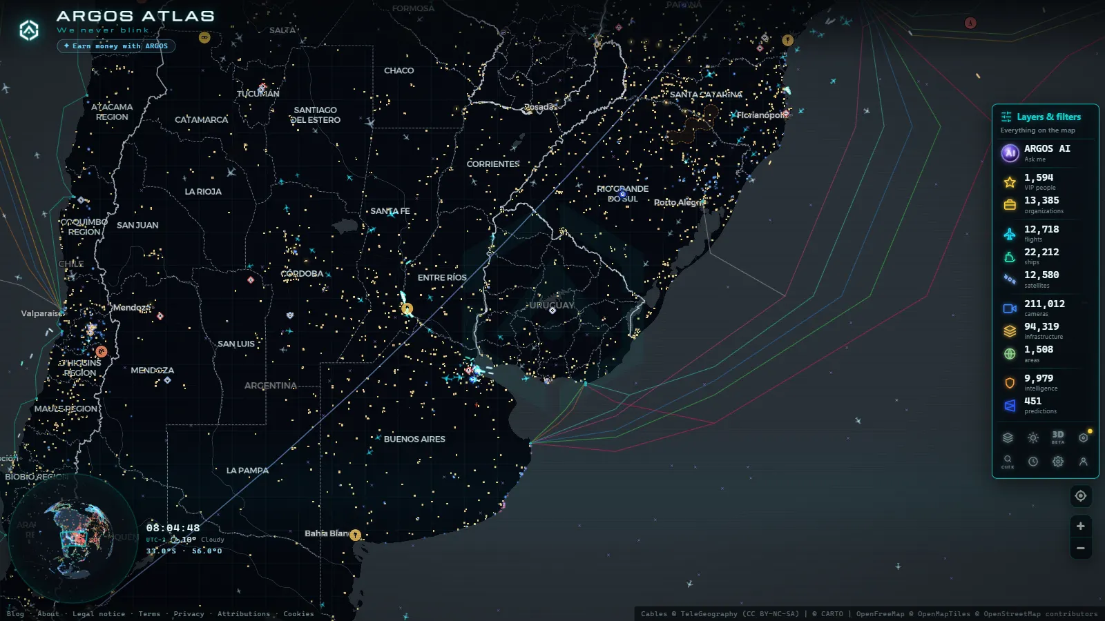
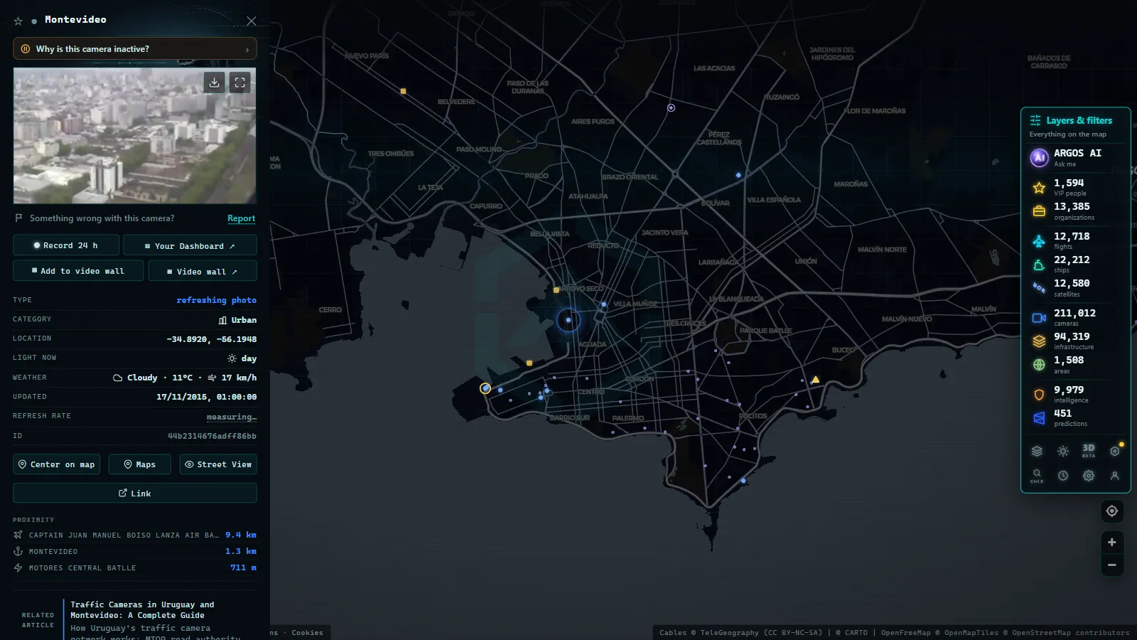
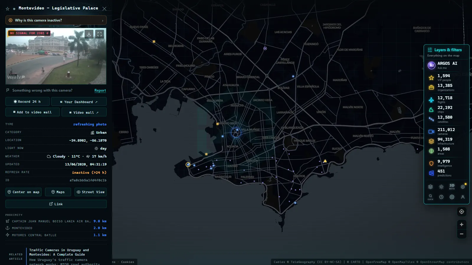
ARGOS ATLAS brings together traffic cameras from multiple cities and countries, including points across Uruguay, onto a single interactive map. From the interface you can navigate the map, zoom into Montevideo or the Atlantic coast, and see which cameras are available at any given moment, without needing to search source by source.
The platform also shows real-time flights over Uruguayan airspace, ships on the Rio de la Plata and off the coast, and the country's energy infrastructure. It is a useful tool for planning a journey, conducting journalistic monitoring, or performing mobility analysis.
You can explore Montevideo, the Rambla, and the Interbalnearia cameras directly on the map view. For a broader regional perspective, see our articles on traffic cameras in Buenos Aires and traffic cameras in Santiago de Chile.
What Visitors to Uruguay Should Know
For international travelers arriving at Carrasco International Airport and heading east along the Interbalnearia toward Punta del Este, the journey typically takes between 90 minutes and three hours depending on the season and day of the week. During peak summer weekends, Friday and Sunday afternoons are the worst times. The camera network gives local authorities visibility into where the congestion is building, but this information does not yet flow seamlessly to international navigation apps.
The most practical approach for visitors remains a combination of local radio traffic updates, Waze community reports from Uruguayan users, and monitoring tools like ARGOS ATLAS that pull from official camera sources and show real-time conditions along the route.
Trends: Toward a More Integrated System
Uruguay has taken concrete steps toward integrating its traffic systems. The Montevideo Mobility Management Center project, driven by the Intendencia with international cooperation support, aims to centralize urban traffic control, smart traffic signals, and cameras into a single control room. If that project matures, public accessibility to data could improve substantially.
At the national level, MTOP has expressed interest in advancing toward open traffic data standards, following the example of countries like Brazil and Colombia where portions of road camera data are accessible through public APIs.
In the meantime, for any driver wanting to know whether the Interbalnearia is backed up before leaving on a summer Friday, the best option remains a combination of traffic radio, social media groups, and mapping tools like ARGOS ATLAS that aggregate real-time information from multiple sources into a single, readable view.
Conclusion
Uruguay's traffic camera system is functional but still fragmented. MTOP covers national highways, the Intendencia de Montevideo manages the urban network, and concession operators run their own systems on contracted segments. The Rambla Sur and the Ruta Interbalnearia are the two corridors with the highest monitoring density in the country. Making that data accessible to citizens through integrated platforms is the next major step for Uruguayan mobility infrastructure.
From the ARGOS ATLAS channel.
Frequently asked questions
Where can I see Montevideo traffic cameras in real time?
Cameras operated by the Intendencia de Montevideo and MTOP are available through public portals and monitoring platforms like ARGOS ATLAS, which consolidates multiple sources into a single interactive view.
Which sections of the Ruta Interbalnearia have traffic cameras?
The Interbalnearia corridor (Ruta 10 and sections of Ruta 8) has monitoring points between Montevideo and Punta del Este, especially at resort town access roads and MTOP-managed toll plazas.
Are the cameras on Montevideo's Rambla Sur publicly accessible?
The Intendencia de Montevideo has cameras along the Rambla and main avenues. Some of that feed is accessible through open data portals and civic monitoring tools like ARGOS ATLAS.
- Traffic Cameras in Costa Rica: COSEVI, Route 27 and the Country's Most Monitored Roads
- Live Traffic Cameras in Medellin: Metro, Mountain Autopistas and Aerial Cable Cars
- Live Traffic Cameras in France: Bison Futé, SANEF, APRR and the Major Motorways
- Live Traffic Cameras in Germany: BASt, Autobahn Monitoring and State Portals
- Live Traffic Cameras in Italy: Autostrade A1 Autosole, ANAS Roads and Alpine Passes
- Live Traffic Cameras in Canada: Ontario 511, DriveBC, and Quebec 511