Blog · Traffic cameras
Live Traffic Cameras in France: Bison Futé, SANEF, APRR and the Major Motorways
The essentials, in 20 seconds
- Bison Futé: France's national traffic information brand since 1976, aggregating real-time camera and sensor data into maps and four-day forecasts.
- DIRIF: hundreds of cameras across the Paris region's ring roads and entry corridors, among the most granular public feeds in France.
- SANEF: manages the A1 Paris-Lille, France's busiest motorway (100,000+ vehicles a day), with near-continuous camera coverage.
- APRR: operates more than 2,300 km of motorway, including the A6 Autoroute du Soleil from Paris to Lyon.
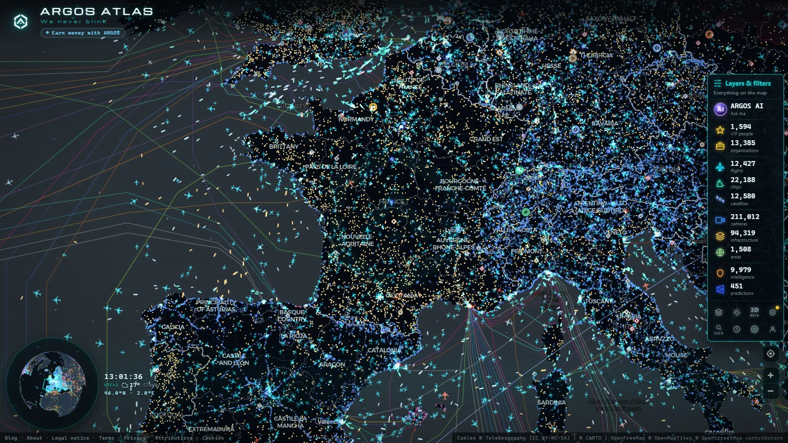
- ARGOS ATLAS: maps French traffic cameras alongside flight and vessel tracking on one interactive layer.
France's Traffic Camera Network: One of Europe's Most Comprehensive Systems
France operates one of the densest road monitoring networks on the European continent. Tens of thousands of kilometres of motorways and national roads are covered by fixed cameras, incident-detection systems, and variable message signs. This infrastructure serves primarily an informational purpose: helping drivers anticipate congestion, enabling rapid response to accidents, and coordinating traffic management across a network that handles some of the heaviest cross-border flows in Europe.
Understanding who runs the system, how it is structured, and which motorways have the best coverage is essential for anyone who needs to make practical use of the open data these systems generate.
Bison Futé: The National Traffic Information Brand
The name is unmistakable. Bison Futé (the "cunning bison") has been France's public-facing traffic information brand since 1976, born out of a campaign to ease summer holiday congestion. What started as a seasonal communication initiative has grown into an integrated platform combining:
- Real-time traffic maps fed by cameras and in-road sensors.
- Forecasts up to four days ahead, colour-coded green through orange, red, and black.
- Information on roadworks, heavy-vehicle restrictions, and weather-related closures.
- Special operations bulletins for the mass summer and winter holiday exoduses.
The system is coordinated through the Centres Régionaux d'Information et de Coordination Routière (CRICR), regional hubs that aggregate data from motorway concessionaires, state road directorates, and weather services, then feed the national Bison Futé platform.
Bison Futé does not manage cameras on concessioned motorways directly. Its role is to aggregate and broadcast the information produced by private operators and the Inter-regional Road Directorates.
The DIRs: State Management of Non-Concessioned Roads
The Directions Interdépartementales des Routes (DIRs) are the French state bodies responsible for the national road network that has not been handed over to private concessionaires. Eight DIRs cover different geographic areas:
- DIRIF (Île-de-France): manages the complex peri-urban network around Paris, including the inner and outer ring roads and all major entry corridors to the capital. With hundreds of cameras, DIRIF produces some of the most granular publicly available traffic imagery in France.
- DIR Nord: covers northern France, including connections toward Belgium and the Channel ports.
- DIR Atlantique, DIR Centre-Est, DIR Méditerranée, and others cover their respective regions.
Each DIR operates its own camera network and variable message sign infrastructure, publishing data through the Ministry's regional portals.
SANEF: The Northern and Eastern Motorway Network
SANEF (Société des Autoroutes du Nord et de l'Est de la France) is one of the largest motorway concessionaires in Europe, managing more than 1,700 km of tolled motorway. Its most strategically important routes include:
- A1 Paris-Lille: France's busiest motorway by daily traffic volume, with over 100,000 vehicles a day on some sections. It connects the capital with the Belgian border and the Channel Tunnel rail link at Calais. Camera coverage along the A1 is near-continuous, with critical monitoring points at Roissy-Charles de Gaulle Airport, Le Bourget, and the Porte de la Chapelle access to Paris.
- A4 Paris-Metz-Strasbourg: the main eastward corridor toward Germany.
- A2 and A26: routes toward Belgium and the northeastern border.
- A16: the access corridor to Calais and the Channel Tunnel terminal.
SANEF publishes real-time traffic data on its own portal and has integrated camera feeds into several third-party platforms. For anyone monitoring traffic on the Paris northern approaches, SANEF's A1 cameras are the primary data source.
APRR and the Autoroute du Soleil
APRR (Autoroutes Paris-Rhin-Rhône) manages more than 2,300 km of motorway across central and south-eastern France. Its network includes some of the most travelled corridors in Western Europe:
- A6 Autoroute du Soleil: the iconic route linking Paris to Lyon, continuing as the A7 through the Rhône Valley to Marseille. The A6 is synonymous with French summer holiday traffic, with notorious weekend jams between Beaune and Lyon. APRR's camera network covers key points including Nemours, Auxerre, Chalon-sur-Saône, and the Bifurcation de Villefranche interchange.
- A7 Rhône Valley motorway: south from Lyon to Marseille, crossing one of France's most scenically dramatic and operationally demanding corridors.
- A31, A36, A39: eastern and central routes connecting to the German and Swiss borders.
APRR operates its own traffic management system with toll data integration, incident detection, and variable message signs. Its cameras are among the most consistently accessible of any French private operator.
Other Concessionaires: ASF, Cofiroute, Escota
The French concessioned motorway system is highly fragmented. Beyond SANEF and APRR, several other operators manage significant networks:
- ASF (Autoroutes du Sud de la France): operates the A9 along the Mediterranean coast, the A61 through the Languedoc, and routes across the southwest.
- Cofiroute: manages the A10 (Paris-Tours-Bordeaux) and A11 toward Brittany. The A10 is the primary corridor for traffic heading to southwestern France and is particularly congested during summer holiday periods.
- Escota: operates the A8 through Provence and the Côte d'Azur, one of the most camera-monitored sections of French motorway given the volume of cross-border traffic with Italy.
- ATMB and SFTRF: manage the Mont Blanc and Fréjus Alpine tunnels, both of which have extensive in-tunnel camera systems for safety and traffic management.
What Traffic Camera Footage from France Actually Shows
French motorway cameras fall broadly into two categories.
General overview cameras are mounted on gantries and roadside poles at regular intervals. They provide a wide-angle view of traffic flow at a given point. These are the cameras most commonly made available to the public, typically as static images refreshed every two to five minutes or as low-frame-rate streams.
High-resolution incident cameras are concentrated at major interchanges, tunnel entries, and urban access points, especially in Île-de-France and around Lyon. These feed the CRICR control rooms and are used for real-time incident management. Full live streams from these systems are generally not publicly accessible, though some imagery is released through official platforms.
The resolution and update frequency of publicly accessible feeds has improved steadily over the past decade, and several operators now provide near-real-time imagery for the busiest sections of their networks.
ARGOS ATLAS: French Traffic Cameras on an Integrated Map
ARGOS ATLAS brings together publicly available traffic camera feeds from France alongside flight data, vessel tracking, airport information, and infrastructure layers. From the interactive map you can:
- Locate camera points along France's major motorways and national roads.
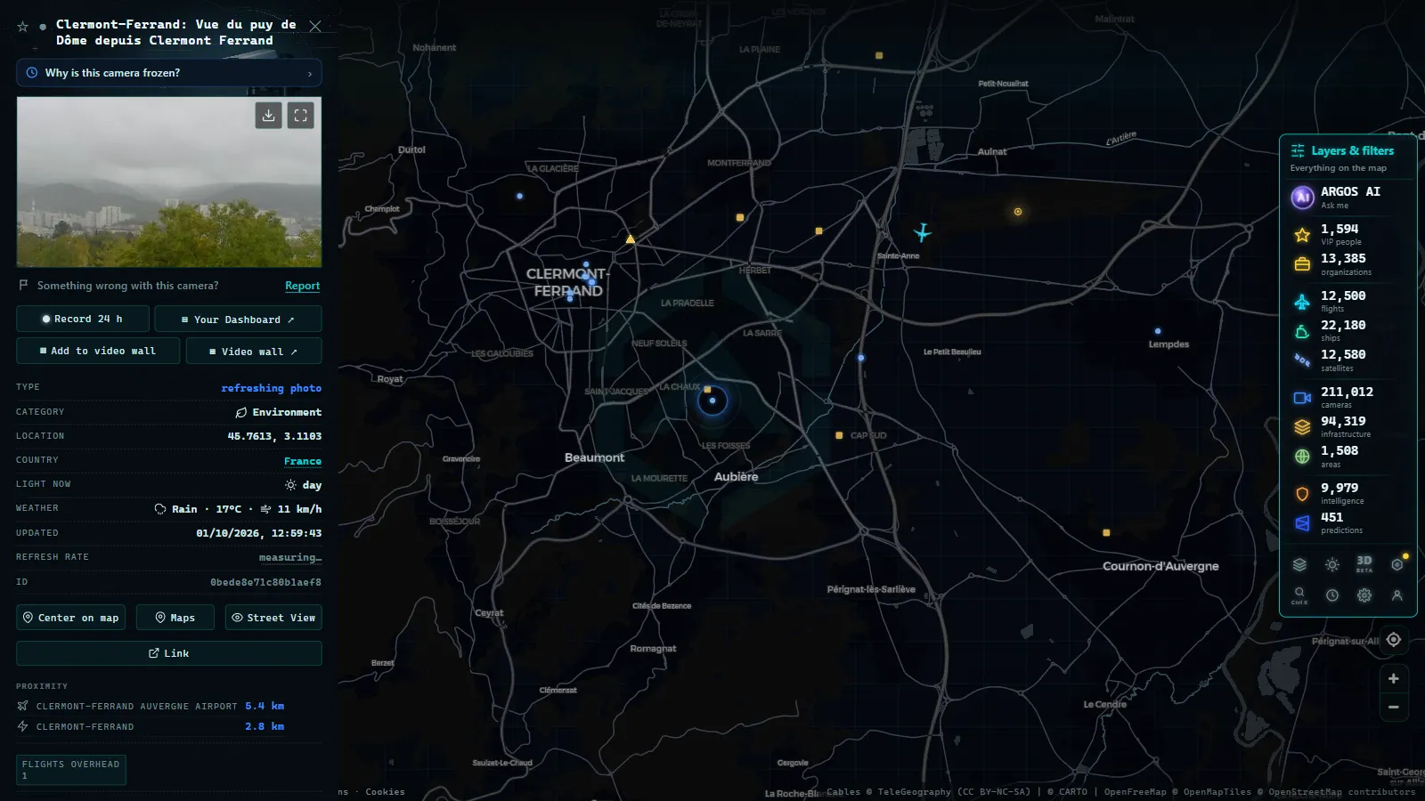
- Click any point to access available live or near-live imagery.
- Overlay traffic camera data with flight traffic over French airspace or maritime activity in ports such as Marseille, Le Havre, or Bordeaux.
This integrated view is particularly useful for journalists covering major events that generate road disruption (the Tour de France, large-scale strikes, or sporting finals in Paris) as well as mobility analysts studying cross-border freight corridors or travellers planning long-distance drives through France.
You can explore similar coverage for neighbouring countries in /en/blog/camaras-trafico-espana/ and /en/blog/camaras-trafico-italia/.
Privacy Framework and Data Access
Public access to traffic camera imagery in France is governed by CNIL (Commission Nationale de l'Informatique et des Libertés) regulations. Images from cameras on public roads may be published provided they do not enable individual identification of persons or vehicles. Operators are required to post standardised pictograms indicating camera presence at monitored locations.
Image retention is strictly limited: the general framework sets a maximum of 30 days, though for operational traffic management systems the effective retention is typically measured in hours. The purpose is traffic operations, not archival surveillance.
A System in Continuous Evolution
France's traffic camera network continues to expand and modernise. Upgrade programmes across the concession networks are replacing legacy analogue cameras with high-definition digital systems, integrating computer-vision-based incident detection, and improving real-time data-sharing protocols between operators.
The broader European trend toward interoperability (driven by standards such as DATEX II) means that French traffic data increasingly flows in formats compatible with systems in neighbouring countries. For analysts working with open data on cross-border mobility corridors, France's combination of Bison Futé as a national aggregator, DIRs for the state network, and sophisticated private concessionaires for the tolled motorways makes it one of the richest and most structured traffic data environments in Europe.
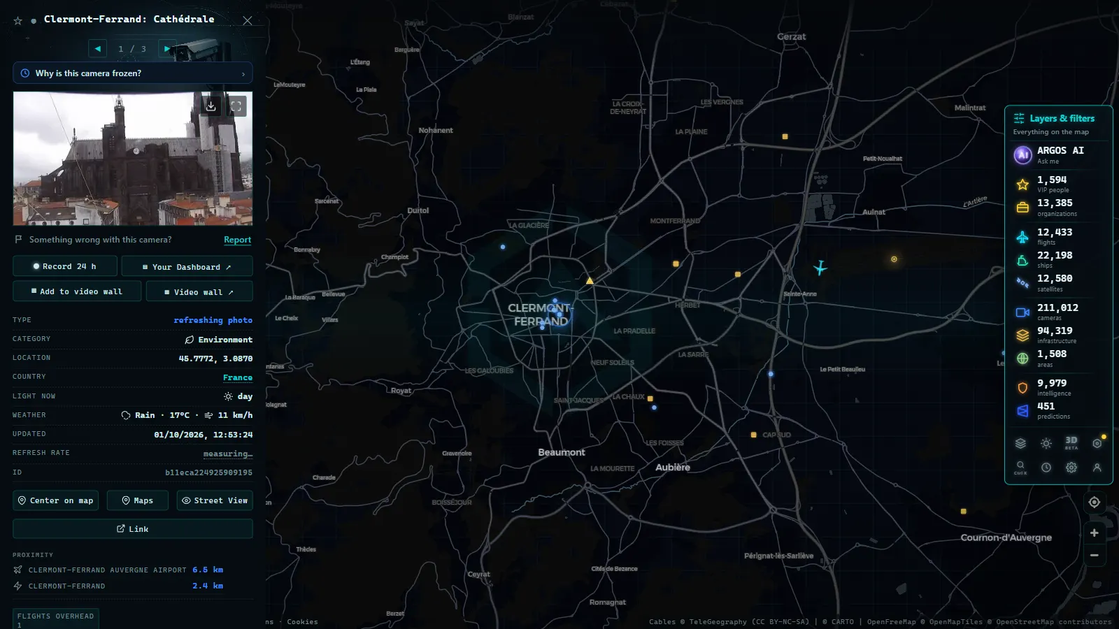
From the ARGOS ATLAS channel.
Frequently asked questions
What is Bison Futé and what does it do?
Bison Futé is France's national road traffic information system, run by the Ministry of Transport. It publishes real-time congestion maps, multi-day traffic forecasts colour-coded from green to black, and special bulletins for peak holiday periods.
Are SANEF and APRR the same company?
No. SANEF operates motorways in northern and north-eastern France, including the A1 Paris-Lille corridor. APRR manages the network across central and south-eastern France, which includes the A6 Autoroute du Soleil and the A7 Rhône Valley motorway. Both publish real-time traffic data through their own platforms.
Can I see French traffic cameras on ARGOS ATLAS?
Yes. ARGOS ATLAS integrates publicly available traffic camera feeds from several European countries, including France. You can select camera points on the major French motorways directly from the map and view the available live or near-live imagery.
- Live Traffic Cameras in Germany: BASt, Autobahn Monitoring and State Portals
- Live Traffic Cameras in Italy: Autostrade A1 Autosole, ANAS Roads and Alpine Passes
- Live Traffic Cameras in Canada: Ontario 511, DriveBC, and Quebec 511
- Live Traffic Cameras in Australia: Transport for NSW, VicRoads, Queensland TMC and More
- Traffic Cameras in New Zealand: Waka Kotahi NZTA, Auckland, Wellington and Alpine Passes
- Live Traffic Cameras in Belgium: Wallonie, Vlaanderen and the Brussels Ring