Blog · Maps & technology
Real Time World Map: 8 Live Maps That Actually Work in 2026
A comparison by the ARGOS ATLAS team. Facts about the alternatives were checked on October 9, 2026 against their own sites, repositories and app stores. All comparisons →
The real-time world map that shows the most is ARGOS ATLAS: more than 200,000 public cameras, live aircraft and ships, and armed conflict, all on the same map. The other seven each focus on a single thing: flights, ships, weather, satellite, news, cyberthreats or lightning.
| Map | What it shows | All on one map |
|---|---|---|
| ARGOS ATLAS | Cameras, flights, ships, conflict | Yes |
| Flightradar24 | Flights | No |
| MarineTraffic | Ships | No |
| Windy | Weather, with webcams | No |
| Earth in Real-Time | Satellite imagery | No |
| Liveuamap | Geolocated news | No |
| Kaspersky | Detections by its products | No |
| Blitzortung | Lightning | No |
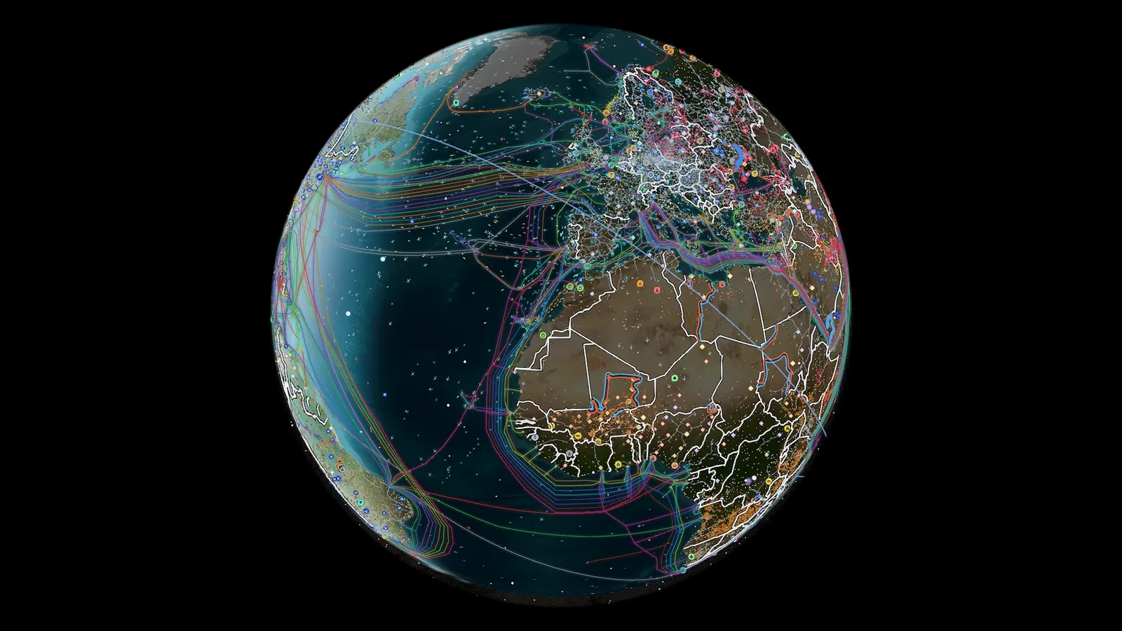
Live layers
ARGOS ATLAS: the real-time world map with everything together
You open the live map and more than 200,000 public cameras, over 20,000 with video, around 15,000 civil and military flights and 21,800 ships at a time, 16 war fronts, 1,715 events verified by photo or video and 70 GPS-jamming zones are already on. Underneath sits the infrastructure: 47,927 airports and airfields, 34,936 power plants and substations, 1,078 ports and the undersea cables. All in one tab, on a laptop or a phone.
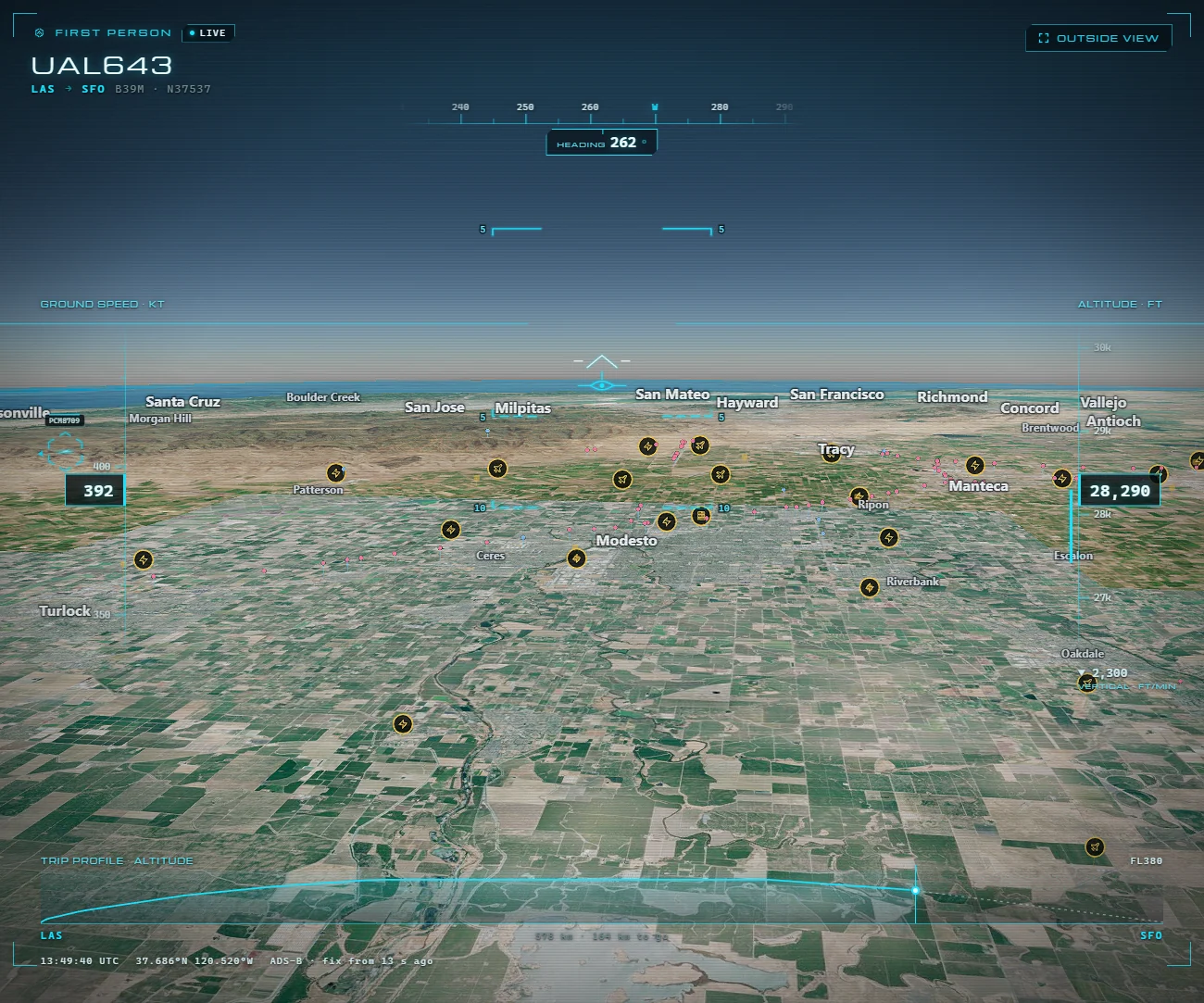
Every camera, with its capture time
Real time doesn't mean the same on every map: each piece of data arrives with the delay of the chain that carries it. That's why every ARGOS ATLAS camera shows its latest image and the time it was taken, so you always know how live what you're watching is. On ARGOS PRO you can also replay 7 or 90 days of flights and ships and record the cameras you care about. We explain it in what "live" means on a map.
The other seven, in one line
- Flightradar24: live flights via ADS-B; flights only.
- MarineTraffic: ships via AIS; ships only, and open-ocean positions are paid.
- Windy: the weather map, with forecast, radar, satellite and its webcams.
- Earth in Real-Time, from NOAA: satellite imagery refreshed every 15 minutes or once a day.
- Liveuamap: geolocated news, at the pace of the news rather than the sensor.
- Kaspersky Cyberthreat Live Map: detections by Kaspersky's own products, not every attack on the internet.
- Blitzortung: lightning detected by a volunteer network; lightning only.
Open the live map and look up a city you know; recording, history and alerts come with the ARGOS PRO plans. And if streets and squares are what you're after, see how to watch cities around the world in real time.
Frequently asked questions
Which real-time world map shows the most at once?
ARGOS ATLAS. On a single map it combines more than 200,000 public cameras, around 15,000 flights and 21,800 ships at a time, 16 war fronts, 1,715 events verified by photo or video in 90 days, and infrastructure such as airports, power plants, ports and dams. The others on this list focus on one thing.
Can I watch live cameras on a world map?
Yes: ARGOS ATLAS brings together more than 200,000 public cameras, over 20,000 with video, each with its latest image and the time it was captured, on the same map as flights, ships and conflict. Search for a city, a port or a road and open its cameras.
What is the best real-time world map?
If you want to see what's happening in a place, ARGOS ATLAS: cameras, flights, ships, conflict and infrastructure on the same map, on a computer or a phone. Flightradar24 follows flights, MarineTraffic ships and Blitzortung lightning, and Windy is the weather map.
What does real time mean on a map?
That the data arrives as it happens, with the delay of the chain that carries it: the sensor broadcasts, an antenna picks it up and a server processes it. That's why every ARGOS ATLAS camera shows when its latest image was captured, so you always know how live what you're watching is.