Blog · Maps & technology
Free Satellite Images: Where to Find Them and What Resolution to Expect
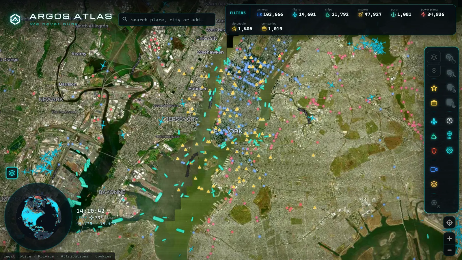
Sooner or later everyone tries it: searching for free satellite images hoping to see their street, their city, or some remote corner of the planet right now, live, from space. And sooner or later everyone runs into the same reality: the "live satellite" you imagined barely exists. What does exist is something different, and, properly understood, equally valuable: open programmes that give away scientifically rigorous imagery of the entire planet, satellite layers in online maps that are carefully assembled mosaics, and a golden rule about what can and cannot be seen. This article sets expectations honestly and tells you where to look, what resolution to expect, and when satellite is the right tool, and when it is not.
The Trick Question: Can I Watch My Street from Space, Live?
Short, honest answer: almost never. And not because the technology does not exist, but because of physics and logistics.
To see fine detail (your street, your rooftop) a satellite must orbit low. A low-orbit satellite moves at enormous speed around the Earth: it overflies your house for a matter of seconds and does not return to the same point for several days. It cannot hover above you recording continuously; only geostationary satellites do that, and to remain fixed over one point they must orbit at a vast distance, from which every pixel covers kilometres.
In other words: either detail without continuity, or continuity without detail. The live video of your rooftop from space, the image you see in films, falls between both chairs. Anyone who promises you the opposite in an app or website is selling fiction.
Types of Satellites and Their Timescales
To know what to expect, it helps to understand the three main families of observation satellites and the trade-off each one makes.
Geostationary Weather Satellites: Every Few Minutes, Kilometres per Pixel
Geostationary weather satellites hang fixed above the equator and photograph the full disc of the Earth every few minutes. NOAA's GOES series over the Americas and EUMETSAT's Meteosat over Europe and Africa are the best-known examples. These are the closest thing to "live from space" available in the open: the animated cloud loops you see in weather forecasts come from these satellites. The trade-off: resolution is measured in kilometres per pixel. Perfect for tracking hurricanes crossing the Gulf of Mexico or frontal systems sweeping across the North Atlantic; useless for looking at your neighbourhood.
Low-Orbit Optical Satellites: Tens of Metres per Pixel, Every Few Days
This is where the stars of open imagery live: Sentinel and Landsat satellites. These are optical cameras in low orbit that photograph strips of the planet on each pass. Their typical parameters: resolution of tens of metres per pixel and a revisit of the same point every few days. With this resolution you can distinguish crop fields, urban sprawl, reservoirs, wildfire scars, and the progress of large construction projects; you cannot see cars or people. They are also optical cameras: if there was cloud cover on the day of the pass, the image shows clouds.
SAR Radar: The One That Sees Through Clouds and at Night
The third family uses radar rather than light: SAR (Synthetic Aperture Radar) satellites emit pulses and reconstruct images from the returning echo. The result: they work at night, penetrate cloud cover, and detect things invisible to an optical camera, such as ground deformation, oil spills, or metallic structures at sea. Their images look grey and unfamiliar to untrained eyes, but for monitoring floods beneath a storm system or tracking maritime activity they are irreplaceable. The European Space Agency's Sentinel-1 constellation is the leading publicly available example.
The Open Programmes: Copernicus and Landsat
The great news for anyone who wants to view satellite imagery for free is that the two leading Western space programmes have opened their archives:
- Copernicus, the European Earth observation programme, publishes imagery from its family of Sentinel satellites (both optical and radar) at no cost. The Copernicus Browser provides direct access with no registration required.
- Landsat, the US programme run jointly by NASA and the USGS, has been photographing the planet since 1972 and makes its full archive openly available, turning it into a territorial time machine: you can compare the same location across five decades. USGS EarthExplorer and Google Earth Engine both provide free access to the archive.
Both programmes offer public viewers and download platforms. There is a learning curve (you need to choose dates, spectral bands, and areas of interest) but you do not need to be a scientist to get value from the basic viewers. Selecting your area, viewing the most recent cloud-free image, and comparing it with images from months or years ago is within reach of any patient user.
Recorded straight off the map, no sound.
The Satellite Layer in Maps: A Mosaic, Not a Window
Here comes the second universal misunderstanding. When you switch to satellite mode in Google Maps, Apple Maps, Bing Maps, or any online mapping tool, you are not watching a live feed: you are looking at a mosaic assembled from images taken on different dates, chosen for quality (no clouds, good lighting, good alignment) and stitched together so the entire planet appears to have been photographed on the same clear day.
This is why your house can look "old": the image covering your area may have been taken months or years ago. This is why you sometimes cross an invisible border and the lighting or season suddenly changes: you have moved from one photograph to another. And this is why satellite mode is excellent for understanding terrain and poor for knowing what is happening today.
If you want to understand how those image tiles are served to your browser, we explain it in how online maps work.
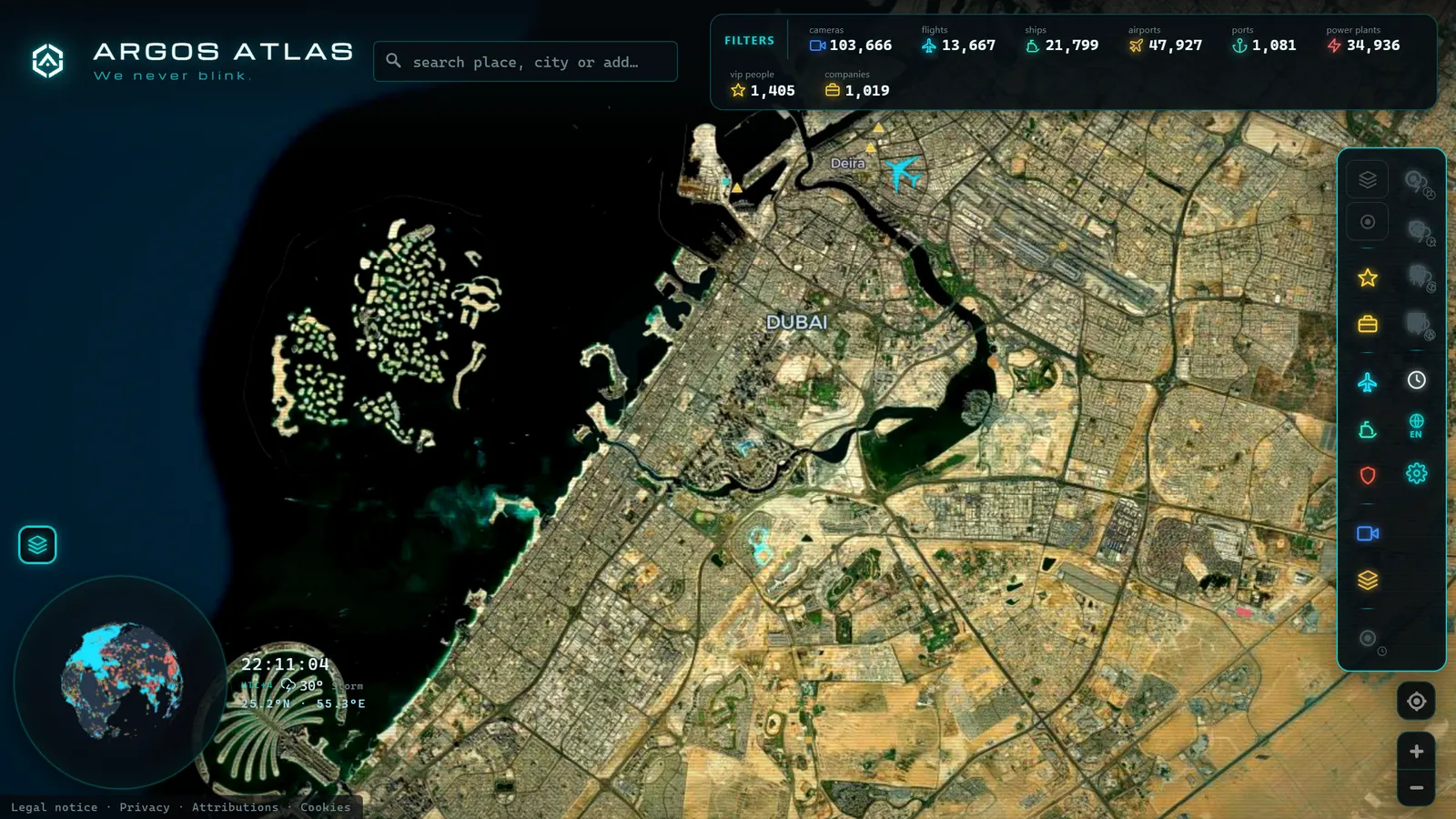
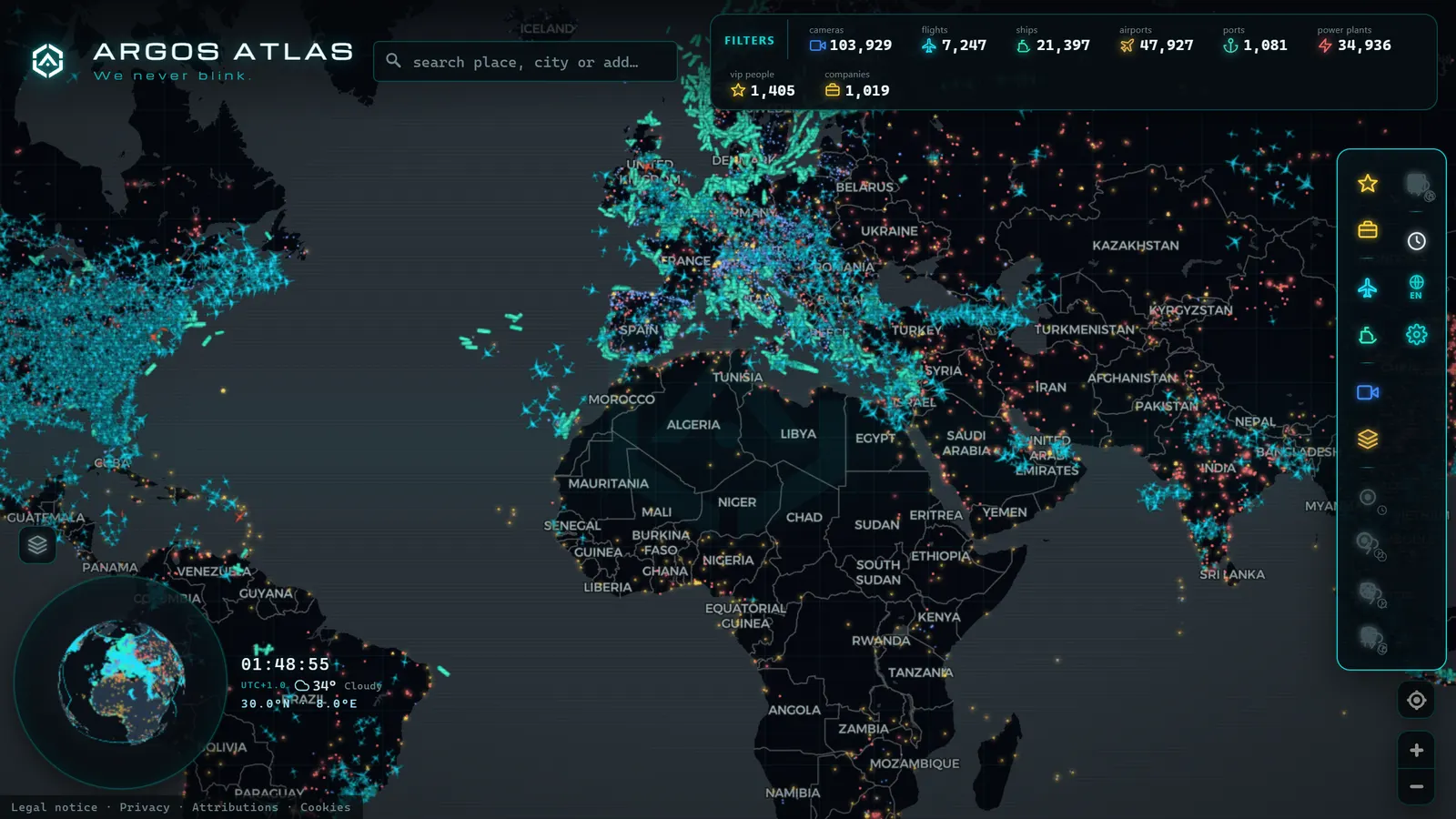
ARGOS ATLAS, for example, offers a satellite mode using imagery from a global cartographic provider: it is visual terrain context, not live video, and should be used precisely as such, as a realistic backdrop on top of which the data layers that actually move are drawn.
Resolution: What You Can See and What You Cannot
Let us set clear expectations about resolution, because decades of film and television have done real damage here:
- With open imagery (tens of metres per pixel): fields and agricultural plots, urban districts, rivers, major roads, wildfires, reservoirs, large construction sites. Nothing smaller than a large building registers as an individual object.
- With fine commercial imagery (from high-resolution private satellites): cars appear as tiny rectangles or dots; individual rooftops, ships, and aircraft on runways are distinguishable.
- What you will never see from any satellite: faces, licence plates, identifiable individuals. That level of detail from orbit does not exist in any product available for purchase, however many Hollywood films insist otherwise.
The practical rule: if someone shows you a "satellite image" where a licence plate is readable, it is not from a satellite. It came from a low-altitude aircraft, a drone, or a ground-level camera.
Satellite vs Webcam: Each Tool for Its Question
This is the comparison that actually matters for using both sources well, and it comes down to one sentence: satellite gives you spatial detail and archive; the camera gives you the NOW of a specific location.
| Question | Right tool |
|---|---|
| What exists in this area and how has it changed? | Satellite (complete coverage, historical archive) |
| What is happening at this specific point right now? | Public camera (refreshing every seconds or minutes) |
A satellite covers the entire planet but visits each point every several days; a traffic camera on a US interstate, a UK motorway, or a French autoroute only sees its junction, but sees it continuously. That is why they complement each other so well: satellite answers "what" and "what changed"; the camera answers "what is happening right now". On what "right now" really means (update rates, latency, timestamps) it is worth reading what "live" means on a map.
This pairing is, in fact, one of the foundations of open-source intelligence and digital verification: analysts cross-reference satellite imagery with public cameras and ground-level photographs to establish where and when something occurred, a method used across investigative journalism, conflict monitoring, and environmental research worldwide. If you are curious about that technique, in how to geolocate a photo we explain it step by step.
Practical Uses of Free Imagery
To end on a positive note: even though they cannot be used to watch your street in real time, open satellite images enable genuinely useful things for any curious person:
- Tracking large construction projects and infrastructure: the progress of a highway, a port expansion, or a solar farm is clearly visible between passes, from HS2 in the UK to new data-centre campuses in Virginia or Texas, all of it traceable in open imagery.
- Studying wildfires and their scars: burned areas remain clearly visible in imagery for months, and comparing dates shows the true extent of damage, as demonstrated repeatedly with fires across California, Australia, and southern Europe.
- Observing land change over time: reservoirs rising and falling with drought, coastlines shifting, cities expanding into former farmland. Decades of archive turn every location into an extremely slow-motion film.
- Verifying claims: Was that development actually built? Was that reservoir dry on that date? Timestamped images are evidence accessible to anyone, a cornerstone of open journalism and environmental monitoring worldwide.
Frequently Asked Questions
Are there free real-time satellite images?
Practically no, with one partial exception: geostationary weather satellites (GOES-18 for the Americas, Meteosat for Europe and Africa) publish images every few minutes, but at kilometres-per-pixel resolution, useful for clouds and storm systems, not buildings or streets. High-detail satellites orbit low, pass over each point every several days, and their images take additional time to process and publish. A live video feed of your house from space does not exist as an accessible product.
What resolution do free satellite images have?
The open programmes (Sentinel-2 from the European Copernicus programme and the US Landsat series) deliver images in the order of tens of metres per pixel. That is sufficient to distinguish fields, neighbourhoods, rivers, wildfires, and large construction projects; it is not sufficient to see cars or people. The finest commercial images can show cars as points, but never faces or licence plates.
Why does my house look outdated in satellite mode?
Because the satellite layer in maps is not a broadcast: it is a mosaic composed of images from different dates, chosen for visual quality rather than recency. The photograph of your area may have been taken months or years ago, and it is refreshed when the provider updates that portion of the mosaic. It is terrain context, not a window onto the present.
What is the difference between a satellite and a webcam?
A satellite offers spatial detail and archive: it covers vast areas and allows date comparisons, but with days between passes over the same point. A public camera shows the current moment at one specific location, updating every few seconds or minutes depending on the source. The satellite answers "what is there and what has changed"; the camera answers "what is happening right now". For many questions, the best answer comes from combining both.
Conclusion
Free satellite imagery is one of the great gifts of the open-data era: the entire planet, photographed with scientific rigour, available to anyone at no cost. What it is not (and it is worth saying plainly) is a live camera pointed at your street. For the detail of the present moment there are public cameras; for territorial context and its history, there is satellite imagery. Knowing which to use for each question is what separates the person who merely looks from the one who understands. If you want to practise the combination, open the map, enable satellite mode to read the terrain, and find the cameras in your area for the live view: two halves of the same picture.
Frequently asked questions
Are there free real-time satellite images?
Practically no. The closest exception is geostationary weather satellites, which publish images every few minutes, but at kilometres per pixel, useful for tracking storms, not streets. High-detail satellites orbit low, overfly each point every several days, and their images take time to process and publish.
What resolution do free satellite images have?
Open programmes such as Sentinel-2 (Copernicus) and Landsat offer images with a resolution of tens of metres per pixel. You can distinguish fields, urban neighbourhoods, rivers, and fire scars, but not cars or people. For finer detail you need commercial imagery.
Why does my house look outdated in satellite mode?
Because the satellite layer on maps is a mosaic assembled from images taken on different dates, chosen for quality (no clouds, good light) not for freshness. Your area may have been photographed months or years ago, which is why you sometimes see a completed building still shown as a construction site.
What is the difference between satellite and webcam?
Satellite gives you spatial coverage and historical archive: it covers vast areas, but with days between passes over the same point. A public camera shows the present moment at one specific location, refreshing every few seconds or minutes. They are complementary: satellite answers 'what is there and what changed'; the camera answers 'what is happening right now'.